
 United Kingdom
 France
 Germany
 Netherlands
 Sweden
 USA
USA
 Italy
Italy
 Spain
Spain
More From Contributor


Krakow PopOut
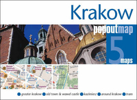
Kraków Pop-Out Map from Compass Maps in a series designed to provide two street plans, the city centre plus a wider area around it, in a handy format to fit neatly all but the smallest pockets, with, as appropriate, transport network diagrams, additional useful maps, etc. Each title’s two cover flaps open up to reveal two street plans: the city centre in greater detail, plus a wider area around it for sightseeing further afield. Both plans highlight numerous sights and cultural institutions, etc, and are indexex for streets and places of interest.Additional maps on the cover flaps show the old Jewish district of Kazimierz, a diagram of the city’s tram network, plus the surrounding region including Wieliczka, Wadowice and Auschwitz.

Product Description
Reviews/Comments
Add New
Vouchers
No voucher codes found.
Do you know a voucher code for this product or supplier? Add it to Insights for others to use.
Do you know a voucher code for this product or supplier? Add it to Insights for others to use.
 Denmark