More From Contributor
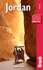
£9.99
Jordan at 1:475, 000 on an indexed road map from Explorer Publishing, with a special at-a-glance distance calculator incorporated into the map cover & showing distances in kilometres or miles between 12 locations, including Beirut, Damascus & Jerusalem. The map has at its base a satellite image of the country with a few spot heights & names of topographical features. All place names are in the Latin alphabet only. Road network

Includes::
selected desert tracks, gives distances on main routes & shows locations of border crossings & petrol stations. Railway lines are shown with stations & local airports are also marked. Symbols indicate various places of interest, including UNESCO World Heritage sites, archaeological remains, etc. Latitude & longitude are shown as margin ticks & cross-hairs at 30

...
Archived Product
£12.79
Jordan in the Countries & Regions series from Lonely Planet, market-leading comprehensive guides aimed at independent travellers & serving a large range of international destinations. Frank & informal in style, the guides explore an extensive range of sights, activities, accommodation, restaurants & nightlife & are designed for practical use while travelling on the road. Written & researched by a team of experts, each book is independent in its recommendations & suggestions, often offering individual takes on individual destinations. Widely recognised for their reliability, each Lonely Planet country & region guide has the same layout. Introductory sections profile the destination with individual chapters on particular highlights, getting started, (including when to go) itineraries, history, culture, arts, food & drink & the environment. Each guide is organised geographically by region, with individual sections detailing an extensive range of sights, places of interest, attractions, restaurants, nightlife, accommodation & any local activities. The guides have detailed explanations of historical context where relevant. There is also practical guidance on ...
Archived Product
£11.99
Jordan in the Countries, Regions & Cities series from Rough Guides; comprehensively detailed guidebooks specifically designed for independent travellers & serving a range of worldwide destinations. Widely recognised for their free editorial style, Rough Guide authors are allowed to express their personal opinions on a range of subjects. Although sometimes controversial, this editorial stance allows readers to experience more detailed & personal takes on each destination, a feature often more limited in other guidebooks. Cultural & historical nuances are explored in significant depth throughout the text & descriptions on the ambience of individual settings alongside personal recommendations, particularly in cities, are notably prevalent. Each Rough Guide in the Countries, Regions & Cities series has a similar layout. A ...
Archived Product
£15.99
Jordan in the Countries, Regions & Cities series from Rough Guides; comprehensively detailed guidebooks specifically designed for independent travellers & serving a range of worldwide destinations. Widely recognised for their free editorial style, Rough Guide authors are allowed to express their personal opinions on a range of subjects. Although sometimes controversial, this editorial stance allows readers to experience more detailed & personal takes on each destination, a feature often more limited in other guidebooks. Cultural & historical nuances are explored in significant depth throughout the text & descriptions on the ambience of individual settings alongside personal recommendations, particularly in cities, are notably prevalent. Each Rough Guide in the Countries, Regions & Cities series has a similar layout. A ...
Archived Product
£14.99
Baedeker; the most famous & cherished travel brand in the world is proud to announce the addition of this exciting new title to its innovative series. Jordan: one of the world's oldest cultures. Explore splendid desert castles, gaze in awe at the haunting wilderness of Wadi Rum, or bathe in the restful waters of the Red Sea. Jordan is simply captivating! This superb full-colour, illustrated guide features 3D laminated cut-outs to show you the key sights in perspective & a large, fully-indexed, pull-out map. Additional detailed maps & plans can also be found throughout the guide, clearly pin-pointing the best places to stay & the top places to eat & drink. At the heart of the guide is a wealth of comprehensive information written by experts on the sights & top attractions, in an easy-to-read A-Z format. Also included are great, practical travel tips covering accommodation & food & drink for all budgets, entertainment, sport, transport & health; not to mention some insider tips for saving money or having a unique travel experience. There is also a variety of recommended tours covering the best routes available, to ensure you get the most from your destination. The plastic wallet means that you can keep the guide & map together & ensures that both will survive in all weather. Baedeker
- setting a new standard in 21st century travel guide publishing.
...
Archived Product
£9.99
Jordan at 1:610, 000 with a street plan of Amman, plus Syria at 1:740, 000 with a street plan of Damascus on a double-sided map from ITMB, with each road map indexed & presenting the topography by altitude colouring. On one side is a map of Jordan at 1:610, 000 with the whole of Israel & southern Lebanon. On the reverse coverage extends northwards to cover the whole of Syria at 1:740, 000 & the remaining part of Lebanon. Both altitude colouring & the spot heights are given in feet. Seasonal rivers & streams are marked, as well as deserts & salt pans, oasis, wells, & national parks or other protected areas. Road network

Includes::
desert tracks & shows driving distances on main routes. Railway lines are included & local airports are marked. Symbols show locations of various places of interest including archaeological sites, etc. Latitude & longitude lines are drawn at intervals of 1º. Each side has a separate index. The two capitals are shown on a large street plan of their central districts, annotated with selected hotels, embassies, & various places of interest.

...
Archived Product
£12.79
Jordan in the Countries & Regions series from Lonely Planet, market-leading comprehensive guides aimed at independent travellers & serving a large range of international destinations. Frank & informal in style, the guides explore an extensive range of sights, activities, accommodation, restaurants & nightlife & are designed for practical use while travelling on the road. Written & researched by a team of experts, each book is independent in its recommendations & suggestions, often offering individual takes on individual destinations. Widely recognised for their reliability, each Lonely Planet country & region guide has the same layout. Introductory sections profile the destination with individual chapters on particular highlights, getting started, (including when to go) itineraries, history, culture, arts, food & drink & the environment. Each guide is organised geographically by region, with individual sections detailing an extensive range of sights, places of interest, attractions, restaurants, nightlife, accommodation & any local activities. The guides have detailed explanations of historical context where relevant. There is also practical guidance on ...
Archived Product
£20.00
Tony Howard’s Cicerone guide to Treks & Climbs in Wadi Rum, Jordan details is one of the few guides dedicated to exploring the outdoor opportunities in the country. Wadi Rum is located in the south of Jordan, close to the Red Sea port of Aqaba & is particularly remote, despite being only a five hour flight & short onward journey from Europe. The region was made famous by Lawrence of Arabia & it was the subsequent film of that name that brought the author to the area to explore, with the permission of the local Bedouin, some of the best routes in the region. Recently updated in 2007, the guide describes routes in Jebel Rum Massif, Jebel Um Ishrin Massif, Barrah Canyon Area, the Massif of Khush Khashah & Khazali, Burdah & the Domes of Abu Khsheibah, Outlying areas north & south of Rum & Petra. This new edition also features more routes, bringing the total to near 300. An extensive introduction provides information on a wealth of practical & general levels – Passports & Visas, The Bedouin, Flora & Fauna, Equipment for Climbing, Climbing History, & Pre-Historic sites being just a few. Detailed treks & climbs are supplemented by detailed line diagrams mapping the ascent in addition to sketches of each route, making it easier to plan each ascent. ...
Archived Product
£9.99
Jordan, Syria & Lebanon on an indexed overview map from Hildebr&, with street plans of central Amman & Damascus, notes on history & tourist attractions in Jordan & Syria, & a distance table. Topography is shown by subtle relief shading, spot heights & mountain passes, names of mountain ranges & deserts, plus numerous seasonal rivers & lakes. Road network

Includes::
desert tracks & shows distances on main routes. Railways & local airports are marked. Locations of interest are highlighted (although Krak des Chevaliers is not considered to be one!). All place names are transliterated with main towns given alternative versions (Halab/ Aleppo). Political boundaries are drawn according to what is locally acceptable, i.e. pre-1967: the whole of the West Bank is shown as the Palestinian Autonomous Territory, with the Golan Heights shown as Syria, but both marked as under Israeli occupation. The map has no geographical coordinates. Map legend

Includes::
English. On the reverse are street plans of central Amman & Damascus, annotated with main places of interest, public buildings, embassies, etc. Notes in English, German & French describe Jordan’s & Syria’s history, climate & tourist attractions. Also included is a distance table.


...
Archived Product
£16.99
Jordan in the Travel Guide series from Bradt; encompassing a comprehensive range of titles to destinations worldwide, with a particular focus on Africa, Central & South America. Bradt are one of the country’s leading independent publishers & have an ethos that focuses on responsible travel, in alliance with a philosophy of sustainability; both in the destinations the guides cover but also in encouraging tourists to limit the impact they have on the local environment. Bradt guides have a reputation for appealing to more independent travelers & often cover destinations that are not available from other publishers. Each guide opens with two comprehensive chapters on Background & Practical Information, covering details of the country’s geography, culture, natural history, government & politics, economy, people, language, religion, education & culture. Important practical advice

Includes::
when to visit, highlights, suggested itineraries, tour operators, red tape, embassies & consulates, getting there & away, health, safety, what to take, money, budgeting, getting around, accommodation, eating & drinking, public holidays, shopping, arts & entertainment, media & communications, business, travel culture & cultural etiquette. Individual sections are organized geographically by region & typically open with information on practicalities & orientation, before focusing on what to see & where to go. Information on what to see, where to stay, where to eat & how to find your way around is provided, with a range of budgets catered for. Simple black & white maps locate key visitor sites & places of accommodation. Bradt Travel Guides include appendices that provide an in-depth introduction to the language of each country, a glossary of terms & a listing of books & internet resources providing further information on the destination.

...
Archived Product

Jordan

Jordan at 1:750, 000 on a road map from the Royal Jordanian Geographic Centre, with a large street plan of central Amman, notes about the country, and numerous colour photos of its various sights and places of interest.The road map shows the country’s network of roads and desert tracks, indicating driving distances on main routes and locations of petrol supplies and telephone connections. Railway lines are shown with stations and the maps also shows local airports and internal administrative boundaries. Topography is shown by altitude colouring and graphics for mud pans, salt flats, and mineral springs. Symbols highlight archaeological sites, tombs and rest houses. The map has latitude and longitude lines at intervals of 30’. Outside Jordan only altitude colouring is provided,
with no roads, towns or country names and with present day international boundaries. On the reverse is a street plan of central Amman showing locations of places of worship, sport facilities, petrol stations, etc. The plan is annotated with numbers highlighting locations of various hotels, embassies (?), and other facilities but, unfortunately, no list with their names is provided.All place names on the map and the plan are shown in Latin alphabet only. All the text is in English.
RIP - This product is no longer available on our network. It was last seen on 25.09.2019

This page now acts as a permanent archive for this product. Add more information using the comments box below to ensure it can still be found by future generations.

Use our search facility to see if it is available from an alternative contributor.
  • Availability: Out Of Stock
  • Supplier: Stanfords
  • SKU: XL00000033289
Availability: In Stock
£15.99

Product Description

Jordan at 1:750, 000 on a road map from the Royal Jordanian Geographic Centre, with a large street plan of central Amman, notes about the country, & numerous colour photos of its various sights & places of interest. The road map shows the country’s network of roads & desert tracks, indicating driving distances on main routes & locations of petrol supplies & telephone connections. Railway lines are shown with stations & the maps also shows local airports & internal administrative boundaries. Topography is shown by altitude colouring & graphics for mud pans, salt flats, & mineral springs. Symbols highlight archaeological sites, tombs & rest houses. The map has latitude & longitude lines at intervals of 30’. Outside Jordan only altitude colouring is provided, with no roads, towns or country names & with present day international boundaries. On the reverse is a street plan of central Amman showing locations of places of worship, sport facilities, petrol stations, etc. The plan is annotated with numbers highlighting locations of various hotels, embassies (?), & other facilities but, unfortunately, no list with their names is provided. All place names on the map & the plan are shown in Latin alphabet only. All the text is in English.

Reviews/Comments

Add New

Intelligent Comparison

Oooops!
We couldn't find anything!
Perhaps this product's unique.... Or perhaps we are still looking for comparisons!
Click to bump this page and we'll hurry up.

Price History

Vouchers

No voucher codes found.
Do you know a voucher code for this product or supplier? Add it to Insights for others to use.

Facebook

Jargon Buster

mineral - A naturally occurring solid chemical substance.
Graphics - A general term for visual aspects of an item/display
Mud - A combination of water and soil/clay/silt. Oftern brown in colour
Telephone - A device used for communicating audio over long distances
Colour - The categorised spectrum of light visable to humans
Day - The time it takes a planet or other space objects to complete one rotation.
Network - A link and communication between things. Often computers or people.
Large - something that takes up more space than normal.
Road - a manmade lane or a path that is used to speed up travel.
Altitude - Something that can be quite high in relation to sea or ground level.

Supplier Information

Stanfords
Stanfords was established in 1853 and opened their iconic Covent Garden flagship store in 1901. They have become the top retailer of maps, travel books and accessories in the UK and arguably offer the largest selection of maps and travel books worldwide. Famous names such as Captain Robert Falcon Scott, Ranulph Fiennes and Michael Palin have purchased from Stanfords. They now have a shop in Bristol and both stores together with other venues operate a calendar of events including talks, book signings and exhibitions. As a specialist map retailer, the map selection is comprehensive and includes road maps, street maps and walking maps from worldwide destinations, as well as a selection of world atlases and wall maps. Books include travel guides and travel literature. Stanfords also stock globes, from miniatures made of blue marble to magnificent floor-standing globes. The website features a selection of interesting articles on travel topics.
Page Updated: 2023-11-12 20:15:36

Community Generated Product Tags

Oh No! The productWIKI community hasn't generated any tags for this product yet!
Menu