-
Home
-
Contributors
-
International
-
Account
-
Information
More From Contributor
- Gold Hill in Colorado, at 1: 40, 680 in an extensive series of GPS compatible, contoured hiking ...
Includes:: the whole of Afghanistan & the western half of Burma/ Myanmar. Relief shading with spot heights & names of mountain ranges presents the topography. Road network distinguishes between highways in good & poor condition & shows distances on main routes. Railway lines & local airports are included & the map also shows internal administrative boundaries with names of the states/provinces. No places of interest or tourist sights are marked. Latitude & longitude margin ticks are at 4 ...
- arrive & threaten to pull down the school Randall has to put on a fund-raising performance of the Indian epic The Ramayana in order to help the slum dwellers buy their own l&. Meanwhile he`s also been spotted by a Bollywood Director who persuades him to take the role of leading man in his new film. Will Randall is `the teacher who travels` &, as in SOLOMON TIME, this is a funny & heart-warming account of how one man`s enthusiasm & old-fashioned desire to do good have helped to preserve a community. ...
- indeed to this extensive & life-changing collection of recipes geared towards eating much more healthily. Recognising the exceptional health-promoting properties of foods from simple spices through to berries, fruits & vegetables, Gurpareet sets out to inform us about how each recipe in this wonderful collection
- via high antioxidant levels, cardiovascular health benefits & a myriad of curative properties
- will help to improve our health & wellbeing. This book is set to establish itself as the health food craze of 2010. ...

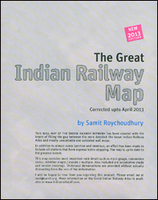
Indian Railway Map
eastern part of Pakistan (without grading).Enlargements present the environs of Delhi, Kolkata, Mumbai and Chennai in greater detail. Another inset shown a map of India with railway transit times, e.g. Delhi to Thiruvananthapuram in 42 hours.
This page now acts as a permanent archive for this product. Add more information using the comments box below to ensure it can still be found by future generations.
Use our search facility to see if it is available from an alternative contributor.
- External links may include paid for promotion
- Availability: Out Of Stock
- Supplier: Stanfords
- SKU: 9786000505851
Product Description
Indian Railway Map by Samit Roychoudhury, the author of the Railway Atlas of India, showing the country’s network with stations & graded according to gauge, single or double lines, electrified routes, etc, with enlargements for the environs of Delhi, Mumbai, Kolkata & Chennai. The main map presents India at 1:5, 000, 000 with states in different colours. The railway network is graded into broad, meter & narrow gauge routes, indicating single or double lines & electrified sections. Also marked are dedicated freight lines. Stations are graded according to their status: zonal or divisional headquarters, junctions, etc. Symbols indicate locations of electric & diesel loco sheds. Also marked are international border crossings & the map shows the railway network in the eastern part of Pakistan (without grading). Enlargements present the environs of Delhi, Kolkata, Mumbai & Chennai in greater detail. Another inset shown a map of India with railway transit times, e.g. Delhi to Thiruvananthapuram in 42 hours.
Reviews/Comments
Add New
Intelligent Comparison
We couldn't find anything!
Perhaps this product's unique.... Or perhaps we are still looking for comparisons!
Click to bump this page and we'll hurry up.
Price History
Vouchers
Do you know a voucher code for this product or supplier? Add it to Insights for others to use.


 United Kingdom
 France
 Germany
 Netherlands
 Sweden
 USA
USA
 Italy
Italy
 Spain
Spain


 Denmark