
 United Kingdom
 France
 Germany
 Netherlands
 Sweden
 USA
USA
 Italy
Italy
 Spain
Spain
More From Contributor


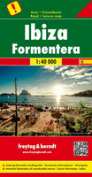
Ibiza - Formentera F&B
Ibiza and Formentera at 1:40, 000 on a road map from Freytag & Berndt prominently highlighting the two islands’ best sights which have multilingual descriptions in the index booklet attached to the map cover. Road network is shown on a base with topography indicated by relief shading with spot heights, plus colouring for woodlands. Driving distances are indicated on main routes and locations of petrol stations are marked. Also shown are ferry connections with the other Balearic Islands and mainland Spain.Icons indicate various places of interest including campsites, beaches, recreational facilities, etc. Latitude and longitude lines are drawn at 5’ intervals. The index booklet, attached to the map cover, includes multilingual descriptions of recommended best sights. Map legend
and the text include English.
and the text include English.

Product Description
Reviews/Comments
Add New
Vouchers
No voucher codes found.
Do you know a voucher code for this product or supplier? Add it to Insights for others to use.
Do you know a voucher code for this product or supplier? Add it to Insights for others to use.
 Denmark