
 United Kingdom
 France
 Germany
 Netherlands
 Sweden
 USA
USA
 Italy
Italy
 Spain
Spain
More From Contributor

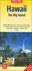

Hawaii Adventure Map
Hawaii Adventure Map at 1:220, 000 from the National Geographic with excellent presentation of the islands’ volcanic terrain and numerous places of interest, printed on light, waterproof and tear-resistant synthetic paper. The islands are presented on four separate panels.On one side is Hawaii – the Big Island, with on the reverse separate panels for Oahu, Kauai and Niihau, plus Maui with Molokai, Lanai and Kahoolawe. An additional small panel shows the whole group together. Topography is shown by contours at 200m intervals, enhanced by relief shading and colouring for forest cover, plus plenty of names of mountain ranges, peaks, etc. On Hawaii itself the map also shows different lava flows annotated with dates of eruptions. National parks and other protected areas are
prominently highlighted. The map shows each island’s road network including local trails, with driving distances given on main routes. Airports and ferry connections between the islands are marked. A wide range of symbols indicate various places of interest, including campsites, beaches and surfing locations, bird sanctuaries, historical sites and monuments, etc. The map is indexed and each panel has latitude and longitude lines at 15’ intervals.
prominently highlighted. The map shows each island’s road network including local trails, with driving distances given on main routes. Airports and ferry connections between the islands are marked. A wide range of symbols indicate various places of interest, including campsites, beaches and surfing locations, bird sanctuaries, historical sites and monuments, etc. The map is indexed and each panel has latitude and longitude lines at 15’ intervals.

Product Description
Reviews/Comments
Add New
Vouchers
No voucher codes found.
Do you know a voucher code for this product or supplier? Add it to Insights for others to use.
Do you know a voucher code for this product or supplier? Add it to Insights for others to use.
 Denmark