
 United Kingdom
 France
 Germany
 Netherlands
 Sweden
 USA
USA
 Italy
Italy
 Spain
Spain
More From Contributor


Europe Eastern F&B
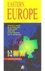
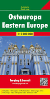
Eastern Europe at 1:2, 000, 000 from Freytag & Berndt, with a separate 72-page booklet with an extensive index listing locations with postcodes plus providing street plans of central areas in the region’s 12 capital cities.The map shows road and rail networks at the level appropriate to its scale, clearly indicating on main routes their road numbers, including where appropriate the E-numbers. Also marked are ferry connections, local airports, and within larger countries internal administrative boundaries. Within the countries using the Cyrillic and in Greece names of larger town are given in both Latin and local alphabet. Latitude/longitude grid is drawn at intervals of 1º. Map legend includes English. The index, arranged by country and showing locations with their postcodes, is
in a separate booklet attached to the map cover. The booklet also includes street plans of city centres in 12 capitals: Athens, Belgrade, Budapest, Bucharest, Kiev, Minsk, Moscow, Riga, Sofia, Tallinn, Vilnius and Warsaw. All street names are is Latin alphabet.
in a separate booklet attached to the map cover. The booklet also includes street plans of city centres in 12 capitals: Athens, Belgrade, Budapest, Bucharest, Kiev, Minsk, Moscow, Riga, Sofia, Tallinn, Vilnius and Warsaw. All street names are is Latin alphabet.

Product Description
Reviews/Comments
Add New
Vouchers
No voucher codes found.
Do you know a voucher code for this product or supplier? Add it to Insights for others to use.
Do you know a voucher code for this product or supplier? Add it to Insights for others to use.
 Denmark