
 United Kingdom
 France
 Germany
 Netherlands
 Sweden
 USA
USA
 Italy
Italy
 Spain
Spain
More From Contributor


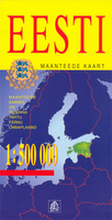
Estonia
Estonia on an indexed road map with plans of Tallinn, Pärnu and Tartu, from Latvia’s leading cartographic publisher, Jana Seta. Picturesque towns or villages, national parks and other places of particular interest are highlighted.The map shows the country’s road network, including gravel roads and country tracks, indicating locations of petrol stations and border crossings, with driving distances on main and most secondary routes. Railway lines and ferry routes are also marked. Picturesque towns or villages, national parks or protected areas and other places of particular interest are highlighted. The map also shows internal administrative boundaries with names of the provinces. Topographic information shows swamps and moors, plus some spot heights. The map is indexed and has
latitude and longitude lines drawn at 30’ intervals. Map legend includes English.Also included are plans of Tallinn, Pärnu and Tartu showing traffic routes across each city and main streets. Tallinn has an enlargement showing the centre in greater detail. Also included is a distance table.
latitude and longitude lines drawn at 30’ intervals. Map legend includes English.Also included are plans of Tallinn, Pärnu and Tartu showing traffic routes across each city and main streets. Tallinn has an enlargement showing the centre in greater detail. Also included is a distance table.

Product Description
Reviews/Comments
Add New
Vouchers
No voucher codes found.
Do you know a voucher code for this product or supplier? Add it to Insights for others to use.
Do you know a voucher code for this product or supplier? Add it to Insights for others to use.
 Denmark