
 United Kingdom
 France
 Germany
 Netherlands
 Sweden
 USA
USA
 Italy
Italy
 Spain
Spain
More From Contributor


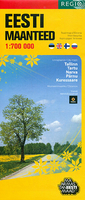
Estonia
Estonia at 1:700, 000 on an overview road map from the Tallinn based Regio, highlighting locations of petrol stations, with on the reverse street plans of the country’s five main cities: Tallinn, Kuressaare, Narva, Pärnu and Tartu.On one side is a road map designed to show the network of principal and secondary roads plus selected local roads, distinguishing between surfaced and gravel roads. Driving distances are shown on main routes and border crossings are marked. Locations of petrol stations run by Statoil are prominently highlighted, with smaller symbols showing other filling stations. Latitude and longitude lines are drawn at 30’ and 1° respectively. Map legend includes English.On the reverse are street plans of Estonia’s five main cities: Tallinn, Kuressaare, Narva,
Pärnu and Tartu. The plans highlight main traffic arteries and location s of Statoil stations, as well as other services, selected hotels, etc. Also provided is a distance table.* Overprint on the road map shows page-by-page coverage of the country on Regio’s excellent Road Atlas of Estonia.
Pärnu and Tartu. The plans highlight main traffic arteries and location s of Statoil stations, as well as other services, selected hotels, etc. Also provided is a distance table.* Overprint on the road map shows page-by-page coverage of the country on Regio’s excellent Road Atlas of Estonia.

Product Description
Reviews/Comments
Add New
Vouchers
No voucher codes found.
Do you know a voucher code for this product or supplier? Add it to Insights for others to use.
Do you know a voucher code for this product or supplier? Add it to Insights for others to use.
 Denmark