
 United Kingdom
 France
 Germany
 Netherlands
 Sweden
 USA
USA
 Italy
Italy
 Spain
Spain
More From Contributor

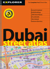

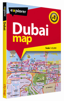
Dubai Street Plan
Dubai on a street plan from the locally-based Explorer Publishing, presenting on one side the city, including the Dubai International Airport and Palm Jumeira, at 1:45, 000, plus on the reverse a wider area at 1:80, 000. All place names are in the Latin alphabet only.On one side is a plan of the city at 1:45, 000 highlighting its network of main traffic arteries. The plan shows names of neighbourhoods, plus names or numbers of main and selected connecting streets. Various facilities and places of interest are named and/or marked by symbols, including hotels and restaurants, banks, embassies and consulates, etc.On the reverse a wider area is presented at 1:80, 000, with coverage extending to include the Al Maktoum Airport and the Palm Jabal Ali). Accompanying index lists
neighbourhoods, projects, visitor attractions, shopping and souks, etc. Map legend and names of facilities are in English.
neighbourhoods, projects, visitor attractions, shopping and souks, etc. Map legend and names of facilities are in English.

Product Description
Reviews/Comments
Add New
Vouchers
No voucher codes found.
Do you know a voucher code for this product or supplier? Add it to Insights for others to use.
Do you know a voucher code for this product or supplier? Add it to Insights for others to use.
 Denmark