
 United Kingdom
 France
 Germany
 Netherlands
 Sweden
 USA
USA
 Italy
Italy
 Spain
Spain
More From Contributor

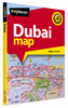


Dubai Street Atlas
Dubai Street Atlas from the locally-based Explorer Publishing in an A5 spiral-bound format, highlighting locations of hotels, various places of interest and institutions, all listed in an extensive 123-page index, with an additional directory of recommended facilities, etc. All place names are in the Latin alphabet and in English.The atlas presents the city’s central districts at 1:10, 000, outer districts at 1:20, 000, and the suburbs at 1:31, 250. Major traffic arteries are highlighted and colouring indicates the type of area (residential, park, beach, etc.) or the institution (hotel, shopping centre, museums, government building, etc). A wide range of facilities and places of interest are marked by symbols. Additional overview maps show metro lines, main roads with
suburb names and Salik toll gates, plus locations of emergency service. Also provided are maps of Palm Jebel Ali, Palm Jumeirah and The World Archipelago, an overview road map of the northern part of UAE and Oman, a 7-page directory of services with contact numbers plus notes on driving in Dubai.
suburb names and Salik toll gates, plus locations of emergency service. Also provided are maps of Palm Jebel Ali, Palm Jumeirah and The World Archipelago, an overview road map of the northern part of UAE and Oman, a 7-page directory of services with contact numbers plus notes on driving in Dubai.

Product Description
Reviews/Comments
Add New
Vouchers
No voucher codes found.
Do you know a voucher code for this product or supplier? Add it to Insights for others to use.
Do you know a voucher code for this product or supplier? Add it to Insights for others to use.
 Denmark