More From Contributor
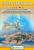
£19.50
From pristine beaches & jungle waterfalls to high-altitude coffee plantations, award-winning author & photographer James Kaiser shows readers the best of Costa Rica, including the country`s stunning collection of national parks. Filled with rich details & hundreds of high-quality color photographs, this guide, which provides fascinating chapters on the country`s unique history, culture, ecology, & wildlife, is sure to appeal to anyone looking for more than just restaurant & hotel reviews. Giving travelers everything they need to plan an unforgettable trip, this resource also

Includes::
a ” Top 10 Ways to Avoid a Cultural Misunderstanding” that helps visitors avoid common, & potentially embarrassing, cultural mistakes.

...
Archived Product
£19.99
The ” Costa Rica: Travellers` Wildlife Guide” is a detailed illustrated guide to the fauna of Costa Rica. It also offers general information for the country such as its geography, habitats & flora, visitor information for its national parks & general advice on ecotourism. Most travellers to Costa Rica want to experience its lush tropical forests & catch glimpses of exotic wildlife; toucans & parrots, hummingbirds & hawks, monkeys & big cats, frogs & toads, crocodiles, & (yes) snakes. Here is all the information you will need to find, identify & learn about Costa Rica’s magnificent wildlife. The author, himself a wildlife biologist & experienced ecotraveller, visited national parks, reserves, & other ecological sites, discussed wildlife with local & international experts & veteran tour leaders, & then selected, for new color illustrations, nearly 350 of Costa Rica’s most common amphibians, reptiles, birds, & mammals—the species you are actually likely to see. Also pictured are some animals of special biological significance—for instance, some highly endangered species. Easy-to-carry, entertainingly written, beautifully illustrated—you will want to have this book as constant companion on your journey.* Identification, distribution, & conservation information on Costa Rica’s frequently spotted animals.* Up-to-date information on the ecology, behavior, & conservation of the families of animals to which the pictured species belong.* Information on habitats & on the most common plants you will encounter.* Brief descriptions of Costa Rica’s most frequently visited parks & reserves.* Information on ecotourism in general & on conservation in Costa Rica. Written by Les Beletsky About this series: Traveller’s Wildlife Guides, edited by Les Beletsky, is a series of travel-wildlife books aimed at environmentally conscious travellers (ecotourists) for whom some of the best parts of any trip are glimpses of animals in natural settings. The purpose of these books is to enhance enjoyment of a trip & enrich wildlife sightings by providing identifying information on several hundred of the most frequently encountered animals of a covered country or region, along with up-to-date information on their ecology, behaviour, & conservation ...
Archived Product
£3.99
The Lonely Planet Costa Rican Phrasebook is not only an extensive list of useful phrases, but also an ideal tool to start getting to grips with a language & beginning two-way communication. Containing excellent sections on language basics such as numbers, question phrases, dates, phrase construction, grammar & pronunciation, as well as containing concise but well-rounded two-way dictionaries, Lonely Planet phrasebooks enable you to quickly & confidently construct your own phrases in addition to those given. The given phrases cover all the essential travel & tourism categories such as transport, communications, business meetings & accommodation, as well as in-depth categories such as health, food & social interaction. The phrasebooks are designed to enable more than just simple question-answer communication, allowing the start of two-way conversations
- putting you comfortably on your way to learning the language & understanding its speakers. True to Lonely Planet
...
Archived Product
£4.99
This work

Includes::
comprehensive food section plus etiquette & cultural tips. It is an easy-to-use pronunciation

...
Archived Product
£4.99
Get more from your trip with easy-to-find phrases for every travel situation. Never get stuck for words with our 3500-word two-way dictionary. Order the right meal with our menu decoder. Avoid embarrassing situations with essential tips on culture manners. Lonely Planet phrasebooks have been connecting travelers & locals for over a quarter of a century. Our phrasebooks & mobile apps cover more languages than any other publisher. ...
Archived Product
£8.99
Costa Smeralda & the Maddalena Archipelago Smart Map at 1:175, 000 from the Touring Club Italiano, printed on light waterproof & tear-resistant synthetic paper, with a street plan of central Olbia annotated with main sights, plus 11 more recommendations of places worth visiting. Coverage extends from the Straights of Bonifacio between Sardinia & Corsica southwards to Ozieri & Pattada. Cartography is an enlargement of TCI’s excellent regional series at 1:200, 000. Additional overprint highlights the publishers’ recommendations. On the reverse are notes, based on Touring Editore’s vast experience of presenting the country’s heritage & culture, about various aspects of the region: nature, art, local festivals, etc, or, since all the text is in Italian only: natura e ambiente, arte e cultura, manifestazioni, sapori e colori & tempo libero. Map legend & all the text are in Italian only. To see the list of titles in this series please click on the series link. ...
Archived Product
£8.95
Costa Smeralda: Arzachena area at 1:30, 000 in a series of contoured, GPS compatible maps from Ed. Abies. Overprint highlights beaches, campsites, B&B & agriturismo accommodation, petrol stations, sport & recreational facilities, viewpoints, caves, archaeological sites & nuraghi. The map has a UTM grid. Main series at 1:60, 000 (Nos. 1 to 12) The maps have contours at 100m intervals & colouring for woodlands & maquis shrubl&. Local trails are highlighted, with additional overprint for selected hiking, mountain bike & kayaking routes listed on the reverse of the maps with brief notes & grading for the degree of difficulty. All the maps have a UTM grid for GPS users. Very extensive range of symbols highlight numerous places of interest & tourist facilities, including campsites & caravan parks, beaches, sport & recreational sites, archaeological remains & nuraghi, etc. The maps also indicate places where typical local products can be purchased. On the reverse each title has descriptions of its main places of interest, beaches, etc. More detailed maps at 1:25, 000/1:30, 000 (Nos. 3A to 12A) Contour interval is 25m, plus colouring for vegetation. Local trails are marked but unless indicated in the individual description, special routes are not included. Tourist overprint, as described above, is also less extensive than on the 1:60, 000 maps. Most titles have GPS coordinates. On the reverse are extensive notes describing the area. Map legend & additional text on all the maps

Includes::
English.

...
Archived Product
£8.95
Costa Smeralda: Portobello di Gallura to Golfo Aranci area in a series of contoured, GPS compatible maps at 1:60, 000 from Ed. Abies, with extensive tourist information including special recreational routes plus additional coverage at more detailed scales of selected popular areas. Main series at 1:60, 000 (Nos. 1 to 12) The maps have contours at 100m intervals & colouring for woodlands & maquis shrubl&. Local trails are highlighted, with additional overprint for selected hiking, mountain bike & kayaking routes listed on the reverse of the maps with brief notes & grading for the degree of difficulty. All the maps have a UTM grid for GPS users. Very extensive range of symbols highlight numerous places of interest & tourist facilities, including campsites & caravan parks, beaches, sport & recreational sites, archaeological remains & nuraghi, etc. The maps also indicate places where typical local products can be purchased. On the reverse each title has descriptions of its main places of interest, beaches, etc. More detailed maps at 1:25, 000/1:30, 000 (Nos. 3A to 12A) Contour interval is 25m, plus colouring for vegetation. Local trails are marked but unless indicated in the individual description, special routes are not included. Tourist overprint is also less extensive than on the 1:60, 000 maps. Most titles have GPS coordinates. On the reverse are extensive notes describing the area. For more details see individual descriptions. Map legend & additional text on all the maps

Includes::
English.

...
Archived Product
£9.99
Costa Smeralda: Portobello di Gallura to Golfo Aranci area in a series of contoured, GPS compatible maps at 1:60, 000 from Ed. Abies, with extensive tourist information including special recreational routes plus additional coverage at more detailed scales of selected popular areas.* Main series at 1:60, 000 (Nos. 1 to 12)* The maps have contours at 100m intervals & colouring for woodlands & maquis shrubl&. Local trails are highlighted, with additional overprint for selected hiking, mountain bike & kayaking routes listed on the reverse of the maps with brief notes & grading for the degree of difficulty. All the maps have a UTM grid for GPS users. Very extensive range of symbols highlight numerous places of interest & tourist facilities, including campsites & caravan parks, beaches, sport & recreational sites, archaeological remains & nuraghi, etc. The maps also indicate places where typical local products can be purchased. On the reverse each title has descriptions of its main places of interest, beaches, etc.* More detailed maps at 1:25, 000/1:30, 000 (Nos. 3A to 12A)* Contour interval is 25m, plus colouring for vegetation. Local trails are marked but unless indicated in the individual description, special routes are not included. Tourist overprint is also less extensive than on the 1:60, 000 maps. Most titles have GPS coordinates. On the reverse are extensive notes describing the area. For more details see individual descriptions. * Map legend & additional text on all the maps

Includes::
English.*

...
Archived Product
£14.99
Costabona
- Alta Val de Ter area of the Catalan Pyrenees on a contoured & GPS compatible map at 1:25, 000 from Editorial Alpina,
...
Archived Product

Costa Smeralda

Costa Smeralda, the north-eastern tip of Sardinia and the nearby islands on a detailed map at 1:65, 000 from Litografia Artistica Cartografica in their GlobalMap imprint, highlighting the area’s beaches, campsites, historical and architectural heritage, etc.Coverage extends inland to just beyond Luogosanto and south past Olbia to Porto San-Paolo and the island of Tavolara. Coverage includes the islands of the La Maddalena archipelago which form a national park, as well as the southern tip of Corsica and French islands in the Straights of Bonifacio. The map shows local roads, cart tracks and country paths and indicates ferry connections. Symbols mark locations of tourist information services, campsites, beaches, churches and important architectural sites, megalithic nuraghi and
archaeological remains, interesting natural sites, etc. Topography is presented by contours, enhanced by relief shading with plenty of spot heights and names of local hills, etc. The map has a UTM grid for GPS, plus latitude and longitude margin ticks at 10’. Map legend includes English.
RIP - This product is no longer available on our network. It was last seen on 25.09.2019

This page now acts as a permanent archive for this product. Add more information using the comments box below to ensure it can still be found by future generations.

Use our search facility to see if it is available from an alternative contributor.
  • External links may include paid for promotion
  • Availability: Out Of Stock
  • Supplier: Stanfords
  • SKU: 9788879144544
Availability: In Stock
£7.99

Product Description

Costa Smeralda, the north-eastern tip of Sardinia & the nearby islands on a detailed map at 1:65, 000 from Litografia Artistica Cartografica in their Global Map imprint, highlighting the area’s beaches, campsites, historical & architectural heritage, etc. Coverage extends inland to just beyond Luogosanto & south past Olbia to Porto San-Paolo & the island of Tavolara. Coverage

Includes::
the islands of the La Maddalena archipelago which form a national park, as well as the southern tip of Corsica & French islands in the Straights of Bonifacio. The map shows local roads, cart tracks & country paths & indicates ferry connections. Symbols mark locations of tourist information services, campsites, beaches, churches & important architectural sites, megalithic nuraghi & archaeological remains, interesting natural sites, etc. Topography is presented by contours, enhanced by relief shading with plenty of spot heights & names of local hills, etc. The map has a UTM grid for GPS, plus latitude & longitude margin ticks at 10’. Map legend

Includes::
English.

Reviews/Comments

Add New

Intelligent Comparison

Oooops!
We couldn't find anything!
Perhaps this product's unique.... Or perhaps we are still looking for comparisons!
Click to bump this page and we'll hurry up.

Price History

Vouchers

No voucher codes found.
Do you know a voucher code for this product or supplier? Add it to Insights for others to use.

Facebook

Jargon Buster

GPS - Global Positioning System - Global position using satellites
Natural - not manmade

Supplier Information

Stanfords
Stanfords was established in 1853 and opened their iconic Covent Garden flagship store in 1901. They have become the top retailer of maps, travel books and accessories in the UK and arguably offer the largest selection of maps and travel books worldwide. Famous names such as Captain Robert Falcon Scott, Ranulph Fiennes and Michael Palin have purchased from Stanfords. They now have a shop in Bristol and both stores together with other venues operate a calendar of events including talks, book signings and exhibitions. As a specialist map retailer, the map selection is comprehensive and includes road maps, street maps and walking maps from worldwide destinations, as well as a selection of world atlases and wall maps. Books include travel guides and travel literature. Stanfords also stock globes, from miniatures made of blue marble to magnificent floor-standing globes. The website features a selection of interesting articles on travel topics.
Page Updated: 2023-11-12 20:15:36

Community Generated Product Tags

Oh No! The productWIKI community hasn't generated any tags for this product yet!
Menu