More From Contributor
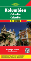
£10.99
Colombia & Ecuador at 1:2, 500, 000 on a double-sided map from Nelles on a smaller size sheet offering a convenient format when travelling. Each country is accompanied by street plans of town centres in its main cities. On one side is the northern part of Colombia, extending south beyond Cali to Popayan. Coverage also

Includes::
the western tip of Venezuela around Lake Maracaibo & Merida, plus most of Panama. Street plans show city centres of Bogota, Medellin & Cartagena. On the reverse is the remaining part of Columbia & Ecuador, plus the Amazonian part of Peru with Iquitos & coverage south beyond Cajamarca. Street plans show Quito with an enlargement for its Old Town, Guayaquil, Cuenca & Otavalo. Also provided is an inset showing the Galapagos Islands. Topography is shown by relief shading with names of mountain ranges & peaks & spot heights, plus graphics to marshlands & swamp areas. Road network distinguishes between highways in good & poor condition. Railway lines & local airports are included & the map also shows internal administrative boundaries with names of the provinces. National parks & various places of interest are prominently highlighted. The map has latitude & longitude margin ticks at intervals of 2° & is not indexed. The street plans highlight various places of interest, facilities & public buildings, plus selected tourist accommodation.

...
Archived Product
£7.95
Colombia & Ecuador at 1:2, 500, 000 on a double-sided map from Nelles on a smaller size sheet offering a convenient format when travelling. Each country is accompanied by street plans of town centres in its main cities. On one side is the northern part of Colombia, extending south beyond Cali to Popayan. Coverage also

Includes::
the western tip of Venezuela around Lake Maracaibo & Merida, plus most of Panama. Street plans cover the city centres of Bogota, Medellin & Cartagena. On the reverse is the remaining part of Columbia & Ecuador, plus the Amazonian part of Peru with Iquitos & coverage south beyond Cajamarca. Street plans show Quito with an enlargement for its Old Town, Guayaquil, Cuenca & Otavalo. Also provided is an inset showing the Galapagos Islands. Topography is shown by relief shading with names of mountain ranges & peaks & spot heights, plus graphics to marshlands & swamp areas. Road network distinguishes between highways in good & poor condition. Railway lines & local airports are included & the map also shows internal administrative boundaries with names of the provinces. National parks & various places of interest are prominently highlighted. The map has latitude & longitude margin ticks at intervals of 2

...
Archived Product
£17.99
With its jagged, volcanic peaks; sands of gold, black & silver; palm-trimmed Pacific & Caribbean coastlines; tufted fields of coffee; dense jungles, snow-capped mountains & idyllic islands; numerous indigenous cultures & exciting buzzing cities, Colombia is `ten countries in one`: a diverse & little-explored succession of eye-popping geological highlights on one of Latin America`s most varied terrains. Now in its third edition Bradt`s Colombia enchants wildlife fanatics & provides plenty of first-hand insight into striking colonial cities, rainforests, beaches, historic villages & secret gems. ...
Archived Product
£16.99
This guide to Colombia reflects the resurgence of tourism following years of lawlessness. With a strong focus on the country's cultural attractions, the guide will also appeal to visitors with an interest in Colombia's renowned flora & fauna (Colombia has more plant & animal species per square km than any other country). The well-developed infrastructure gives easy access to its historic colonial cities & range of eco-tourism initiatives. ...
Archived Product
£15.99
Colombia Handbook in the Handbooks series from Footprint; comprehensive & leading guides designed & written for independent travellers who enjoy exploring off the beaten track. Footprint guides have an established reputation, built up since 1921, for catering for more adventurous & individual travellers. An unrestrictive editorial style also gives authors the freedom to capture & explore local cultures, sights & areas that are often not covered in other guides. Widely recognised for their reliability & independent writing style, Footprint guides all have the same layout. Introductory sections introduce the reader to the destination, with chapters on planning on your trip & essentials, including practical information & guidance on subjects such as when & where to go, itineraries, sport & activities, arts, getting there & around, eating & drinks, sleeping & a dedicated section on the anticipated carbon footprint involved in travelling to the destination. Each guide is organised geographically by region or country, with individual sections having a particular focus on an extensive range of sights & places of interest. Further, there are also details of accommodation, nightlife, restaurants & any notable local activities. Information boxes throughout the text give readers an insight into local customs, stories & sights of particular interest.A ...
Archived Product
£16.99
Footprint`s Colombia Handbook will guide you from salsa clubs & gold museums to the Amazon jungle & mountain peaks. Great coverage of the top activities & sights in the region, including numerous adventure sports, jungle trekking & hot springs. Loaded with information & suggestions on how to get off the beaten track, from stays in authentic coffee fincas to lively fiestas in the tiniest of villages.

Includes::
comprehensive information from transport & practicalities to history, culture & landscape. Plus all the usual accommodation, eating & drinking listings for every budget. Full-colour planning section to inspire you & help you find the best experiences, from Cartagena, the emerald in Colombia`s crown, to the hidden tombs & mysterious statues of ancient cultures, Footprint`s fully updated edition will help you navigate this incredible destination.

...
Archived Product
£9.99
Colombia at 1:1, 400, 000 on a light, waterproof & tear-resistant, indexed map from ITMB with an enlargement showing the environs of Bogota in greater details, plus large street plans of central Bogota, Medellin & Cartagena annotated with hotels & places of interest. The map divides the country north/south with Bogota included on both sides. Topography is shown by altitude colouring; national parks & other protected areas are highlighted. Road network indicates unpaved roads,

Includes::
selected seasonal tracks & shows driving distances on main routes. Railway lines are included & domestic airports are marked. The map also shows internal administrative boundaries with names of the provinces. Various places of interest are highlighted including cultural & natural World Heritage Sites. Latitude & longitude lines are drawn at 2°30’ intervals & each side has a separate index. Large, clear street plans present central Bogota, Medellin & Cartagena, showing locations of several hotels, various facilities & places of interest. Also included are maps showing in greater detail the environs of the capital (1:700, 000) plus the main natural regions of Colombia.

...
Archived Product
£14.99
Colombia in the Green Guide series from Michelin; detailed guides exploring the major sights & attractions of a range of cities, regions & countries. Drawing on a long publishing history, Michelin guides are renowned for their individual ‘star rating’, ranking restaurants, sights & attractions. Listings in each guide are organised alphabetically, allowing readers to access information quickly as well as being designed for practical use on the road. With an emphasis on cultural activities & history, each sight is graded & has extensive background information. Practical visitor information is clearly highlighted with symbols. Predominantly recognised for their extensive coverage of French regions (shown on our website in a separate series), the Green Guides also cover international destinations. An extensive introductory section on planning your trip provides information on when & where to go, useful pre-trip information, getting there, where to stay & eat & what to do & see. There are also individual sections on Nature, History & Art ad Culture & a selection of driving tours of the area. Fold-out maps at the front & back of the book give an overview of the area covered by the guide. The structure of each guide varies depending on the type of destination. National & regional guides cover regions alphabetically, each with their own accommodation, sights & food & drink listings, while City guides cover sights alphabetically with one city-wide section for listings. Accommodation & food & drink listings are both concise & comprehensive, aiming to cater for all budgets & tastes. Both sights & listings often include information specific to travelling with kids. Each of the places covered in the guide is listed alphabetically & three Michelin star ratings
- highly recommended, recommended & interesting, which have been used for more than 100 years
- help readers identify places of interest, restaurants & notable local attractions. Individual listings include principal sights for each city or town, local walking & driving tours in addition to tips on local excursions. There is also an ‘address book’ information box in each section including recommendations for the best restaurants & accommodation in the area, as well as any relevant leisure activities. A series of overview regional & city plans also helps navigation & orientation for each region.

...
Archived Product
£11.50
Indexed, waterproof & tear-resistant map of Colombia at 1:1, 400, 000 published by Reise Know-How as part of their highly acclaimed World Mapping Project. The map is double-sided, with a generous overlap & Bogota included on both sides, to provide the best balance between a good scale & a convenient size sheet. Road & rail networks are easy to see on a clear base which shows the area’s topography by altitude colouring with contours, spot heights, & names of mountain ranges. The map also shows mangroves, swamps, & seasonal lakes & rivers. Internal administrative boundaries are shown with names of the provinces. Road network

Includes::
unsurfaced roads & seasonal tracks. A wide range of symbols highlights various places of interest, including UNESCO heritage sites, archaeological remains, selected hotels, beaches, surfing & diving sites, paragliding sites, etc. The map has a latitude & longitude grid at intervals of 1° & an index of place names. Map legend

Includes::
English.


...
Archived Product

Colombia F&B

Columbia at 1:1, 000, 000 on a large map, double-sided map from Freytag & Berndt with bold relief shading and colouring providing good representation of the country’s topography, plus highlighting of numerous places of interest.The map divides the country north/south with no overlap between the sides. Coverage extends to Quito and Iquitos and includes the western part of Venezuela up to the outskirts of Caracas. Topography is presented by relief shading with graphics for swamps, marshlands, etc. National parks and other protected areas are prominently highlighted. Road network includes selected local tracks, shows locations of petrol stations and border crossings, and gives driving distances on main routes. Scenic roads are highlighted. Railway lines are included and domestic
airports are marked. The map also shows internal administrative boundaries with names of the provinces, as well as oil wells and pipelines. Various places of interest are prominently highlighted by icons. The map has latitude and longitude lines drawn at intervals of 1° and is indexed. Multilingual map legend includes English.
RIP - This product is no longer available on our network. It was last seen on 25.09.2019

This page now acts as a permanent archive for this product. Add more information using the comments box below to ensure it can still be found by future generations.

Use our search facility to see if it is available from an alternative contributor.
  • External links may include paid for promotion
  • Availability: Out Of Stock
  • Supplier: Stanfords
  • SKU: 9783707913958
Availability: In Stock
£10.99

Product Description

Columbia at 1:1, 000, 000 on a large map, double-sided map from Freytag & Berndt with bold relief shading & colouring providing good representation of the country’s topography, plus highlighting of numerous places of interest. The map divides the country north/south with no overlap between the sides. Coverage extends to Quito & Iquitos &

Includes::
the western part of Venezuela up to the outskirts of Caracas. Topography is presented by relief shading with graphics for swamps, marshlands, etc. National parks & other protected areas are prominently highlighted. Road network

Includes::
selected local tracks, shows locations of petrol stations & border crossings, & gives driving distances on main routes. Scenic roads are highlighted. Railway lines are included & domestic airports are marked. The map also shows internal administrative boundaries with names of the provinces, as well as oil wells & pipelines. Various places of interest are prominently highlighted by icons. The map has latitude & longitude lines drawn at intervals of 1° & is indexed. Multilingual map legend

Includes::
English.

Reviews/Comments

Add New

Intelligent Comparison

Oooops!
We couldn't find anything!
Perhaps this product's unique.... Or perhaps we are still looking for comparisons!
Click to bump this page and we'll hurry up.

Price History

Vouchers

No voucher codes found.
Do you know a voucher code for this product or supplier? Add it to Insights for others to use.

Facebook

Jargon Buster

Venezuela - A tropical country on the north coast of South America
Oil - A hydrophobic liquid with high carbon and hydrogen content. Has many variations including; cooking oils, petrochemical oils, essential oils.
Graphics - A general term for visual aspects of an item/display
Network - A link and communication between things. Often computers or people.
Large - something that takes up more space than normal.
Road - a manmade lane or a path that is used to speed up travel.

Supplier Information

Stanfords
Stanfords was established in 1853 and opened their iconic Covent Garden flagship store in 1901. They have become the top retailer of maps, travel books and accessories in the UK and arguably offer the largest selection of maps and travel books worldwide. Famous names such as Captain Robert Falcon Scott, Ranulph Fiennes and Michael Palin have purchased from Stanfords. They now have a shop in Bristol and both stores together with other venues operate a calendar of events including talks, book signings and exhibitions. As a specialist map retailer, the map selection is comprehensive and includes road maps, street maps and walking maps from worldwide destinations, as well as a selection of world atlases and wall maps. Books include travel guides and travel literature. Stanfords also stock globes, from miniatures made of blue marble to magnificent floor-standing globes. The website features a selection of interesting articles on travel topics.
Page Updated: 2023-11-12 20:15:36

Community Generated Product Tags

Oh No! The productWIKI community hasn't generated any tags for this product yet!
Menu