
 United Kingdom
 France
 Germany
 Netherlands
 Sweden
 USA
USA
 Italy
Italy
 Spain
Spain
More From Contributor


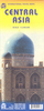


Central Asia Reise Know-How
The countries of Central Asia: Uzbekistan, Turkmenistan, Kyrgyzstan and Tajikistan, plus the southernmost part of Kazakhstan between Almaty and Qyzylorda presented by Reise-Know-How at 1:1, 700, 000 on a waterproof and tear-resistant, indexed road map with topographic and tourist information. The map, part of the publishers’ highly acclaimed World Mapping Project, is double-sided (with a very generous overlap) to provide the best balance between a good scale and a convenient size sheet.Road and rail networks are easy to see on a clear base which shows the area’s topography by altitude colouring with contours, spot heights, mountain passes and names of its numerous mountain ranges. Internal administrative boundaries are shown with names of the provinces. Road network includes
unsurfaced roads and seasonal tracks. A wide range of symbols highlights various places of interest, including UNESCO heritage sites, the route of the Silk Road, museums and archaeological remains, selected hotels, beaches, winter sports areas, etc. National parks and protected areas are prominently shown. Also marked are oil and gas pipelines. The map has a latitude and longitude grid at intervals of 1° and an index of place names with a separate list of national parks. Map legend includes English.
unsurfaced roads and seasonal tracks. A wide range of symbols highlights various places of interest, including UNESCO heritage sites, the route of the Silk Road, museums and archaeological remains, selected hotels, beaches, winter sports areas, etc. National parks and protected areas are prominently shown. Also marked are oil and gas pipelines. The map has a latitude and longitude grid at intervals of 1° and an index of place names with a separate list of national parks. Map legend includes English.
Product Description
Reviews/Comments
Add New
Vouchers
No voucher codes found.
Do you know a voucher code for this product or supplier? Add it to Insights for others to use.
Do you know a voucher code for this product or supplier? Add it to Insights for others to use.
 Denmark