More From Contributor
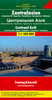
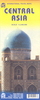
£9.99
Gizi Map coverage of Central Asia at 1:1, 750, 000 is available either in a geographical version or in a road edition &


...
Archived Product
£9.99
Gizi Map coverage of Central Asia at 1:1, 750, 000 is available either in a geographical version or in a road edition &


...
Archived Product
£10.99
Central Asia at 1:1, 500, 000 on a large map from Freytag & Berndt with a separate index booklet attached to the map cover also providing street plans of central Asgabat, Astana, Bishkek, Dushanbe & Tashkent. The map covers the whole of Uzbekistan, Tajikistan & Kyrgyzstan, plus most of Turkmenistan & southern Kazakhstan. Topography of the area is very effectively presented by relief shading, with plenty of names of geographical features such as mountain chains, peaks, valleys, deserts, etc, & additional graphics for forests, salt flats, swamps, wells in arid areas, sandy or rocky deserts, etc. National parks & other protected areas are highlighted. Road network indicates four different types of roads, including desert tracks, & indicates distances on main routes & locations of border crossings. The course of the various variants of the Silk Road is prominently marked. Railway lines are included & local airports are marked. The map also shows oil pipelines & internal administrative boundaries with names of the provinces. Symbols indicate various places of interest including UNESCO World Heritage sites. Latitude & longitude lines are drawn at 1° intervals. Multilingual map legend

Includes::
English. The index, arranged by country, is in a separate booklet attached to the map cover. The booklet also provide street plans (each covering two pages of Asgabat, Astana, Bishkek, Dushanbe & Tashkent. The plans highlight principal traffic arteries & give names of other main streets as well as various places of interest. Place names on the map & the street plans are shown transliterated into Latin alphabet, with some larger cities given alternative spellings (Toshkent/ Taschkent) or shown in Cyrillic alphabet.

...
Archived Product
£13.50
Central Asia Geographical Edition Wall Map at 1:1, 750, 000, size 121 x 81cm / 47.5” x 32” approx. Gizi Map coverage of Central Asia is available either in a geographical version or in a road edition &

Includes::
Uzbekistan, Kyrgyzstan, Tajikistan, plus southern Kazakhstan & most of Turkmenistan. Both versions show the region’s rail & road networks, including selected dirt tracks, give driving distances on major roads, & highlight several variants of the Silk Route. All place names are transliterated; local administrative boundaries are marked & names of provinces are shown. Detailed topographic information

Includes::
names of mountain ranges, deserts & other geographical features, numerous spot heights & peak names, swamps & salt flats, glaciers, etc. National parks are marked. Lines of latitude & longitude are drawn at 1° intervals. Index of localities is on the reverse of each map. Map legend

Includes::
English.GEOGRAPHICAL EDITION: The map has bold altitude colouring to provide a vivid picture of the region’s topography. Road Edition: Altitude colouring has been replaced by relief shading to provide a clearer background for the road & rail networks. Both versions are available either folded or as a wall map.


...
Archived Product
£9.99
Central Asia at 1:2, 400, 000 on a double-sided, indexed map published by ITMB, providing much wider coverage of the region than usually found in alternative titles, extending out to include most of Kazakhstan. The map has a small overlap between the two sides & covers all Uzbekistan, Tajikistan & Kyrgyzstan, plus Kazakhstan
- missing just small areas along its northern border with Russia & the north-western border with China, & also Turkmenistan where the south-western part of the country with Ashgabat is not included. Bold altitude colouring with spot heights & names of peaks, mountain ranges, etc, plus graphics for deserts, swamps, salt pans & glaciers present the region’s topography. National parks & other protected areas are highlighted & also marked are numerous water wells. The map shows road network, including selected seasonal tracks & highlighting the course of the Silk Road, railways & local airports. Symbols mark locations of various places of interest, including the area’s World Heritage sites. Latitude & longitude lines are drawn at 2° intervals. The map has an extensive index of localities.
...
Archived Product
£11.50
The countries of Central Asia: Uzbekistan, Turkmenistan, Kyrgyzstan & Tajikistan, plus the southernmost part of Kazakhstan between Almaty & Qyzylorda presented by Reise-Know-How at 1:1, 700, 000 on a waterproof & tear-resistant, indexed road map with topographic & tourist information. The map, part of the publishers’ highly acclaimed World Mapping Project, is double-sided (with a very generous overlap) to provide the best balance between a good scale & a convenient size sheet. Road & rail networks are easy to see on a clear base which shows the area’s topography by altitude colouring with contours, spot heights, mountain passes & names of its numerous mountain ranges. Internal administrative boundaries are shown with names of the provinces. Road network

Includes::
unsurfaced roads & seasonal tracks. A wide range of symbols highlights various places of interest, including UNESCO heritage sites, the route of the Silk Road, museums & archaeological remains, selected hotels, beaches, winter sports areas, etc. National parks & protected areas are prominently shown. Also marked are oil & gas pipelines. The map has a latitude & longitude grid at intervals of 1° & an index of place names with a separate list of national parks. Map legend

Includes::
English.


...
Archived Product
£13.50
Central Asia Road Edition Wall Map at 1:1, 750, 000, size 121 x 81cm / 47.5” x 32” approx. Gizi Map coverage of Central Asia is available either in a geographical version or in a road edition &

Includes::
Uzbekistan, Kyrgyzstan, Tajikistan, plus southern Kazakhstan & most of Turkmenistan. Both versions show the region’s rail & road networks, including selected dirt tracks, give driving distances on major roads, & highlight several variants of the Silk Route. All place names are transliterated; local administrative boundaries are marked & names of provinces are shown. Detailed topographic information

Includes::
names of mountain ranges, deserts & other geographical features, numerous spot heights & peak names, swamps & salt flats, glaciers, etc. National parks are marked. Lines of latitude & longitude are drawn at 1° intervals. Index of localities is on the reverse of each map. Map legend

Includes::
English. Geographical edition: The map has bold altitude colouring to provide a vivid picture of the region’s topography.ROAD EDITION: Altitude colouring has been replaced by relief shading to provide a clearer background for the road & rail networks. Both versions are available either folded or as a wall map.


...
Archived Product
£8.50
The mountains of Central Asia on at 1:500, 000 on 11 detailed, contoured maps derived from the Soviet era topographic survey but with transliterated place names & an English language map legend. The series provides coverage of the Tien Shan & Pamir Mountains, with the whole of Kyrgyzstan, northern Tajikistan, plus the adjoining regions of Uzbekistan (including Tashkent & Samarkand), southern Kazakhstan (with Almaty) & the Sinkiang Province of China. The maps have contours at 100m intervals, enhanced by altitude colouring & relief shading, with plenty of spot heights & names of various mountain chains, peaks, valleys, etc. Additional colouring and/or graphics indicate glaciers, cliffs, rock boulders, sands, ridges & dunes, mud & salt flats, different types of vegetation, etc. The maps show all the information expected of topographic mapping at this scale, including detailed presentation of local roads & tracks, railways, aerodromes, isolated settlements, national & internal administrative borders, etc. Latitude & longitude grid is drawn at 20’ & 30’ respectively. The series was prepared in mid-2000s when all the place names have been transliterated from the original Russian mapping & given, where possible, modern local names for larger towns. Each map provides a guide to the transliteration, as well as English & German glossary for the abbreviations. Map legend is in English. ...
Archived Product
£11.95
Map No. F-6 in the ONC series: military topographic survey mapping covering the world's land masses & significant islands at 1:1, 000, 000. The maps are useful as general topographical coverage where nothing else is available, although they are designed primarily as flying charts for military aircraft. ONC stands for Operational Navigation Chart. Relief is portrayed by a combination of contours (basic interval 1000ft, intermediate contours shown where appropriate), elevation tinting & relief shading, plus spot heights. Towns, villages, major roads, railways & airports are shown but please note that many of the smaller settlements are not named & the road information is not necessarily up to date, as compilation & revision dates vary. Some air navigation information also appears on the map, such as radio beacons & restricted flying zones. Each ONC chart has both UTM & latitude/longitude grids overprinted on it, with additional margin ticks. IMPORTANT
- PLEASE NOTE: The series is gradually being withdrawn from sale to the general public & some sheets may no longer be available when ordered by us. Due to the nature of the map projection assembling these sheets to make a larger map is not recommended. in addition, colours used for relief are not constant throughout the series. In some areas of central Africa & South America the maps have blank spaces, reflecting localized deficiencies or inconsistencies in the survey data.
...
Archived Product
£12.99
Between these covers, the millennia of mercantile & cultural exchange along the Silk Route are celebrated by travellers & writers from Marco Polo to Sven Hedin, from William of Rubrick to Ella Maillart. Kathleen Hopkirk has spent a lifetime researching this vital heartl&, traversed by five, inhospitable deserts but united by ancient chains of trading oases: from the Buddhist Empire of Kushan, to the scholarly Islamic centre at Bukhara, from the military conquerors massing in both directions to the saintly missionaries & monks who moved between its centres of learning. This mysterious homeland of the Tartars, Turks, Mongols, Uzbeks, Uighurs, Tajiks, Scythians & Sarmatians, gave the world terrifying conquerors of the stature of Gengiz Khan & Tamberlane. Later it became the focus of the Great Game, a rivalry for influence in the area between the empires of Russia & Britain played out by spies, ambassadors, agents & travel writers for 150 years, itself a continuation of the old cultural rivalry between Persia & China for the soul of this vast region. ...
Archived Product

Central Asia Nelles

Central Asia at 1:1, 750, 000 from Nelles Verlag, with its smaller size sheet offering a convenient format for use when travelling and now published on light, waterproof and tear-resistant synthetic paper. The map includes street plans of Tashkent, Biškek, Dushanbe, and Ashgabat, all annotated with places of interest and various facilities.The map divides the whole region east/west, covering the whole of Turkmenistan, Tajikistan and Kyrgyzstan, plus Uzbekistan south of the Aral Sea. Vivid relief shading with numerous spot heights and names of mountain ranges presents very effectively the topography of this mountainous region. National parks and other protected area are marked. Road network distinguishes between partially paved roads and dirt tracks, and shows distances on main
routes. Railway lines and local airports are included, and the map also shows internal administrative boundaries with names of the provinces. Various places of interest are prominently marked. All place names are in the Latin alphabet. Latitude and longitude margin ticks are at 1° intervals. The map has no index of localities. Map legend includes English.Also included are street plans of central Tashkent, Biškek, Dushanbe, and Ashgabat, all annotated with places of interest and various facilities.
RIP - This product is no longer available on our network. It was last seen on 25.09.2019

This page now acts as a permanent archive for this product. Add more information using the comments box below to ensure it can still be found by future generations.

Use our search facility to see if it is available from an alternative contributor.
  • External links may include paid for promotion
  • Availability: Out Of Stock
  • Supplier: Stanfords
  • SKU: 9783865742988
Availability: In Stock
£10.99

Product Description

Central Asia at 1:1, 750, 000 from Nelles Verlag, with its smaller size sheet offering a convenient format for use when travelling & now published on light, waterproof & tear-resistant synthetic paper. The map

Includes::
street plans of Tashkent, Biškek, Dushanbe, & Ashgabat, all annotated with places of interest & various facilities. The map divides the whole region east/west, covering the whole of Turkmenistan, Tajikistan & Kyrgyzstan, plus Uzbekistan south of the Aral Sea. Vivid relief shading with numerous spot heights & names of mountain ranges presents very effectively the topography of this mountainous region. National parks & other protected area are marked. Road network distinguishes between partially paved roads & dirt tracks, & shows distances on main routes. Railway lines & local airports are included, & the map also shows internal administrative boundaries with names of the provinces. Various places of interest are prominently marked. All place names are in the Latin alphabet. Latitude & longitude margin ticks are at 1° intervals. The map has no index of localities. Map legend

Includes::
English. Also included are street plans of central Tashkent, Biškek, Dushanbe, & Ashgabat, all annotated with places of interest & various facilities.

Reviews/Comments

Add New

Intelligent Comparison

Oooops!
We couldn't find anything!
Perhaps this product's unique.... Or perhaps we are still looking for comparisons!
Click to bump this page and we'll hurry up.

Price History

Vouchers

No voucher codes found.
Do you know a voucher code for this product or supplier? Add it to Insights for others to use.

Facebook

Jargon Buster

Paper - A thin sheet mainly used for writing. Available in a variety of colours. Made mainly from wood pulp.
Waterproof - Resistant to water, usualy specified by depth in metres
Size - is the measurement of how big an object is in space.
Network - A link and communication between things. Often computers or people.
Road - a manmade lane or a path that is used to speed up travel.
Resistant - Something that can repel against something.
Convenient - Something that suits and fits well to other activities.

Supplier Information

Stanfords
Stanfords was established in 1853 and opened their iconic Covent Garden flagship store in 1901. They have become the top retailer of maps, travel books and accessories in the UK and arguably offer the largest selection of maps and travel books worldwide. Famous names such as Captain Robert Falcon Scott, Ranulph Fiennes and Michael Palin have purchased from Stanfords. They now have a shop in Bristol and both stores together with other venues operate a calendar of events including talks, book signings and exhibitions. As a specialist map retailer, the map selection is comprehensive and includes road maps, street maps and walking maps from worldwide destinations, as well as a selection of world atlases and wall maps. Books include travel guides and travel literature. Stanfords also stock globes, from miniatures made of blue marble to magnificent floor-standing globes. The website features a selection of interesting articles on travel topics.
Page Updated: 2023-11-12 20:15:36

Community Generated Product Tags

Oh No! The productWIKI community hasn't generated any tags for this product yet!
Menu