
 United Kingdom
 France
 Germany
 Netherlands
 Sweden
 USA
USA
 Italy
Italy
 Spain
Spain
More From Contributor


Central America ITMB
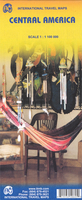
Central America at 1:1, 100, 000 on a double-sided indexed map from ITMB with enlargements for the environs of San Jose and the Panama Canal area, information about each country’s size, highest peak, etcThe map divides the region north/south across Nicaragua (along the 12°latitude) with a small overlap between the two sides. Relief is shown by elevation colouring and spot heights, with swamps, reefs and active volcanoes marked. Road network includes selected seasonal tracks, gives intermediate distances on main routes, and shows locations of border crossings and selected petrol stations. Railways, domestic airports and landing strips, and major ferry routes are marked, as well as the internal administrative boundaries with names of the provinces. National parks and nature
reserves, beaches, archaeological sites and other places of interest are highlighted. Latitude and longitude lines are shown at intervals of 1°. Each side has a a separate index of place names and is annotated with panels of useful information about the region. The map also includes enlargements of the Panama Canal corridor, the environs of San Jose, Isla del Coco, and Isla de San Andres.
reserves, beaches, archaeological sites and other places of interest are highlighted. Latitude and longitude lines are shown at intervals of 1°. Each side has a a separate index of place names and is annotated with panels of useful information about the region. The map also includes enlargements of the Panama Canal corridor, the environs of San Jose, Isla del Coco, and Isla de San Andres.

Product Description
Reviews/Comments
Add New
Vouchers
No voucher codes found.
Do you know a voucher code for this product or supplier? Add it to Insights for others to use.
Do you know a voucher code for this product or supplier? Add it to Insights for others to use.
 Denmark