
 United Kingdom
 France
 Germany
 Netherlands
 Sweden
 USA
USA
 Italy
Italy
 Spain
Spain
More From Contributor


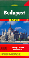
Budapest F&B
Budapest on a single sheet from Freytag & Berndt, Austria’s leading cartographic house, combining a street plan of the whole city with a detailed enlargement of its central area, transport diagram and a map of the environs.Features an indexed street plan of the city with its outer suburbs at 1:27, 500. The plan shows tram and bus routes with stops and line numbers, and the rail network with local stations. The central area is shown in greater detail at 1:5, 000, with public transport and one way streets. Also provided is a diagram of the entire public transport network and a road map of the city’s environs at 1:500, 000.Map legend for the street plans and all the descriptions include English.

Product Description
Reviews/Comments
Add New
Vouchers
No voucher codes found.
Do you know a voucher code for this product or supplier? Add it to Insights for others to use.
Do you know a voucher code for this product or supplier? Add it to Insights for others to use.
 Denmark