
 United Kingdom
 France
 Germany
 Netherlands
 Sweden
 USA
USA
 Italy
Italy
 Spain
Spain
More From Contributor


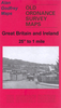


Bristol And District 1912
Bristol and District in 1912 in a series of reproductions of Ordnance Survey’s famous ”Inch to the Mile” maps published in the Alan Godfrey Editions to provide a historical record of England and Wales in the second half of 19th and early 20th century.In this title coverage stretches from Clevedon eastward to Keynsham and Kingswood, and from Stoke Gifford southward to Chew Magna. Other locations include: in GLOUCESTERSHIRE Avonmouth, Clifton, Filton, Frenchay, Henbury, Shirehampton and Winterbourne; plus in SOMERSET Abbots Leigh, Backwell, Barrow Gurney, Bedminster, Bishopsworth, Brislington, Brockley, Clapton in Gordano, Compton Dando, Congresbury, Dundry, Easton in Gordano, Flax Bourton, Kenn, Keynsham, Kingston Seymour, Long Ashton, Nailsea, Norton
Malreward, Pill, Portbury, Portishead, Publow, Puxton, Queen Charlton, Stanton Drew, Tickenham, Walton in Gordano, Weston in Gordano, Whitchurch, Winford, Wraxall, Wrington and Yatton. On the reverse is a more detailed map of Nailsea.About the Alan Godfrey Editions of the OS Inch to the Mile Maps: the maps provide an invaluable overview of a wider area, typically 18 x 12 miles (29 x 19 kms approx.), and offer historical mapping for small towns and villages not covered by the more detailed series for which the Godfrey Editions are better known. On the reverse all the maps have historical notes and most titles also include a more detailed, large scale map of a small town or a village in the area.To see other titles in this series please click on the series link.
Malreward, Pill, Portbury, Portishead, Publow, Puxton, Queen Charlton, Stanton Drew, Tickenham, Walton in Gordano, Weston in Gordano, Whitchurch, Winford, Wraxall, Wrington and Yatton. On the reverse is a more detailed map of Nailsea.About the Alan Godfrey Editions of the OS Inch to the Mile Maps: the maps provide an invaluable overview of a wider area, typically 18 x 12 miles (29 x 19 kms approx.), and offer historical mapping for small towns and villages not covered by the more detailed series for which the Godfrey Editions are better known. On the reverse all the maps have historical notes and most titles also include a more detailed, large scale map of a small town or a village in the area.To see other titles in this series please click on the series link.

Product Description
Reviews/Comments
Add New
Vouchers
No voucher codes found.
Do you know a voucher code for this product or supplier? Add it to Insights for others to use.
Do you know a voucher code for this product or supplier? Add it to Insights for others to use.
 Denmark