More From Contributor

£10.99
Bolzano (Bozen) at 1: 8, 000 & Merano (Meran) at 1:10, 000 on indexed street plans from Litografia Artistica Cartografica, 41 monuments in Bolzano & 19 in Merano, including historic buildings & churches, cultural or educational institutions, & important municipal buildings or facilities are numbered & listed next to the plan. Car parks are prominently marked. Each town has a separate index. Litografia Artistica Cartografica (LAC) are Italy’s leading publishers of street plans with an extensive range of titles. Where appropriate, the plans include an enlargement showing the historic centre in greater detail. On each plan monuments including historic buildings & churches, archaeological sites, cultural or educational institutions, & important municipal buildings or facilities are numbered & listed next to the plan. Unless indicated to the contrary in the individual description, one way streets are not marked. Street index is on the reverse. ...
Archived Product
£9.99
One of the titles in Freytag & Berndt’s series of hiking maps of Dolomites. The maps have contours at 100-metre intervals. An overprint highlights footpaths, including all nine Alte Vie
- the Dolomites High Level Routes, with cycling, mountain bike, & ski routes also shown on some of the titles. The maps show mountain refuges, campsites, youth hostels, etc. Geographical coordinates vary from margin ticks showing latitude & longitude in steps of 5` to a UTM grid
- please see individual descriptions. Map legend

Includes::
English. This title
Includes:: UTM grid, GPS waypoints, index, cycle & mountain bike routes, ski routes, a booklet with description of the area in German & Italian only.


...
Archived Product
£10.99
Bolzano/ Bozen
- Renon/ Ritten area in a series of Tabacco maps at 1:25, 000 covering the Dolomites & the mountains of north-eastern
...
Archived Product
£8.50
Map No. 54, Bolzano & Environs
- with a panorama map on the reverse, from Kompass in a series of walking maps of selected areas
...
Archived Product
£10.99
Map No. 154, Bolzano & Environs at 1:25, 000 printed on sturdy waterproof & tear-resistant plastic paper. The map is part of Kompass series providing detailed coverage of the Dolomites & Lake Garda area & supplementing their main series of walking maps of Italy at 1:50, 000. Maps in this series have a more detailed base & smaller contour interval than coverage at 1:50, 000.* Cartography:* maps at 1:25, 000 have contours at 25-m intervals. An overprint shows local & long-distance footpaths, including all the high level routes (Alte Vie). The maps also show the ”via ferrata” paths along the iron rails & ladders fitted into the rock faces. Other information

Includes::
various types of accommodation (campsites, alpine huts & refuges, etc.), recreational facilities, places of interest, local bus stops, etc. Many titles also have mountain bike trails or ski routes. Selected titles include on the reverse panorama drawings of the area, as indicated in the individual descriptions.* Geographical coordinates:* most maps are now GPS compatible
- titles without geographical coordinates are annotated to that effect in their individual description.* Map legend

Includes::
English.**PLEASE NOTE BEFORE ORDERING!* * Booklets:* many titles come with booklets describing the area and/or various hiking routes. These booklets are in * Italian & German only*, apart from a handful of titles where an English language booklet is specifically indicated in the individual description. So, unless English language booklet is actually mentioned, the map can only be supplied with an Italian/ German booklet. These booklets are not necessary to use the maps since, as stated above, full English language map legend is provided.


...
Archived Product
£12.99
Bolzano Province at 1:200, 000 in a series of handy size provincial road maps from Litografia Artistica Cartografica (LAC) with more minor local roads & country tracks than can be found on most regional maps from other publishers. This title is published with the traditional style LAC cartography.LAC’s provincial series is gradually being changed to a new style of digitally derived cartography, so presentation of adjoining titles may vary. All the maps have hill shading to represent the general relief with spot heights for selected peaks, & show a few more local roads & rough tracks than the other road map series. Intermediate road distances are indicated. Regional, provincial & communal borders are marked, & railways, funiculars, airports, sea ferry links & campsites are shown. The legend is in Italian only. The new, digitally produced editions are indexed & have enhanced, more finely drawn cartography: the hill-shading is less bold, motorway service areas are marked, natural parks are highlighted & an expanded range of symbols indicates various landmarks & sites, e.g. antiquities, churches, etc. Two styles of the new cartography are produced, differing only in the colour of the predominant background shading: grey or yellow/green. Some of the new editions include geographical coordinates for the map corners. The index of localities is on the reverse. To see all the titles in this series please click on the series link. ...
Archived Product
£17.99
Topographic survey of Portugal at 1:50, 000 from the Instituto Geográfico do Exército, the country’s military survey organisation. The maps have contours at 20m intervals & in addition to the standard features shown on topographic mapping at this scale also indicate various types of terrain or vegetation (s&, terraces, rocks, woodlands, vineyards, etc). Each sheet covers an area of 32 x 20km (20 x 12.5 miles approx). The maps have a 1-km UTM grid plus latitude & longitude coordinates for the map corners. Map legend & a glossary of terms used on the maps include English.EDITION DATES: most titles in this series date from 1990s or later. To see all the titles in this series please click on the series link. ...
Archived Product
£17.99
Topographic survey of Portugal at 1:50, 000 from the Instituto Geográfico Português, the country’s civilian survey organisation. The maps have contours at 25m intervals & in addition to the standard features shown on topographic mapping at this scale also indicate various types of vegetation (vineyards, olive groves, etc). Each sheet covers an area of 32 x 20km (20 x 12.5miles approx). The maps have latitude & longitude margin ticks at 1’ intervals & UTM coordinates for the map corners – each sheet also shows conversion details from BBLx (Bessel-Bonnie system, Datum Lisbon) to UTM. Map legend is in Portuguese only.EDITION DATES: most titles in this series have now been updated in the 1990s or later. To see all the titles in this series please click on the series link. ...
Archived Product
£475.00
The authentic Models` Bombay Box Side Table has beautiful character & will improve with age. Looks great as a feature piece ...
Archived Product
£485.00
The authentic Models` Bombay Box Side Table has beautiful character & will improve with age. Looks great as a feature piece ...
Archived Product

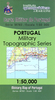
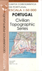
Bolzano And Environs Kompass 54

Map No. 54, Bolzano and Environs, from Kompass, printed on waterproof and tear-resistant synthetic paper in a series of walking maps of selected areas of Italy at 1:50, 000, with hiking routes on a topographic base, various types of accommodation, recreational facilities, places of interest, etc. Kompass are Europe’s largest publishers of walking maps, with extensive coverage of hiking areas in other countries, all listed on our website. *Cartography:* All the maps highlight local hiking paths and, where appropriate, long-distance routes or _via ferrata_ trails, and show various types of accommodation such as selected inns and hotels, campsites, mountain huts and refuges, etc. Some titles also highlight cycle or mountain bike trails or ski routes. Selected titles include
on the reverse panorama drawings of the area, as indicated in the individual descriptions. *PLEASE NOTE BEFORE ORDERING!* *Booklets:* many titles come with booklets describing the area and/or various hiking routes. These booklets are in *Italian and German only*, apart from a handful of titles where an English language booklet is specifically indicated in the individual description. So, unless English language booklet is actually mentioned, the map can only be supplied with an Italian/German booklet. These booklets are not necessary to use the maps since, as stated above, full English language map legend is provided.
RIP - This product is no longer available on our network. It was last seen on 25.09.2019

This page now acts as a permanent archive for this product. Add more information using the comments box below to ensure it can still be found by future generations.

Use our search facility to see if it is available from an alternative contributor.
  • External links may include paid for promotion
  • Availability: Out Of Stock
  • Supplier: Stanfords
  • SKU: 9783850266956
Availability: In Stock
£11.95

Product Description

Map No. 54, Bolzano & Environs, from Kompass, printed on waterproof & tear-resistant synthetic paper in a series of walking maps of selected areas of Italy at 1:50, 000, with hiking routes on a topographic base, various types of accommodation, recreational facilities, places of interest, etc. Kompass are Europe’s largest publishers of walking maps, with extensive coverage of hiking areas in other countries, all listed on our website. * Cartography:* All the maps highlight local hiking paths &, where appropriate, long-distance routes or _via ferrata_ trails, & show various types of accommodation such as selected inns & hotels, campsites, mountain huts & refuges, etc. Some titles also highlight cycle or mountain bike trails or ski routes. Selected titles include on the reverse panorama drawings of the area, as indicated in the individual descriptions. *PLEASE NOTE BEFORE ORDERING!* * Booklets:* many titles come with booklets describing the area and/or various hiking routes. These booklets are in * Italian & German only*, apart from a handful of titles where an English language booklet is specifically indicated in the individual description. So, unless English language booklet is actually mentioned, the map can only be supplied with an Italian/ German booklet. These booklets are not necessary to use the maps since, as stated above, full English language map legend is provided.

Reviews/Comments

Add New

Intelligent Comparison

Oooops!
We couldn't find anything!
Perhaps this product's unique.... Or perhaps we are still looking for comparisons!
Click to bump this page and we'll hurry up.

Price History

Vouchers

No voucher codes found.
Do you know a voucher code for this product or supplier? Add it to Insights for others to use.

Facebook

Jargon Buster

Paper - A thin sheet mainly used for writing. Available in a variety of colours. Made mainly from wood pulp.
Hiking - An outdoor activity envolving walking in nature
Italian - A word used ot descibe something from Italy
Waterproof - Resistant to water, usualy specified by depth in metres
Italy - a country in Europe.
Language - the method of communication used in different areas. Humans and computers have many different languages.
Resistant - Something that can repel against something.
Accommodation - A room in which someone can live in, for example in a hotel
Individual - A single separate item or person.
Language - The way humans communicate either written and spoken.

Supplier Information

Stanfords
Stanfords was established in 1853 and opened their iconic Covent Garden flagship store in 1901. They have become the top retailer of maps, travel books and accessories in the UK and arguably offer the largest selection of maps and travel books worldwide. Famous names such as Captain Robert Falcon Scott, Ranulph Fiennes and Michael Palin have purchased from Stanfords. They now have a shop in Bristol and both stores together with other venues operate a calendar of events including talks, book signings and exhibitions. As a specialist map retailer, the map selection is comprehensive and includes road maps, street maps and walking maps from worldwide destinations, as well as a selection of world atlases and wall maps. Books include travel guides and travel literature. Stanfords also stock globes, from miniatures made of blue marble to magnificent floor-standing globes. The website features a selection of interesting articles on travel topics.
Page Updated: 2023-11-12 20:15:36

Community Generated Product Tags

Oh No! The productWIKI community hasn't generated any tags for this product yet!
Menu