
 United Kingdom
 France
 Germany
 Netherlands
 Sweden
 USA
USA
 Italy
Italy
 Spain
Spain
More From Contributor


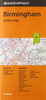

Birmingham And District 1910
Birmingham and District in 1910 in a series of reproductions of Ordnance Survey’s famous ”Inch to the Mile” maps published in the Alan Godfrey Editions to provide a historical record of England and Wales in the second half of 19th and early 20th century.The map is centred on Birmingham and stretches from Halesowen and Rowley Regis eastward to Shustoke and Meriden, and from Sutton Coldfield southward to Solihull. Other locations include: in STAFFORDSHIRE Darlaston, Great Barr, Oldbury, Smethwick, Wednesbury and West Bromwich; in WARWICKSHIRE Aston, Barston, Berkswell, Bickenhill, Castle Bromwich, Coleshill, Curdworth, Elmdon, Erdington, Great Packington, Hampton in Arden, Handsworth, Kingsbury, Lea Marston, Little Packington, Marston Green, Maxstoke, Minworth,
Nether Whitacre, Olton, Sheldon, Solihull, Water Orton and Wishaw; plus in WORCESTERSHIRE Frankley, Hasbury, Illey, Kings Norton, Northfield and Yardley. On the reverse is an extract from Warwickshire Sheet 19.03, showing the village of Olton in 1903.About the Alan Godfrey Editions of the OS Inch to the Mile Maps: the maps provide an invaluable overview of a wider area, typically 18 x 12 miles (29 x 19 kms approx.), and offer historical mapping for small towns and villages not covered by the more detailed series for which the Godfrey Editions are better known. On the reverse all the maps have historical notes and most titles also include a more detailed, large scale map of a small town or a village in the area.To see other titles in this series please click on the series link.
Nether Whitacre, Olton, Sheldon, Solihull, Water Orton and Wishaw; plus in WORCESTERSHIRE Frankley, Hasbury, Illey, Kings Norton, Northfield and Yardley. On the reverse is an extract from Warwickshire Sheet 19.03, showing the village of Olton in 1903.About the Alan Godfrey Editions of the OS Inch to the Mile Maps: the maps provide an invaluable overview of a wider area, typically 18 x 12 miles (29 x 19 kms approx.), and offer historical mapping for small towns and villages not covered by the more detailed series for which the Godfrey Editions are better known. On the reverse all the maps have historical notes and most titles also include a more detailed, large scale map of a small town or a village in the area.To see other titles in this series please click on the series link.

Product Description
Reviews/Comments
Add New
Vouchers
No voucher codes found.
Do you know a voucher code for this product or supplier? Add it to Insights for others to use.
Do you know a voucher code for this product or supplier? Add it to Insights for others to use.
 Denmark