More From Contributor

£20.99
Bernese Jura & Lakes, map No. 5026, in the standard topographic survey of Switzerland at 1:50, 000 from Swisstopo, i.e. without the special overprint highlighting walking trails, local bus stops, etc, presented in Swisstopo’s hiking editions of the 50K survey. Highly regarded for their superb use of graphic relief & hill shading, the maps give an almost 3-D picture of Switzerland`s mountainous terrain. Contours are at 20m intervals. All the maps have a 1-km grid with the Swiss national coordinates. This standard version of the 50K survey covers the whole country on 78 small format sheets, with special larger format maps published for several popular tourist destinations. Small format sheets cover an area of 35 x 24 km (21 x 15 miles approx) & have map legend in the language of the area covered by the map. The special larger sheets cover 50 x 35 km (31 x 22 miles approx) & have no map legend, but a separate leaflet can be provided instead.PLEASE NOTE: the hiking editions of the 1:50, 000 Swisstopo survey are listed on our website in a separate series. ...
Archived Product
£19.99
Bernese Oberland on a contoured & GPS compatible map at 1:120, 000 from Kümmerly + Frey, useful for planning walking holidays by indicating access to hiking trails by public transport. The map covers many popular holiday resorts including Grindelwald, Wengen, Müren & Interlaken, the peaks of Jungfrau, Eiger & Mönch, the famous railway line to Jungfraujoch, etc. Maps in Kümmerly + Frey‘s Holiday Series have contours at 100-metre intervals, enhanced by shading & graphic relief to provide a vivid presentation of the terrain. An overprint highlighting walking trails distinguishes between hiking paths, more strenuous mountain routes & alpine sections. Symbols indicate locations of mountain huts, Friends of Nature houses, youth hostels, campsites & selected isolated inns, interesting natural curiosities, etc. Picturesque towns or villages are prominently highlighted & the maps also show roads with public transport facilities plus, of course, railways & all forms of mountain transport (cable cars, chair lifts, etc). The maps have Swiss national grid lines at 5km intervals. Map legend

Includes::
English. To see the list of titles in this series please click on the series list.

...
Archived Product
£17.95
The Bernese Alps is accomplished walker Kev Reynolds’ Cicerone guide to the best walking routes in the very heart of the Swiss Alps. The guide covers the entirety of the Bernese Alps, including walks near the dramatic peaks of the Eiger, Monch & Jungfrau. Reynolds also covers some of the lesser-known mountains that boast picturesque scenery in romantic valleys, lakes, flower-filled meadows & strategically placed mountain huts. This edition was also recently updated with the latest information on routes. The guide is divided into 10 main geographical sections
- Haslital, Lutschental, Lauterbrunnental, Kiental, Kandertal, Engstligental, Diemtigtal, Ober Simmental, Lauenental & Sannental as well as a further chapter suggesting three multi-day routes. Each of the over 100 routes included has information on distance, height gain, estimated timings, distance & general location. The book’s introduction has practical tips on getting to the area, public transport in the Bernese Alps, accommodation, weather, safety check list, suggested equipment & a note about the difficulty gradings of the walks. Detailed route descriptions are accompanied by colour sketch diagrams mapping the route in addition to colour photographs illustrating some of the magnificent highlights of the Bernese Alps.
...
Archived Product
£19.99
Bernese Oberland West: Thun
- Interlaken
- Grindelwald
- Gstaad area at 1:60, 000 in Kümmerly + Frey’s series of cycling


...
Archived Product
£19.99
Bernese Oberland East: Interlaken
- Grindelwald
- Jugfrau Region
- Furka Pass area at 1:60, 000 in Kümmerly + Frey’s series


...
Archived Product
£20.99
Bernese Oberl&, map No. 5004, in the standard topographic survey of Switzerland at 1:50, 000 from Swisstopo, i.e. without the special overprint highlighting walking trails, local bus stops, etc, presented in Swisstopo’s hiking editions of the 50K survey. Coverage extends from Thun & Brienz with their lakes, across the peaks of Jungfrau, Eiger & Finsteraarhorn, to beyond the Aletschhorn &

Includes::
Interlaken, Grindelwald, Lauterbrunnen, Wengen, Mürren & other popular holiday resorts. Highly regarded for their superb use of graphic relief & hill shading, the maps give an almost 3-D picture of Switzerland`s mountainous terrain. Contours are at 20m intervals. All the maps have a 1-km grid with the Swiss national coordinates. This standard version of the 50K survey covers the whole country on 78 small format sheets, with special larger format maps published for several popular tourist destinations. Small format sheets cover an area of 35 x 24 km (21 x 15 miles approx) & have map legend in the language of the area covered by the map. The special larger sheets cover 50 x 35 km (31 x 22 miles approx) & have no map legend, but a separate leaflet can be provided instead.PLEASE NOTE: the hiking editions of the 1:50, 000 Swisstopo survey are listed on our website in a separate series.

...
Archived Product
£19.50
A selection of graded climbs for the whole spectrum of abilities. All the big mountains are included together with less well-known peaks. Compact, concise & detailed. Replaces a previous two-volume edition, Bernese Alps East & West, published in 1979, now with extended coverage including the very fine alpine rock climbing area of the Salbitschijen. About this series: Compact & portable mountain climbing guides. Each guide is organized by mountain group, with individual ascents described & graded by difficulty. Photographs are included, with recommended routes superimposed. General information is also included about the local area. Vinyl covered for durability. ...
Archived Product
£39.95
Earth Art: Colours of the Earth is a spectacular large-format collection of breathtaking aerial photographs by world-renowned photographer Bernhard Edmaier. Travelling all over the globe, from the Bahamas to Icel&, New Zealand to Alaska, & the Grand Canyon to Chile, Edmaier captures rarely-seen landscapes from above, such as bubbling mud pools, volcanic eruptions, coral reefs, eroded canyons & arctic glaciers. 150 full-page photographs cover the entire spectrum, & each image is accompanied by an explanation of how, where & why these spectacular colours occur on the earth`s surface. Earth Art is the perfect gift book for anyone who loves travel, nature & the environment, as well as photographic art & design, & is inspired by the natural beauty of our planet. ...
Archived Product
£7.95
Map No. 93, Bernina
- Sondrio, from Kompass in a series of walking maps of selected areas of Italy at 1:50, 000, with hiking
...
Archived Product
£9.95
Bernina
- Valmalenco
- Sondrio area at 1:50, 000 on a GPS compatible hiking & recreational map at 1:50, 000 from Kompass,

...
Archived Product

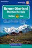
Bernese Oberland Hallwag Panorama Map

Beautiful panorama drawing of the Bernese Oberland from Hallwag, looking southwards from Bern towards the peaks from the Fleckistock in the east, across the over-4000m trio of Finsteraarhorn, Mõnch and Jungfrau, to Les Diablerets in the west. Each valley and mountain is clearly visible. Names and altitude are indicated for numerous peaks. The map also shows the railway network, with towns and villages. Excellent for planning or retracing journeys across this wonderful landscape.
RIP - This product is no longer available on our network. It was last seen on 25.09.2019

This page now acts as a permanent archive for this product. Add more information using the comments box below to ensure it can still be found by future generations.

Use our search facility to see if it is available from an alternative contributor.
  • External links may include paid for promotion
  • Availability: Out Of Stock
  • Supplier: Stanfords
  • SKU: 9783828301238
Availability: In Stock
£8.95

Product Description

Beautiful panorama drawing of the Bernese Oberland from Hallwag, looking southwards from Bern towards the peaks from the Fleckistock in the east, across the over-4000m trio of Finsteraarhorn, Mõnch & Jungfrau, to Les Diablerets in the west. Each valley & mountain is clearly visible. Names & altitude are indicated for numerous peaks. The map also shows the railway network, with towns & villages. Excellent for planning or retracing journeys across this wonderful landscape.

Reviews/Comments

Add New

Intelligent Comparison

Oooops!
We couldn't find anything!
Perhaps this product's unique.... Or perhaps we are still looking for comparisons!
Click to bump this page and we'll hurry up.

Price History

Vouchers

No voucher codes found.
Do you know a voucher code for this product or supplier? Add it to Insights for others to use.

Facebook

Jargon Buster

Network - A link and communication between things. Often computers or people.
Altitude - Something that can be quite high in relation to sea or ground level.
Wonderful - Another word for describing something that is extremely good, marvellous.

Supplier Information

Stanfords
Stanfords was established in 1853 and opened their iconic Covent Garden flagship store in 1901. They have become the top retailer of maps, travel books and accessories in the UK and arguably offer the largest selection of maps and travel books worldwide. Famous names such as Captain Robert Falcon Scott, Ranulph Fiennes and Michael Palin have purchased from Stanfords. They now have a shop in Bristol and both stores together with other venues operate a calendar of events including talks, book signings and exhibitions. As a specialist map retailer, the map selection is comprehensive and includes road maps, street maps and walking maps from worldwide destinations, as well as a selection of world atlases and wall maps. Books include travel guides and travel literature. Stanfords also stock globes, from miniatures made of blue marble to magnificent floor-standing globes. The website features a selection of interesting articles on travel topics.
Page Updated: 2023-11-12 20:15:36

Community Generated Product Tags

Oh No! The productWIKI community hasn't generated any tags for this product yet!
Menu