
 United Kingdom
 France
 Germany
 Netherlands
 Sweden
 USA
USA
 Italy
Italy
 Spain
Spain
More From Contributor


Argentina F&B
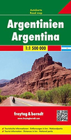
Argentina at 1:1, 500, 000 on a large, double-sided map from Freytag & Berndt presenting the country on three overlapping panels, with an index booklet attached to the map cover also providing street plans Buenos Aires, Córdoba and Rosario.The map divides the country north/south. On one side is northern Argentina, extending south to include Mendoza and Aconcagua, San Luis, Rio Cuarto and Rosario, plus the northern half of Uruguay, coverage of much of Paraguay including Asuncion, and parts of north-eastern Chile. On the reverse the remainder of the country is presented on two panels; coverage on the main panel starts in San Luis, extending east and west to Montevideo and Santiago, and continues southwards along the Andes beyond El Chaltén. The remainder of Patagonia and Terra
del Fuego are on the third panel; coverage here includes Torres del Paine National Park and the Chilean islands south of it.Bold relief shading and colouring for the Andes, with plenty of names of geographical features, do not detract from the presentation of road network which is graded into six types and shows locations of petrol stations. Tourist routes are highlighted. Railway lines are included and local airports are marked. Symbols indicate various places of interest including campsites. National parks and other protected areas are highlighted. The map also shows administrative boundaries with names of the provinces, and indicates numerous oil fields and pipelines. Latitude and longitude lines are drawn at 1º intervals. The index is in a booklet attached to the map cover, which
also provides street plans of central Buenos Aires, Córdoba and Rosario. Also included is a map of the Falkland Islands at the same scale as the main map; place names are in English (Stanley, etc). Map legend includes English.

Product Description
Reviews/Comments
Add New
Vouchers
No voucher codes found.
Do you know a voucher code for this product or supplier? Add it to Insights for others to use.
Do you know a voucher code for this product or supplier? Add it to Insights for others to use.
 Denmark