
 United Kingdom
 France
 Germany
 Netherlands
 Sweden
 USA
USA
 Italy
Italy
 Spain
Spain
More From Contributor


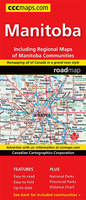
Manitoba
Indexed road map of Manitoba at 1:1, 250, 000 with an additional panel covering north-west Ontario with Lake Superior, plus Winnipeg and Brandon on more detailed road maps and plans of their downtown areas, and street plans of 10 more local towns. The whole province is shown at 1:1, 250, 000 on one side of the map. Topography is indicated by colouring for national/provincial parks and other protected areas, with numerous small rivers and lakes named on the map. Road network indicates paved, loose surface, unimproved or winter only roads, and shows driving distances on main and some local roads. Railway lines are included and locations with scheduled air service are marked. Symbols show campsites, visitor information centre, ski areas and various places of interest. No geographical
coordinates are provided; the index is next to the map.On the reverse a large panel with similar cartography shows north-west Ontario around Thunder Bay at 1:1, 750, 000. Coverage includes the US side of Lake Superior, indicating ferry connections. Enlargements for the environs of Winnipeg (1:200, 000) and Brandon (1:100, 000) are supplemented by street plans of each town’s downtown area highlighting various facilities and places of interest. Further street plans show Dauphin, Flin Flon, Gimli, Morden, Portage la Prairie, Selkirk, Steinbach, The Pas, Thompson and Winkler (scales 50K/100K). Also included is a distance table.To see the list of currently available Canadian province and regional maps form the MapArt / Canadian Cartographics Corporation / JDM Géo publishing group,
including waterproof and tear-resistant FastTrack titles, please click on the series link.

Product Description
Reviews/Comments
Add New
Vouchers
No voucher codes found.
Do you know a voucher code for this product or supplier? Add it to Insights for others to use.
Do you know a voucher code for this product or supplier? Add it to Insights for others to use.
 Denmark