More From Contributor

£3.50
Manchester North West & Central Salford in 1915 in a fascinating series of reproductions of old Ordnance Survey plans in the Alan Godfrey Editions, ideal for anyone interested in the history of their neighbourhood or family. The map covers major areas of both Salford & Manchester, stretching from Peel Park eastward to Shude Hill, & from Salford station northward to Derby Street & York Street. Major features include Exchange station, Victoria station, Salford station with Bailey Yard, River Irwell, Cathedral, Market Street, Salford Town Hall, Salford Iron Works, St Simon`s church, RC Cathedral, Royal Hospital, Royal Museum & Library, Peel Works, Peel Park, Oldfield Road Wharf, much of Lower Broughton, many small works, Broughton Copper Works, Union Bridge Iron Works, Red Bank Spring & Axle Works, Royal Exchange, Chetham`s Hospital, etc. On the reverse are street directory entries for Blackfriars Road & Street & Market Street. About the Alan Godfrey Editions of the 25” OS Series: Selected towns in Great Britain & Ireland are covered by maps showing the extent of urban development in the last decades of the 19th & early 20th century. The plans have been taken from the Ordnance Survey mapping & reprinted at about 15 inches to one mile (1:4, 340). On the reverse most maps have historical notes & many also include extracts from contemporary directories. Most maps cover about one mile (1.6kms) north/south, one & a half miles (2.4kms) across; adjoining sheets can be combined to provide wider coverage.FOR MORE INFORMATION & A COMPLETE LIST OF ALL AVAILABLE TITLES PLEASE CLICK ON THE SERIES LINK. ...
Archived Product
£9.09
Map No. 109, Manchester, in the waterproof & tear-resistant OSActive version of the Ordnance Survey Landranger series at 1:50, 000, including Bolton, Warrington, Appleton Thorn, Mere, Wilmslow, Bramhall, Poynton, New Mills, Cheadle, Lymm, Altrincham, Stockport, Romiley, Sel, Irlam, Clucheth, Golborne, Leigh, Platt Bridge, Salford, Ashton-under-Lyne, Stalybridge, Mossley, Oldham, Walkden, Middleton, Westhoughton, Bury, Denshaw, Rochdale, Tottington, Horwich, Egerton & Ramsbottom, with a section of the Pennine Way & a small part of the Peak District National Park. Edition D3; Publication date April 2012 About Ordnance Survey ...
Archived Product
£3.50
Oxford Street & Gaythorn area of Manchester in 1849 in a series of exceptionally detailed reproductions of old Ordnance Survey street plans for areas of larger cities which have undergone substantial redevelopment in the late 19th or the early 20th century, published in the Alan Godfrey Editions. The plans, printed in back & white, have been taken from the original Ordnance Survey mapping at 1:1, 056 & reproduced at 1:1, 760 – the equivalent of 36 inches (or one yard) to a mile. The maps provide an unrivalled, house-by-house picture of streets & individual buildings with inner courtyards, outbuildings, pavements, covered passages, etc. Many important institutions are named; within the National Galley on Trafalgar Square even the individual rooms (the map is from 1871, so no French Impressionists as yet!). On the reverse are historical notes about the area covered by the map, plus extracts from contemporary street directories. These maps provide a fascinating addition to Alan Godfrey’s huge series of some 2, 000 titles presenting reproductions of street plans at taken from the Ordnance Survey mapping at 1:2, 500 (25” to 1 mile) & reprinted at about 15 inches to one mile (1:4, 340). ...
Archived Product
£14.99
Manchester Pevsner Architectural Guide, in a series of publications begun with the express aim of providing up-to-date guides to the most significant buildings in every part of the country, suitable for both general reader & specialist. Each volume provides an introductory overview of the architecture of the area, followed by a descriptive gazetteer arranged alphabetically by place. Whilst cathedrals & their furnishings, great country houses & their parks form the grand set pieces, the books demonstrate the enjoyable diversity of architecture in the British Isles in accounts of rural churches & farmsteads, Victorian public buildings & industrial monuments. A continuing programme of publication keeps the series up-to-date with new information on older buildings & recent architecture while maintaining the tradition of Pevsner`s own succinct accounts. Each book has over 100 photographs, mostly specially commissioned, numerous maps & plans, a glossary & indexes. ...
Archived Product
£3.50
Piccadilly area of Manchester in 1849 in a series of exceptionally detailed reproductions of old Ordnance Survey street plans for areas of larger cities which have undergone substantial redevelopment in the late 19th or the early 20th century, published in the Alan Godfrey Editions. The plans, printed in back & white, have been taken from the original Ordnance Survey mapping at 1:1, 056 & reproduced at 1:1, 760 – the equivalent of 36 inches (or one yard) to a mile. The maps provide an unrivalled, house-by-house picture of streets & individual buildings with inner courtyards, outbuildings, pavements, covered passages, etc. Many important institutions are named; within the National Galley on Trafalgar Square even the individual rooms (the map is from 1871, so no French Impressionists as yet!). On the reverse are historical notes about the area covered by the map, plus extracts from contemporary street directories. These maps provide a fascinating addition to Alan Godfrey’s huge series of some 2, 000 titles presenting reproductions of street plans at taken from the Ordnance Survey mapping at 1:2, 500 (25” to 1 mile) & reprinted at about 15 inches to one mile (1:4, 340). ...
Archived Product
£2.99
Explore the glorious city of Manchester with the help of this genuinely pocket-sized map. Small in size yet big on detail, this compact, dependable map will ensure you don't miss a thing.

Includes::
2 Pop Out maps
- a detailed street by street plan of the city centre as well as a map of greater Manchester Additional maps cover Salford Keys & the metrolink Ingenious, self-folding map is small enough to fit in your pocket yet offers extensive coverage of the city in an easy-to-use format Thorough street index is also featured & cross-referenced to the map so you can easily find your destination Further key places of interest are also listed offering you advice on the best things to see


...
Archived Product
£1.99
The ultimate pocket city map of Manchester! Explore the glorious city of Manchester with the help of this genuinely pocket-sized, pop-up map. Small in size yet big on detail, this compact, dependable, city map will ensure you don't miss a thing.

Includes::
a Pop Out map
- a detailed street by street plan of the city centre as well as Salford Quays & metrolink Handy, self-folding, tourist map is small enough to fit in your pocket yet offers extensive coverage of the city in an easy-to-use format Thorough street index is also featured & cross-referenced to the map so you can easily find your destination Further key places of interest are also listed offering you advice on the best things to see Hotels, restaurants, stores & attractions are all included on the map


...
Archived Product
£6.95
Manchester Premier Street Plan from Geographers` A-Z Map Company designed to cover the city within its administrative boundaries, with a separate comprehensive index booklet listing streets, places & areas, industrial estates, selected flats & walkways, service areas, stations, & selected places of interest, shown where appropriate with their postcodes. The city is covered at 3.4 inches to 1 mile (1:18, 635). Coverage
Includes:: Ashton-under-Lyne, Denton, Eccles, Kearsley, Oldham, Prestwich, Sale, Salford & Stockport. An inset shows road access to the Manchester International Airport. Current edition of this title was published in 2010. The inside of the map cover has an enlargement presenting the town centre in greater clarity at 5½ inches to 1 mile (1:11, 520), plus a diagram of the rail & Metrolink network. The plans show A & B roads, plus longer street annotated with selected house numbers for easier identification of addresses. One way traffic, restricted access, pedestrianized streets, selected car parks & Park & Ride facilities are marked. Railway stations are shown with names & Metrolink lines indicate stops. Colouring and/or symbols indicate public building, services & facilities, including shopping centres or market streets, industrial buildings, hospitals or healthcare, etc. Public toilets are marked, indicating those with facilities for the disabled. The map also shows local authority & postcode boundaries, plus national grid lines. The index is in a separate booklet attached to the map cover &

Includes::
a list of hospitals, walk-in medical centres & hospices.* This title is also available in a waterproof version, or as a wall map on paper or encapsulated.


...
Archived Product
£13.99
Waterproof & tear-resistant version of Manchester Premier Street Plan from Geographers` A-Z Map Company designed to cover the city within its administrative boundaries, with a separate comprehensive index booklet listing streets, places & areas, industrial estates, selected flats & walkways, service areas, stations, & selected places of interest, shown where appropriate with their postcodes. The city is covered at 3.4 inches to 1 mile (1:18, 635). Coverage
Includes:: Ashton-under-Lyne, Denton, Eccles, Kearsley, Oldham, Prestwich, Sale, Salford & Stockport. An inset shows road access to the Manchester International Airport. Current edition of this title was published in 2008. The inside of the map cover has an enlargement presenting the town centre in greater clarity at 5½ inches to 1 mile (1:11, 520), plus a diagram of the rail & Metrolink network. The plans show A & B roads, plus longer street annotated with selected house numbers for easier identification of addresses. One way traffic, restricted access, pedestrianized streets, selected car parks & Park & Ride facilities are marked. Railway stations are shown with names & Metrolink lines indicate stops. Colouring and/or symbols indicate public building, services & facilities, including shopping centres or market streets, industrial buildings, hospitals or healthcare, etc. Public toilets are marked, indicating those with facilities for the disabled. The map also shows local authority & postcode boundaries, plus national grid lines. The index is in a separate booklet attached to the map cover &

Includes::
a list of hospitals, walk-in medical centres & hospices.* This title is also available on paper, or as a wall map on paper or encapsulated.


...
Archived Product
£24.50
Manchester Premier Wall Map, size 121 x 96cm, *encapsulated version*, from Geographers` A-Z Map Company designed to cover the city within its administrative boundaries, with a separate comprehensive index booklet listing streets, places & areas, industrial estates, selected flats & walkways, service areas, stations, & selected places of interest, shown where appropriate with their postcodes. The city is covered at 3.4 inches to 1 mile (1:18, 635). Coverage
Includes:: Ashton-under-Lyne, Denton, Eccles, Kearsley, Oldham, Prestwich, Sale, Salford & Stockport. An inset shows road access to the Manchester International Airport. Current edition of this title was published in 2008. The plan shows A & B roads, plus longer street annotated with selected house numbers for easier identification of addresses. One way traffic, restricted access, pedestrianized streets, selected car parks & Park & Ride facilities are marked. Railway stations are shown with names. Colouring and/or symbols indicate public building, services & facilities, including shopping centres or market streets, industrial buildings, hospitals or healthcare, etc. Public toilets are marked, indicating those with facilities for the disabled. The map also shows local authority & postcode boundaries, plus national grid lines. The index is in a separate booklet.* This wall map is also available on paper, or as a folded map on paper or waterproof.*LAMINATED & ENCAPSULATED WALL MAPS:*- *laminated* wall maps have a thin layer of plastic usually applied to the printed side only. They can be written on with suitable marker pens without any damage to the map but, unless laminated on both sides, they are not damp-proof.- *encapsulated* wall maps are sealed between two sheets of plastic. They are more rigid & heavier than laminated maps of the same size. They are damp-proof & do not crinkle in humid conditions. Encapsulation gives the map a shiny surface, similar to being displayed behind glass.- *please note:* many publishers & retailers often use these two terms interchangeably. Our map titles & descriptions follow the definitions provided above.
...
Archived Product

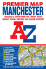
Manchester Pocket Map

This title includes Manchester's clearest mapping in a handy, pocket-sized format. Quick to navigate and conveniently sized to carry with you around the city, the easy-to-read large scale map includes NCP car parks and one-way streets, public toilets, pubs, hotels, petrol stations and public buildings, as well as an index of all streets and places of interest. Fully revised and updated, Pocket Map Manchester is all you need to keep you on the move in Manchester.
RIP - This product is no longer available on our network. It was last seen on 25.09.2019

This page now acts as a permanent archive for this product. Add more information using the comments box below to ensure it can still be found by future generations.

Use our search facility to see if it is available from an alternative contributor.
  • Availability: Out Of Stock
  • Supplier: Stanfords
  • SKU: 9780749555672
Availability: In Stock
£1.50

Product Description

This title

Includes::
Manchester's clearest mapping in a handy, pocket-sized format. Quick to navigate & conveniently sized to carry with you around the city, the easy-to-read large scale map

Includes::
NCP car parks & one-way streets, public toilets, pubs, hotels, petrol stations & public buildings, as well as an index of all streets & places of interest. Fully revised & updated, Pocket Map Manchester is all you need to keep you on the move in Manchester.

Reviews/Comments

Add New

Intelligent Comparison

Oooops!
We couldn't find anything!
Perhaps this product's unique.... Or perhaps we are still looking for comparisons!
Click to bump this page and we'll hurry up.

Price History

Vouchers

No voucher codes found.
Do you know a voucher code for this product or supplier? Add it to Insights for others to use.

Facebook

Jargon Buster

Car - A machine used for transport which runs on roads
Quick - Something that is fast
Large - something that takes up more space than normal.
Pocket - A bag shaped insert in clothing used to carry items

Supplier Information

Stanfords
Stanfords was established in 1853 and opened their iconic Covent Garden flagship store in 1901. They have become the top retailer of maps, travel books and accessories in the UK and arguably offer the largest selection of maps and travel books worldwide. Famous names such as Captain Robert Falcon Scott, Ranulph Fiennes and Michael Palin have purchased from Stanfords. They now have a shop in Bristol and both stores together with other venues operate a calendar of events including talks, book signings and exhibitions. As a specialist map retailer, the map selection is comprehensive and includes road maps, street maps and walking maps from worldwide destinations, as well as a selection of world atlases and wall maps. Books include travel guides and travel literature. Stanfords also stock globes, from miniatures made of blue marble to magnificent floor-standing globes. The website features a selection of interesting articles on travel topics.
Page Updated: 2023-11-12 20:15:36

Community Generated Product Tags

Oh No! The productWIKI community hasn't generated any tags for this product yet!
Menu