More From Contributor

£17.99
Including over 500 photographs of animals in their natural habitats, this book combines information on mammals, reptiles & amphibians. The text not only allows the reader to locate & identify species in the wild, but offers a fascinating insight into the private lives of animals which are typically secretive, & often noctumal. ...
Archived Product
£20.00
Bordering iridescent seas, Puglia sits at the heel of Italy`s `boot`. It is a region where the food is light, nutritious & rustic, & firmly centred around family life. Born in this captivating place, Elisabetta Minervini has brought the vitality of Puglian cooking to her home in London, where she has tried & tested the best traditional recipes for children & adults alike. These include orecchiette (`little-ear` pasta) with broccoli, stuffed peppers, octopus salad & the ultimate homemade pizza
- as well as a host of delicious sweet treats. Perfect for busy mammas, it`s a way of cooking that suits the modern lifestyle, with dishes that can be prepared quickly & easily using inexpensive, healthy ingredients. This lively introduction to all that Puglian family cooking has to offer will bring la dolce vita into your own kitchen!
...
Archived Product
£10.99
This is an all-encompassing, chronological guide to football`s World Cup, one of the world`s few truly international events, in good time for the June 2014 kick-off in Rio de Janeiro. From its beginnings in 1930 to the modern all-singing, all-dancing self-styled `greatest show on Earth`, every tournament is covered with features on major stars & great games, as well as stories about some less celebrated names & quirky stats & intriguing essays. Holt`s focus is very much on what takes place on the field, rather than how football is a mirror for economic corruption, or how a nation`s style of play represents a profound statement about its people, or how a passion for football can lift underpaid, socially marginalised people out of poverty. From the best World Cups, in 1958 & 1970, to the worst, in 1962 & 2010, he looks behind the facts & the technical observations to the stories: the mysterious sins of omission; critical injuries to key players; & coaching U-turns. He explains how England`s World Cup achievements under Sven-Goran Eriksson, far from being a national disgrace, were actually quite impressive, & looks at why Alf Ramsey didn`t take Bobby Charlton off in 1970, but this is no parochial, jingoistic account. The book also asks why Brazil did not contribute in 1966, despite having won the previous two tournaments & going on to win the next one? Why the greatest players of their day did not always shine at the World Cup
- George Best & Alfredo Di Stefano, for example, never even made it to the Finals. Why did Johann Cruyff not go to the 1978 World Cup? & why did one of Germany`s greatest players never play in the World Cup? There are lots of tables, some filled with obvious, but necessary information, but others with more quirky observations. Alongside accounts of epic games, there are also brief biographies of all the great heroes of the World Cup.
...
Archived Product
£7.99
No one sees clearer than an individual whose life is hanging by the finger tips on the edge of an abyss. Probing the furthest reaches of human daring & endurance, here are 28 of the great first-hand accounts of extreme mountaineering, from legendary names. Featuring: Heinrich Harrer
- first conqueror of the notorious Eigerwand; Robert Bates
- the classic account of the ill-fated American 1953 expedition to K2; Maurice Herzog
- his unstoppable ascent of Annapurna at the cost of frostbite; Walter Bonatti
- tragedy on the Central Pillar of Freney on Mont Blanc; George Leigh Mallory
- surviving an avalanche on the 1922 Everest expedition; Rene Desmaison
- his epic story of 14 days stuck on The Grandes Jorasses in winter; &, Jon Krakauer
- recalling his solo ascent of The Devil`s Thumb in Alaska. The price of the summit is often measured in human suffering, yet for those who succeed the rewards can be incalculable. This book is nerve-wracking & unputdownable.


...
Archived Product
£9.99
Map No. 234, Mammoth Cave National Park, KY, in an extensive series of GPS compatible, contoured hiking maps of USA’s national & state parks or forests & other popular recreational areas. Cartography based on the national topographic survey, with additional tourist information. The maps, with most titles now printed on light, waterproof & tear-resistant plastic paper, highlight walking trails along with campsites & other accommodation, picnic sites, areas for various recreational pursuits such as horse riding or skiing, drinking water sources, & many other facilities of interest to the outdoor enthusiast. Cartography is based on information from the USGS (United States Geological Survey
- the country’s national survey organization), revised by the National Geographic Maps in cooperation with the National Park Service, USDA Forest Service, etc. Topography is excellently presented by contours (interval varies according to scale), enhanced by relief shading & colouring/graphics for wood cover, glaciers, etc. All heights are given in feet. The maps have a UTM grid plus latitude & longitude margin ticks & GPS waypoints for selected important locations. Each map is double-sided to give either maximum coverage of the chosen area or additional enlargements of its important sections. Accompanying notes provide useful information on relevant regulations, safety precautions, contact addresses, etc.* *IMPORTANT
- PLEASE NOTE: the series is very extensive, ranging in scale from 1:400, 000 for the vast national parks of Alaska to 1:25, 000 for local map in several states. We recommend, therefore, viewing the series by state rather than the whole list.*

...
Archived Product
£8.99
Map No. 303, Yellowstone NW: Mammoth Hot Springs, WY/MT, in an extensive series of GPS compatible, contoured hiking maps of USA’s national & state parks or forests & other popular recreational areas. Cartography based on the national topographic survey, with additional tourist information. The maps, with most titles now printed on light, waterproof & tear-resistant plastic paper, highlight walking trails along with campsites & other accommodation, picnic sites, areas for various recreational pursuits such as horse riding or skiing, drinking water sources, & many other facilities of interest to the outdoor enthusiast. Cartography is based on information from the USGS (United States Geological Survey
- the country’s national survey organization), revised by the National Geographic Maps in cooperation with the National Park Service, USDA Forest Service, etc. Topography is excellently presented by contours (interval varies according to scale), enhanced by relief shading & colouring/graphics for wood cover, glaciers, etc. All heights are given in feet. The maps have a UTM grid plus latitude & longitude margin ticks & GPS waypoints for selected important locations. Each map is double-sided to give either maximum coverage of the chosen area or additional enlargements of its important sections. Accompanying notes provide useful information on relevant regulations, safety precautions, contact addresses, etc.* *IMPORTANT
- PLEASE NOTE: the series is very extensive, ranging in scale from 1:400, 000 for the vast national parks of Alaska to 1:25, 000 for local map in several states. We recommend, therefore, viewing the series by state rather than the whole list.*

...
Archived Product
£9.99
Map No. 809, Mammoth Lakes / Mono Divide, CA, in an extensive series of GPS compatible, contoured hiking maps of USA’s national & state parks or forests & other popular recreational areas. Cartography based on the national topographic survey, with additional tourist information. The maps, with most titles now printed on light, waterproof & tear-resistant plastic paper, highlight walking trails along with campsites & other accommodation, picnic sites, areas for various recreational pursuits such as horse riding or skiing, drinking water sources, & many other facilities of interest to the outdoor enthusiast. Cartography is based on information from the USGS (United States Geological Survey
- the country’s national survey organization), revised by the National Geographic Maps in cooperation with the National Park Service, USDA Forest Service, etc. Topography is excellently presented by contours (interval varies according to scale), enhanced by relief shading & colouring/graphics for wood cover, glaciers, etc. All heights are given in feet. The maps have a UTM grid plus latitude & longitude margin ticks & GPS waypoints for selected important locations. Each map is double-sided to give either maximum coverage of the chosen area or additional enlargements of its important sections. Accompanying notes provide useful information on relevant regulations, safety precautions, contact addresses, etc.* *IMPORTANT
- PLEASE NOTE: the series is very extensive, ranging in scale from 1:400, 000 for the vast national parks of Alaska to 1:25, 000 for local map in several states. We recommend, therefore, viewing the series by state rather than the whole list.*

...
Archived Product
£7.99
Detailed topographic survey map of the northern half of the isl&, from Tzoundzou 2 (on the east coast) northwards.


...
Archived Product
£12.99
Detailed topographic survey map of the northern half of the isl&, from Tzoundzou 2 (on the east coast) northwards.


...
Archived Product
£25.00
From Olia Hercules
- Observer Rising Star of 2015 ” Exotic, earthy dishes, vibrant colours, big flavours. This is real cooking,
...
Archived Product

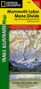
Mammoth High Country

Centred on Obsidian Dome, this map extends north to Lee Vining and the southern fringe of Mono Lake, west to Ellery Lake, south to Lake Virginia in the Sierra National Forest and east to McGee Mtn.One of the five maps in this series reguired to cover the High Sierra between the Yosemite Valley and Mt Whitney. John Muir Trail/Pacific Crest Trail is marked, as well as numerous other local hiking routes.
RIP - This product is no longer available on our network. It was last seen on 25.09.2019

This page now acts as a permanent archive for this product. Add more information using the comments box below to ensure it can still be found by future generations.

Use our search facility to see if it is available from an alternative contributor.
  • External links may include paid for promotion
  • Availability: Out Of Stock
  • Supplier: Stanfords
  • SKU: 9781877689567
Availability: In Stock
£10.95

Product Description

Centred on Obsidian Dome, this map extends north to Lee Vining & the southern fringe of Mono Lake, west to Ellery Lake, south to Lake Virginia in the Sierra National Forest & east to Mc Gee Mtn. One of the five maps in this series reguired to cover the High Sierra between the Yosemite Valley & Mt Whitney. John Muir Trail/ Pacific Crest Trail is marked, as well as numerous other local hiking routes.

Reviews/Comments

Add New

Price History

Vouchers

No voucher codes found.
Do you know a voucher code for this product or supplier? Add it to Insights for others to use.

Facebook

Jargon Buster

Forest - A area with a high density of trees
Hiking - An outdoor activity envolving walking in nature
Dome - A curved shape usually seen on building structures.

Supplier Information

Stanfords
Stanfords was established in 1853 and opened their iconic Covent Garden flagship store in 1901. They have become the top retailer of maps, travel books and accessories in the UK and arguably offer the largest selection of maps and travel books worldwide. Famous names such as Captain Robert Falcon Scott, Ranulph Fiennes and Michael Palin have purchased from Stanfords. They now have a shop in Bristol and both stores together with other venues operate a calendar of events including talks, book signings and exhibitions. As a specialist map retailer, the map selection is comprehensive and includes road maps, street maps and walking maps from worldwide destinations, as well as a selection of world atlases and wall maps. Books include travel guides and travel literature. Stanfords also stock globes, from miniatures made of blue marble to magnificent floor-standing globes. The website features a selection of interesting articles on travel topics.
Page Updated: 2023-11-12 20:15:36

Community Generated Product Tags

Oh No! The productWIKI community hasn't generated any tags for this product yet!
Menu