
 United Kingdom
 France
 Germany
 Netherlands
 Sweden
 USA
USA
 Italy
Italy
 Spain
Spain
More From Contributor


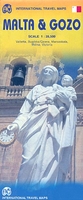
Malta & Gozo ITMB
Malta at 1:28, 500 on an indexed map from ITMB with large, clear street plans of central Valetta, Bugibba/Qawra, Marsaskala, Mdina and Victoria. On one side is Malta itself. Altitude colouring and spot heights show the island’s topography. Road network includes selected local tracks, gives distances on main routes and indicates locations of petrol stations. Symbols highlight various places of interest.On the reverse similar mapping, also at 1:28, 500, covers Gozo and Comino. Both sides show ferry connections between the islands and have latitude and longitude margin ticks at 5’ interval. Each side has a separate index.The reverse side also includes large, clear street plans of central Valetta, Bugibba/Qawra, Marsaskala, Mdina and Victoria, all annotated with selected
accommodation, various facilities and places of interest.
accommodation, various facilities and places of interest.

Product Description
Reviews/Comments
Add New
Vouchers
No voucher codes found.
Do you know a voucher code for this product or supplier? Add it to Insights for others to use.
Do you know a voucher code for this product or supplier? Add it to Insights for others to use.
 Denmark