More From Contributor
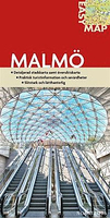
£11.95
Malmö & the nearby Lund in an indexed pocket street atlas fro Liber Kartor, with diagrams of local bus & train lines, plus a street plan of central Copenhagen & the city’s international airport at Kastrup. All the plans are at the same scale of 1:12, 000. There is no map legend, but the plans are self-explanatory. Diagrams show main bus lines in both cities, as well as the region’s rail network. Also included is a small inset showing the location of the tourist information office & the toll barrier on the Swedish side of the bridge linking Malmö with Denmark. ...
Archived Product
£16.99
Topographic survey of Sweden at 1:50, 000, the Terrängkartan, from the Lantmäteriet, covering most of the country in 244 double-sided maps. Please note: the mountainous regions of central & northern Sweden are not covered by this series but presented in a separate “ Fjällkartan
- Mountain Map” series also listed on our website. Each 1:50, 000 topographic survey map covers an area of 37.5 x 40km. The maps have contours at 5 metre intervals, plus relief shading & graphics for rocky outcrops & boulders. Further graphics and/or colouring show different types of land use or vegetation (forests, arable l&, orchards, marshes, peat bogs, etc). An unusual feature of this survey is the colouring indicating buildings below or above two storeys high & “leisure/holiday homes”. The maps indicate privately maintained roads & include all other information expected of topographic survey at this scale. The maps have a 1-km UTM grid, plus latitude & longitude lines 5’ intervals. Map legend

Includes::
English. For coverage of the country’s most visited hiking areas in central & northern Sweden please see Lantmäteriet’s Mountain Map series, listed separately on our website.


...
Archived Product
£11.99
Ardennes Recreational Maps at a scale of 1:25, 000 enable you to discover the Ardennes from junction to junction, each associated with a locality, through a network of hiking, cycling or riding paths. The network of mini walks consists of suggested routes with kilometre distance marked showing field boundaries & urbanised built up areas. Contour markings are at five metre intervals. The map legend is in English, French, Dutch & German. You can scan QR codes on the map for details about the respective locality or upload GPX files of the proposed routes via the provided website. ...
Archived Product
£11.99
Topographical survey of Belgium at 1:20, 000 from Nationaal Geografisch Instituut / Institut Géographique National, the country’s national survey organization. Each 20K map covers one quarter of the corresponding 1:50, 000 map (with adjustments in the border & coastal areas). The maps provide all the information expected of topographic mapping at this scale & in addition have an unusually large amount of vegetation and/or land use information (different types of woodlands, gardens, orchards, heath, etc). The maps have a 1-km UTM grid, with margin ticks for latitude & longitude at intervals of 1`. Map legend & a glossary of terms used on the maps include English. Stanfords keeps as regular stock 20K maps for the World War I battlefields around the Ypres, Messines & Passchendaele, & for the area of the Battle of Waterloo. The 1:20, 000 survey covers the whole of Belgium & maps for other regions can be supplied as special orders. To see the list of titles in this series please click on the series link.PLEASE NOTE: the Long-Distance Footpaths Map of Belgium at 1:300, 000 which shows the division of Belgium into the 50K survey sheets can also be used to see in more detail coverage by the 20K maps. ...
Archived Product
£3.50
Malmesbury in 1919 in a fascinating series of reproductions of old Ordnance Survey plans in the Alan Godfrey Editions, ideal for anyone interested in the history of their neighbourhood or family. The map covers the ancient town of Malmesbury, described by Barrie Trinder as a ”hill-top town of a kind more commonplace in Italy”. It was a place of importance in King Alfred`s time, a centre of trade in the 15th & 16th centuries, & the birthplace of Thomas Hobbes in 1588. However it declined in importance in the 19th century & had a population of just 2, 407 by the time of this map. The map shows it in detail, with features including the town centre, Horsefair, station, Cross Hayes, High Street, Abbey church, Holloway Bridge, Winyard Mill, silk mill, Mill Brewery, malthouses. Coverage extends south to Burton Hill & Burtonhill House. Eastward is a stretch of the GWR Malmesbury branch, & Cowbridge House. Also included is a commercial directory of the town in 1907 & a timetable for the railway branch in 1929. About the Alan Godfrey Editions of the 25” OS Series Selected towns in Great Britain & Ireland are covered by maps showing the extent of urban development in the last decades of the 19th & early 20th century. The plans have been taken from the Ordnance Survey mapping & reprinted at about 15 inches to one mile (1:4, 340). On the reverse most maps have historical notes & many also include extracts from contemporary directories. Most maps cover about one mile (1.6kms) north/south, one & a half miles (2.4kms) across; adjoining sheets can be combined to provide wider coverage.FOR MORE INFORMATION & A COMPLETE LIST OF ALL AVAILABLE TITLES PLEASE CLICK ON THE SERIES LINK. ...
Archived Product
£16.99
Sverigeserien is an outdoor map series consisting of 116 sheets with coverage of southern & central Sweden & the northern coastline. The map is suitable for outdoor activities such as hiking, excursions, trail running, hunting, fishing, riding, cycling, mountain biking, paddling, skating & much more. Every sheet covers an area of 45x 68km. These topographical maps in scale 1:50 000 contain all the information needed for outdoor activities: Terrain information, hiking trails, illuminated tracks, camping, shelters, golf courses, leisure baths, historical remains, roads in different categories, railway lines & much more. Easy to read topography with contour lines, vertical interval 5 m. Sverigeserien is a high-quality map series & is durable for frequent use! Updated content with map data from Lantmäteriet (National Land Survey of Sweden) & printed on Polyart which is water & tear resistant. This means that the map can be folded repeatedly without breaking & can withstand the challenging weather in Sweden during both winter & summer. Legend is in Swedish, English & German. ...
Archived Product
£30.00
Following on from the success of their award-winning books, Saha, Turquoise & Saraban, Greg & Lucy Malouf now offer a must-have collection of their delicious recipes. Middle Eastern food is one of the oldest & most sophisticated cuisines in the world. It`s a cuisine that is subtle, elegant & alluring, using exotic spices such as saffron & cardamom. The book is divided into chapters such as Soups, Dips, Small Plates, Large Plates, Bakery, Sweet & Larder, making it easy to find the recipe you`re after. Discover the joy of Middle Eastern cooking for yourself with the mouth-watering recipes that Greg has created for the home kitchen, as he mixes centuries of tradition with modern techniques & flavours for both the home cook & experienced chef. With over 300 recipes included, this comprehensive recipe collection is sure to become a classic. ...
Archived Product
£16.99
Discover all about whisky from this new & updated edition of the classic, definitive guide to malt whiskies, by the late Michael Jackson. You`ll learn everything you wanted to know about your favourite tipple. From why you should choose Islay, the Islands, or the Highlands, to which whiskies are light & flowery, or rich & treacly. Find whisky tasting notes on over 1, 000 malts arranged from A-Z, including vintages from 1926 onwards. Packed with the latest releases & brand new tasting notes from distilleries in the New World Whisky section. Plus, by describing the characteristics of each whisky, & giving it an overall score, this book helps you to identify whiskies that appeal to you & are worth tracking down. Updated by whisky experts Dominic Roskrow & Gavin D Smith. ...
Archived Product
£13.95
Whisky enthusiasts all over the world look forward to the Malt Whisky Yearbook every autumn. This 11th edition is again fully revised & packed with new & up-to-date information on more than 300 whisky distilleries from all over the world. Distinguished whisky experts contribute with new features written exclusively for this new edition along with details of hundreds of whisky shops, whisky sites & new bottlings. Whisky profiles from around the world explain how whisky in enjoyed in their respective countries. The Independent Bottlers chapter gives you all the details about the world`s most successful blenders & bottlers complete with tasting notes. A comprehensive summary of the whisky year that was & all the latest statistics is also included. Malt Whisky Yearbook 2016

Includes::
more than 250 tasting notes describing the flavour of single malts from all working distilleries in Scotland & Japan. Finally, with more than 500 colour photographs, Malt Whisky Yearbook 2016 is as much an essential reference guide as a book to read for pleasure.

...
Archived Product
£4.99
Malta & Gozo at 1:500, 000 on a road map from Insight Guides, with street plans of Valetta with Sliema, Mdina & Victoria. Both the map & the street plans are indexed, with an additional list of places of interest on the isl&. The map has relief shading to show the topography, with spot heights & names of ridges, etc. Road network gives driving distances on main routes &

Includes::
local roads & tracks. Ferry routes connecting Malta, Gozo & Comino are indicated. Picturesque towns are highlighted & symbols mark various other places of interest. The map has no geographical coordinates. Insets show street plans of Valetta with Sliema, Mdina & Victoria, highlighting places of interest & selected accommodation. The indexes & the list of sights are next to the map. Also included is an overview map showing ferry connections to Malta from southern Sicily.

...
Archived Product

Malmo EasyMap

Malmö on a waterproof and tear-resistant street plan at 1:14, 500 from Norstedts prominently highlighting 25 best tourist sights in and around the city, plus a more detailed enlargement of its centre, a road map of the environs including the link to Copenhagen, etc.The main plan covers the city’s central districts, highlighting principal traffic arteries, pedestrianzed streets, locations of car parks, important buildings, etc. The index is on the reverse, together with a plan presenting the city’s historic centre in greater detail and a small road map of Malmö’s environs. 25 most interesting sights in and around Malmö are prominently highlighted and cross-referenced to brief descriptions. Map legend and all the text are in Swedish only.
RIP - This product is no longer available on our network. It was last seen on 25.09.2019

This page now acts as a permanent archive for this product. Add more information using the comments box below to ensure it can still be found by future generations.

Use our search facility to see if it is available from an alternative contributor.
  • External links may include paid for promotion
  • Availability: Out Of Stock
  • Supplier: Stanfords
  • SKU: 9789113061139
Availability: In Stock
£9.99

Product Description

Malmö on a waterproof & tear-resistant street plan at 1:14, 500 from Norstedts prominently highlighting 25 best tourist sights in & around the city, plus a more detailed enlargement of its centre, a road map of the environs including the link to Copenhagen, etc. The main plan covers the city’s central districts, highlighting principal traffic arteries, pedestrianzed streets, locations of car parks, important buildings, etc. The index is on the reverse, together with a plan presenting the city’s historic centre in greater detail & a small road map of Malmö’s environs. 25 most interesting sights in & around Malmö are prominently highlighted & cross-referenced to brief descriptions. Map legend & all the text are in Swedish only.

Reviews/Comments

Add New

Intelligent Comparison

Oooops!
We couldn't find anything!
Perhaps this product's unique.... Or perhaps we are still looking for comparisons!
Click to bump this page and we'll hurry up.

Price History

Vouchers

No voucher codes found.
Do you know a voucher code for this product or supplier? Add it to Insights for others to use.

Facebook

Jargon Buster

Waterproof - Resistant to water, usualy specified by depth in metres
Car - A machine used for transport which runs on roads
Small - something that takes up less space than normal.
Road - a manmade lane or a path that is used to speed up travel.
Resistant - Something that can repel against something.

Supplier Information

Stanfords
Stanfords was established in 1853 and opened their iconic Covent Garden flagship store in 1901. They have become the top retailer of maps, travel books and accessories in the UK and arguably offer the largest selection of maps and travel books worldwide. Famous names such as Captain Robert Falcon Scott, Ranulph Fiennes and Michael Palin have purchased from Stanfords. They now have a shop in Bristol and both stores together with other venues operate a calendar of events including talks, book signings and exhibitions. As a specialist map retailer, the map selection is comprehensive and includes road maps, street maps and walking maps from worldwide destinations, as well as a selection of world atlases and wall maps. Books include travel guides and travel literature. Stanfords also stock globes, from miniatures made of blue marble to magnificent floor-standing globes. The website features a selection of interesting articles on travel topics.
Page Updated: 2023-11-12 20:15:36

Community Generated Product Tags

Oh No! The productWIKI community hasn't generated any tags for this product yet!
Menu