More From Contributor

£10.50
Southern Mallorca at 1:40, 000 in a series of four GPS compatible, double-sided maps from Reise Know-How printed on light, waterproof & tear-resistant synthetic paper, with very clear presentation of the road network, plus selected hiking & cycling routes. Maps in this series have contours at 100m intervals, enhanced by altitude colouring, with plenty of names of mountain ranges, peaks, etc. Road network

Includes::
local roads & cart tracks; driving distances are shown on main & selected secondary routes. A wide range of symbols highlight various places of interest, including campsites & mountain shelters, archaeological & historical sites, viewpoints, beaches & surfing/diving sites, botanical gardens, etc. For hikers the maps show hiking trails indicating easy, moderate or difficult routes. Also highlighted are recommended cycling routes, with the maps indicating roads closed to cyclists. Each map is double-sided, indexed, & has both a UTM & a latitude/longitude (interval 2’) grid. Map legend

Includes::
English. To see the other titles in this series please click on the series link.


...
Archived Product
£9.99
Mallorca in the AA Spiral Guides series; comprising a selection of titles exploring a wide range of cities, regions & countries in a handy, spiral loose-leaf format. Fold-out flaps at the front & back of each title give an overview of the main regions covered, with page numbers so visitors can locate their destination easily. Each guide explores the destination geographically by region or area & provides the essential information for the main sites & attractions in addition to a recommended tour of each area by car. An introductory section - ...
Archived Product
£8.99
Mallorca in the Step by Step series by Insight Guides focuses on providing tailor made walks & tours around the isl&. The guide features fourteen route recommendations that link up better known sights & take you off of the more beaten track; they are written by local experts who have personally selected places to eat & drink en-route & who offer insider tips on culture, shopping & nightlife. The guide has an array of colour photographs which help bring to life the background & descriptive information provided for destinations & attractions. An overview chapter opens the guide & reviews geography, customs & culture, history, food & drink, shopping, culture & entertainment. Next feature the selected itineraries for walks and/or tours, each of which have a good amount of accompanying information & come with a simple route plan. A user friendly alphabetical directory lists practical information to do with day to day basics & listings of h&-picked hotels & restaurants are provided to suit different budgets & tastes. The publisher ...
Archived Product
£8.99
Mallorca Super-Durable Map & Bird Watching Guide combines the latest island map with a full colour Bird Watching Guide. Navigate to your destination then turn over your map to identify the birds you see there. Mallorca Super-Durable Map is a large (125k) scale topographical map of the island detailing all the major, secondary & minor tarmacked roads plus walking trails suitable for bird watching. Printed on a 840mm by 640mm Super-Durable map sheet which folds to a pocketable 220mm by 120mm using a specialist `concertina map` fold which ensures easy opening, & more importantly easy refolding. Super-Durable Maps come with a 2 year adventurous use wear & tear guarantee, see Discovery Walking Guides website for details. Altitude background colouring clearly shows the altitude range when travelling around the isl&. 100 metre contours compliment the altitude colouring along with a large number of individual height points. Our useful symbol range

Includes::
miradors, picnic areas, petrol stations, bar/restaurants & parking areas where you can pull off the road safely; plus all of Mallorca`s golf courses. All of the suggested Bird Watching Sites are clearly highlighted along with the top beaches from Tripadvisor. Mallorca Bird Watching Guide is on the reverse of the map sheet detailing 51 bird species complete with full colour picture, ID Guide, characteristics & location, for all of the species featured. Suggested Bird Watching Sites are detailed & these are highlighted on the map sheet. Simply use the map to arrive at your bird watching site of choice, then turn the map over to start identifying the birds you see at that location. Mallorca Bird Watching Records Sheets are available as a free pdf download from the Discovery Walking Guides website along with gps waypoint files for all of the Suggested Bird Watching Sites in a range of file formats including Points of Interest (POIs) for Sat Nav users. In use maps have a very tough life so you will appreciate our specialist concertina map fold that means that you can quickly open the map, & more importantly fold it back up to its pocket size after use. Our Super-Durable Maps are printed with 100% oxygenation inks on Polyart by the UK`s leading map printer, which produces a map that feels like silk but will stand up to the roughest treatment of outdoor adventuring & yet fold up like new at the end of your adventure. Polyart is made from high-density polyethylene (HDPE) & is therefore 100% recyclable in category 2 HDPE. For more information see the Polyart website. A digital Custom Map edition of Mallorca Super-Durable Map is available as a free download from the Discovery Walking Guides website. This is a medium resolution (200dpi) kmz file of the printed map for use on Garmin gps units & in Garmin Basecamp & Google Earth software.

...
Archived Product
£7.95
Mallorca at 1:175, 000 on a road map from Editorial Everest prominently highlighting locations of 40 best sights, all accompanied by English language descriptions & photos, plus on the reverse a large, very clear street plan of central Palma de Mallorca. On one side is a road map of Mallorca, indicating the island ...
Archived Product
£8.99
This pocket-sized full-colour guide is designed for walking in Mallorca with a gastronomical touch, using public transport. Even `non-walkers` will appreciate the recommendations for Mallorca restaurants. The walks are dotted all around the isl&, with most in the west & mountainous northwest. For each suggested restaurant there is a photograph of the decor & one of their dishes, plus sample menu, price guide, opening times & a recipe for one of their specialities. Other sections include: planning your trip, logistics on arrival, local markets & specialities, glossary of local food terms, & a restaurant mini-vocabulary. A special feature is the emphasis on natural local foods suitable for those with food intolerances. All recipes have been made by the authors & are known to `work`.10 walks & 2 excursions (one long trip by train, tram & boat, the other a train ride to the centre of the island); plan of central Palma; island map; large-scale (1:35, 000) topo maps for the walks. Free online update service with specific route change information on the publisher`s website, maintained daily. ...
Archived Product
£9.50
Western Mallorca at 1:40, 000 in a series of four GPS compatible, double-sided maps from Reise Know-How printed on light, waterproof & tear-resistant plastic paper, with very clear presentation of the road network, plus selected hiking & cycling routes. PLEASE NOTE: this title still shows old road numbers (see the note below). Maps in this series have contours at 100m intervals, enhanced by altitude colouring, with plenty of names of mountain ranges, peaks, etc. Road network

Includes::
local roads & cart tracks; driving distances are shown on main & selected secondary routes. A wide range of symbols highlight various places of interest, including campsites & mountain shelters, archaeological & historical sites, viewpoints, beaches & surfing/diving sites, botanical gardens, etc. For hikers the maps show hiking trails indicating easy, moderate or difficult routes. Also highlighted are recommended cycling routes, with the maps indicating roads closed to cyclists. Each map is double-sided, indexed, & has both a UTM & A latitude/longitude (interval 2

...
Archived Product
£11.50
Western Mallorca at 1:40, 000 in a series of four GPS compatible, double-sided maps from Reise Know-How printed on light, waterproof & tear-resistant synthetic paper, with very clear presentation of the road network, plus selected hiking & cycling routes. Maps in this series have contours at 100m intervals, enhanced by altitude colouring, with plenty of names of mountain ranges, peaks, etc. Road network

Includes::
local roads & cart tracks; driving distances are shown on main & selected secondary routes. A wide range of symbols highlight various places of interest, including campsites & mountain shelters, archaeological & historical sites, viewpoints, beaches & surfing/diving sites, botanical gardens, etc. For hikers the maps show hiking trails indicating easy, moderate or difficult routes. Also highlighted are recommended cycling routes, with the maps indicating roads closed to cyclists. Each map is double-sided, indexed, & has both a UTM & a latitude/longitude (interval 2’) grid. Map legend

Includes::
English. To see the other titles in this series please click on the series link.


...
Archived Product
£9.99
This is a new edition in this highly successful, completely independent series. Covering Mallorca, Menorca & Ibiza, each hotel has been meticulously researched, so the reader can be sure that only quality accommodation is included. Like all Charming Small Hotel Guides, it is highly selective. Every entry is more than just a bed for the night: it's an experience, worth planning a holiday around, or going out of your way for. This remains the only independently inspected English-language accommodation guide to small & charming hotels in Italy. No hotel pays to be in the guide. ...
Archived Product
£12.99
Mallorca, Menorca & Ibiza Eyewitness travel guide from Dorling Kindersley is a lavishly illustrated book concerned with providing the visitor with detailed background information to sightseeing in the country & a broad cultural introduction. Popular historical buildings & museums are often described with cutaway diagrams allowing you to view ...
Archived Product

Mallorca Walking

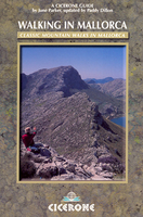
This latest edition of Cicerone’s Walking in Mallorca was originally written by June Parker and has been updated by experience walker Paddy Dillon and is an extensive of the varying walking routes available around the island. The guide covers a wide range of the island’s diverse landscapes, exploring the areas around Andratx, Soller, Pollenca and Palma, taking in rugged mountains, remote valley, cliff coastlines and hidden mountain passes. Particular emphasis is given to the rugged Serra de Tramuntana which dominates the north-western corner of the island.The guide is organized into sections describing 80 routes around the island and new mapping reflects the recent reclassification of Mallorca’s road numbering system. A comprehensive introduction explores the geology, scenery
and natural history of the island as well as practical information on equipment, clothing, recommended maps, grading and route information and the walkers’ country code. Further appendices also describe the high level walk from Andratx to Pollenca in addition to language notes and a topographical glossary. Detailed route descriptions are accompanied by colour diagrams mapping the route as well as colour photographs illustrating some of the highlights of the island.
RIP - This product is no longer available on our network. It was last seen on 25.09.2019

This page now acts as a permanent archive for this product. Add more information using the comments box below to ensure it can still be found by future generations.

Use our search facility to see if it is available from an alternative contributor.
  • External links may include paid for promotion
  • Availability: Out Of Stock
  • Supplier: Stanfords
  • SKU: 9781852844882
Availability: In Stock
£15.95

Product Description

This latest edition of Cicerone’s Walking in Mallorca was originally written by June Parker & has been updated by experience walker Paddy Dillon & is an extensive of the varying walking routes available around the isl&. The guide covers a wide range of the island’s diverse landscapes, exploring the areas around Andratx, Soller, Pollenca & Palma, taking in rugged mountains, remote valley, cliff coastlines & hidden mountain passes. Particular emphasis is given to the rugged Serra de Tramuntana which dominates the north-western corner of the isl&. The guide is organized into sections describing 80 routes around the island & new mapping reflects the recent reclassification of Mallorca’s road numbering system. A comprehensive introduction explores the geology, scenery & natural history of the island as well as practical information on equipment, clothing, recommended maps, grading & route information & the walkers’ country code. Further appendices also describe the high level walk from Andratx to Pollenca in addition to language notes & a topographical glossary. Detailed route descriptions are accompanied by colour diagrams mapping the route as well as colour photographs illustrating some of the highlights of the isl&.

Reviews/Comments

Add New

Intelligent Comparison

Oooops!
We couldn't find anything!
Perhaps this product's unique.... Or perhaps we are still looking for comparisons!
Click to bump this page and we'll hurry up.

Price History

Vouchers

No voucher codes found.
Do you know a voucher code for this product or supplier? Add it to Insights for others to use.

Facebook

Jargon Buster

History - Anything that happens in the past. An acedemic subject.
Colour - The categorised spectrum of light visable to humans
Natural - not manmade
Language - the method of communication used in different areas. Humans and computers have many different languages.
Road - a manmade lane or a path that is used to speed up travel.
Equipment - A product or good that is tactile.
Wide - Something with a large width.
Practical - Weather a task is easy to carry out and realistically succeed.
Experience - To gain further knowledge by practising.
Language - The way humans communicate either written and spoken.

Supplier Information

Stanfords
Stanfords was established in 1853 and opened their iconic Covent Garden flagship store in 1901. They have become the top retailer of maps, travel books and accessories in the UK and arguably offer the largest selection of maps and travel books worldwide. Famous names such as Captain Robert Falcon Scott, Ranulph Fiennes and Michael Palin have purchased from Stanfords. They now have a shop in Bristol and both stores together with other venues operate a calendar of events including talks, book signings and exhibitions. As a specialist map retailer, the map selection is comprehensive and includes road maps, street maps and walking maps from worldwide destinations, as well as a selection of world atlases and wall maps. Books include travel guides and travel literature. Stanfords also stock globes, from miniatures made of blue marble to magnificent floor-standing globes. The website features a selection of interesting articles on travel topics.
Page Updated: 2023-11-12 20:15:36

Community Generated Product Tags

Oh No! The productWIKI community hasn't generated any tags for this product yet!
Menu