More From Contributor

£16.99
Malaysia, Singapore & Brunei in the Countries & Regions series from Lonely Planet, market-leading comprehensive guides aimed at independent travellers & serving a large range of international destinations. Frank & informal in style, the guides explore an extensive range of sights, activities, accommodation, restaurants & nightlife & are designed for practical use while travelling on the road. Written & researched by a team of experts, each book is independent in its recommendations & suggestions, often offering individual takes on individual destinations. Widely recognised for their reliability, each Lonely Planet country & region guide has the same layout. Introductory sections profile the destination with individual chapters on particular highlights, getting started, (including when to go) itineraries, history, culture, arts, food & drink & the environment. Each guide is organised geographically by region, with individual sections detailing an extensive range of sights, places of interest, attractions, restaurants, nightlife, accommodation & any local activities. The guides have detailed explanations of historical context where relevant. There is also practical guidance on ...
Archived Product
£25.00
Malaysian food has long been the hidden jewel of South-east Asian cookery
- it`s a fusion of the Chinese, Malay & Indian cultures
...
Archived Product
£4.99
Enter the colourful world of Malaysian cuisine with this cookbook from an award-winning chef & food writer! Malaysian Cooking introduces the art of using Malaysia`s most aromatic regional ingredients & global influences to prepare zesty food that excites both the palate & sense of smell. Inspired by fond memories of cooking Malaysian staples since her childhood days, the expert in Asian culinary culture Carol Selva Rajah has compiled in this Malaysian cookbook a collection of 60+ new & traditional dishes for anyone wishing to add these vibrant recipes from abroad to their repertoire. These include: Sambals, chutneys, spice pastes, & achars Salads & snacks, like Vegetarian Fritters with Sweet Chili Dip Rice, noodles, & bread, like Saffron Rice with Cloves & Cashews Poultry & meat dishes, like Sweet Blue Ginger Duck with Star Anise Seafood dishes, like Fish in Sweet & Sour Pineapple Broth Vegetable dishes, like Eggplant & Tofu with Spicy Bean Paste Desserts & drinks, like Pandanus Coconut Cake with Palm Sugar Syrup. With this beautifully photographed & easy-to-follow Malaysian cookbook in h&, you too can bring the rich & varied textures, colours, & flavours of Malaysian cuisine to your own home. ...
Archived Product
£9.99
Malësia e Madhe Prefecture at 1:150, 000 in a series of handy size, waterproof & tear-resistant, contoured & GPS compatible road maps from the Tirana-based publishers Vektor. Landscape is presented by altitude colouring & contours lines at 100m intervals, with spot heights & a few more names of topographic features than found on Vektor’s 200K road maps of the country. National parks & nature reserves are prominently highlighted. The prefecture maps appear to show the same small local dirt roads as in the 200K series, but given the increase in scale do so with greater clarity & also provide more detailed GPS coordinates (latitude & longitude lines are drawn at 5’ intervals), useful when travelling across the more remote parts of the country. Railway lines are included & local airports are marked. Symbols highlight campsites, beaches, archaeological & historical sites, caves, etc. The maps also show subdivisions of prefectures & names of the communes, & indicate administrative status of towns. Map legend

Includes::
English. Please note: border crossings are prominently marked but beyond topographic colouring no road or other information is provided outside the country’s borders.

...
Archived Product
£12.99
Malcantone, map No. 286, in the standard topographic survey of Switzerland at 1:50, 000 from Swisstopo, i.e. without the special overprint highlighting walking trails, local bus stops, etc, presented in Swisstopo’s hiking editions of the 50K survey. Coverage

Includes::
Lugano. Highly regarded for their superb use of graphic relief & hill shading, the maps give an almost 3-D picture of Switzerland`s mountainous terrain. Contours are at 20m intervals. All the maps have a 1-km grid with the Swiss national coordinates. This standard version of the 50K survey covers the whole country on 78 small format sheets, with special larger format maps published for several popular tourist destinations. Small format sheets cover an area of 35 x 24 km (21 x 15 miles approx) & have map legend in the language of the area covered by the map. The special larger sheets cover 50 x 35 km (31 x 22 miles approx) & have no map legend, but a separate leaflet can be provided instead.PLEASE NOTE: the hiking editions of the 1:50, 000 Swisstopo survey are listed on our website in a separate series.

...
Archived Product
£9.50
Topographical survey of Belgium at 1:20, 000 from Nationaal Geografisch Instituut / Institut Géographique National, the country’s national survey organization. Each 20K map covers one quarter of the corresponding 1:50, 000 map (with adjustments in the border & coastal areas). The maps provide all the information expected of topographic mapping at this scale & in addition have an unusually large amount of vegetation and/or land use information (different types of woodlands, gardens, orchards, heath, etc). The maps have a 1-km UTM grid, with margin ticks for latitude & longitude at intervals of 1`. Map legend & a glossary of terms used on the maps include English. Stanfords keeps as regular stock 20K maps for the World War I battlefields around the Ypres, Messines & Passchendaele, & for the area of the Battle of Waterloo. The 1:20, 000 survey covers the whole of Belgium & maps for other regions can be supplied as special orders. To see the list of titles in this series please click on the series link.PLEASE NOTE: the Long-Distance Footpaths Map of Belgium at 1:300, 000 which shows the division of Belgium into the 50K survey sheets can also be used to see in more detail coverage by the 20K maps. ...
Archived Product
£11.19
Maldives in the Countries & Regions series from Lonely Planet, market-leading comprehensive guides aimed at independent travellers & serving a large range of international destinations. Frank & informal in style, the guides explore an extensive range of sights, activities, accommodation, restaurants & nightlife & are designed for practical use while travelling on the road. Written & researched by a team of experts, each book is independent in its recommendations & suggestions, often offering individual takes on individual destinations. Widely recognised for their reliability, each Lonely Planet country & region guide has the same layout. Introductory sections profile the destination with individual chapters on particular highlights, getting started, (including when to go) itineraries, history, culture, arts, food & drink & the environment. Each guide is organised geographically by region, with individual sections detailing an extensive range of sights, places of interest, attractions, restaurants, nightlife, accommodation & any local activities. The guides have detailed explanations of historical context where relevant. There is also practical guidance on ...
Archived Product
£13.99
Maldives in the Countries & Regions series from Lonely Planet, market-leading comprehensive guides aimed at independent travellers & serving a large range of international destinations. Frank & informal in style, the guides explore an extensive range of sights, activities, accommodation, restaurants & nightlife & are designed for practical use while travelling on the road. Written & researched by a team of experts, each book is independent in its recommendations & suggestions, often offering individual takes on individual destinations. Widely recognised for their reliability, each Lonely Planet country & region guide has the same layout. Introductory sections profile the destination with individual chapters on particular highlights, getting started, (including when to go) itineraries, history, culture, arts, food & drink & the environment. Each guide is organised geographically by region, with individual sections detailing an extensive range of sights, places of interest, attractions, restaurants, nightlife, accommodation & any local activities. The guides have detailed explanations of historical context where relevant. There is also practical guidance on ...
Archived Product
£14.99
Full colour detailed map of the Maldives, with enlarged sections of the central atolls. It clearly shows the location of all islands, major dive sites, protected marine areas, surfing sites, resorts & islands, historic sites, & shipwrecks. Published by Atoll Editions, this map is a useful reference for exploring the atolls of the Maldives. ...
Archived Product
£45.00
This volume is the most comprehensive to cover the Maldives archipelago. The text provides a full range of sailing directions as well as anchorage locations, supported by detailed charts & aerial photographs in full colour.A substantial introductory section provides important information on the country, as well as covering navigation, equipment & cruising formalities. Climate & weather
- crucial to planning cruises in these waters
- are discussed at length & a chapter is devoted to fishing, surfing & scuba diving. The itineraries section provides abundant explanatory advice on approaches, navigation, anchorages, harbours & places of interest for all the Maldivian atolls. All the subject matter is clearly presented & indexed for easy reference. Attached to the volume is a full colour map (36 x 100cm) of the entire archipelago indicating useful waypoints for the approaches & through the passes. Maldives Cruising Guide is an essential source of information not only for cruising yachtsmen but also for anyone planning to visit these unique & fascinating islands.

...
Archived Product

Malcantone Swisstopo Hiking 286T

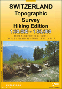
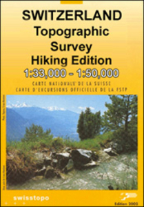
Malcantone area, map No. 286T, at 1:50, 000 in a special hiking edition of the country’s topographic survey, published by Swisstopo in cooperation with the Swiss Hiking Federation. Cartography, identical to the standard version of the survey, is highly regarded for its superb use of graphic relief and hill shading to provide an almost 3-D picture of Switzerland`s mountainous terrain. Contours are at 20m intervals. An overprint highlights routes maintained by the SHF, distinguishing between hiking routes, mountain routes requiring proper footwear, and alpine routes where equipment is needed. Paths which are part of the national or regional network of long-distance hiking routes are specially marked and in the more recent editions are annotated with their official numbers. The maps
show mountain huts, refuges and in remote areas also inns, plus roads with bus service and the positions of bus stops. All the maps have a 1-km grid of the Swiss national coordinates.For a list of all the titles in this series, please click on the series link.
RIP - This product is no longer available on our network. It was last seen on 25.09.2019

This page now acts as a permanent archive for this product. Add more information using the comments box below to ensure it can still be found by future generations.

Use our search facility to see if it is available from an alternative contributor.
  • External links may include paid for promotion
  • Availability: Out Of Stock
  • Supplier: Stanfords
  • SKU: 9783302302867
Availability: In Stock
£18.99

Product Description

Malcantone area, map No. 286T, at 1:50, 000 in a special hiking edition of the country’s topographic survey, published by Swisstopo in cooperation with the Swiss Hiking Federation. Cartography, identical to the standard version of the survey, is highly regarded for its superb use of graphic relief & hill shading to provide an almost 3-D picture of Switzerland`s mountainous terrain. Contours are at 20m intervals. An overprint highlights routes maintained by the SHF, distinguishing between hiking routes, mountain routes requiring proper footwear, & alpine routes where equipment is needed. Paths which are part of the national or regional network of long-distance hiking routes are specially marked & in the more recent editions are annotated with their official numbers. The maps show mountain huts, refuges & in remote areas also inns, plus roads with bus service & the positions of bus stops. All the maps have a 1-km grid of the Swiss national coordinates. For a list of all the titles in this series, please click on the series link.

Reviews/Comments

Add New

Price History

Vouchers

No voucher codes found.
Do you know a voucher code for this product or supplier? Add it to Insights for others to use.

Facebook

Jargon Buster

Hiking - An outdoor activity envolving walking in nature
swiss - Short for Switzerland, one of the richest countries in the world
switzerland - A landlocked country in western Europe. One of the richest countries in the world
Network - A link and communication between things. Often computers or people.
Km - Kilometre. A unit of measurement equal to 1000 metres.
Equipment - A product or good that is tactile.
Regional - An adjective to describe a set geographic area.

Supplier Information

Stanfords
Stanfords was established in 1853 and opened their iconic Covent Garden flagship store in 1901. They have become the top retailer of maps, travel books and accessories in the UK and arguably offer the largest selection of maps and travel books worldwide. Famous names such as Captain Robert Falcon Scott, Ranulph Fiennes and Michael Palin have purchased from Stanfords. They now have a shop in Bristol and both stores together with other venues operate a calendar of events including talks, book signings and exhibitions. As a specialist map retailer, the map selection is comprehensive and includes road maps, street maps and walking maps from worldwide destinations, as well as a selection of world atlases and wall maps. Books include travel guides and travel literature. Stanfords also stock globes, from miniatures made of blue marble to magnificent floor-standing globes. The website features a selection of interesting articles on travel topics.
Page Updated: 2023-11-12 20:15:36

Community Generated Product Tags

Oh No! The productWIKI community hasn't generated any tags for this product yet!
Menu