More From Contributor

£6.99
This illustrated adaptation of Nobel Peace Prize winner Malala Yousafzai`s bestselling memoir, I Am Malala, introduces readers of 7+ to the remarkable story of a teenage girl who risked her life for the right to go to school. Raised in a changing Pakistan by an enlightened father from a poor background & a beautiful, illiterate mother, Malala was taught to stand up for her beliefs. When terrorists took control of her region & declared that girls were forbidden from going to school, Malala refused to sacrifice her education. & on 9 October 2012, she nearly paid the ultimate price for her courage when she was shot on her way home from school. The book follows Malala`s incredible journey to recovery in the aftermath of the attack, from the life-saving surgery she receives in a Birmingham hospital to her reunion with her family & their eventual relocation to Engl&. Today Malala is a global symbol of peaceful protest & the youngest ever person to be awarded the Nobel Peace Prize. Her story of bravery & determination in the face of extremism is more timely now than ever. ...
Archived Product
£12.99
As a child in Pakistan, Malala made a wish for a magic pencil that she could use to redraw reality. She would use it to give gifts to her family, to erase the smell from the rubbish dump near her house, to sleep an extra hour in the morning. As she grew older, Malala wished for bigger & bigger things. She saw a world that needed fixing. & even if she never found a magic pencil, Malala realized that she could still work hard every day to make her wishes come true. This beautifully illustrated picture book tells Malala`s story, in her own words, for a younger audience & shows them the worldview that allowed her to hold on to hope & to make her voice heard even in the most difficult of times. ...
Archived Product
£13.99
This map of Malaren in 1:50, 000 is part of a series of topographic maps from Norstedts Kartforlaget which

Includes::


...
Archived Product
£19.99
The southern part of Sweden in a series of 30 double-sided cycling maps from Norstedts printed on light, waterproof & tear-resistant synthetic paper. Mainland is covered at 1:90, 000 with Gotland at 1:100, 000. The maps, prepared in association with Cykelfrämjandet
- Sweden’s largest national cycling organization, highlight all the national & other major cycle routes, plus a selection of local routes. The overprint indicates sections which are on gravel roads and/or not singposted. Also marked are selected hiking trails. A range of symbols indicate various facilities & places of interest, including campsites & youth hostels, wind shelters, cultural & historical sites, interesting nature & geological spots, etc. The maps provide a very detailed picture of the road network, including privately maintained roads open to the general public. Railway lines are shown with stations & ferry connections are marked. Topography is indicated by light relief shading with spot heights, plus colouring and/or graphics for forests & marshl&. The maps have a UTM grid, plus latitude & longitude lines at intervals of 10’. Map legend

Includes::
English. Each map also provides phone numbers & web addresses of local tourist offices.


...
Archived Product
£7.99
Nicknamed ” The Warm Heart of Africa, ” ” Land of the Lake, ” & ” The Land of Smiling Faces, ” this small, landlocked country in southeast Africa offers travelers a true African experience. Within a single day, visitors can go on safari, enjoy sprawling tea gardens, & watch the sun sets over Lake Malawi, the third-largest lake in Africa & home to many rare species of fish. The country has nine unique national parks & wildlife reserves & has been home to many diverse African cultures, from the indigenous hunter-gathers to the incoming iron-working Bantu settlers. Dress, dance, masks, language, & traditional festivals all reflect waves of migrating tribes--those fleeing Shaka Zulu in the south, Swahili Arab slave traders in the east, & Bantu from Central Africa. Other cultural influences came through the slave trade routes, contact with Portuguese & Indian traders, & English missionaries who introduced Victorian-era buildings. This historic blend has produced a people who are strong, good-humored, conservative, traditional, yet adaptable, creative, loyal, & hard-working. ...
Archived Product
£9.95
Malawi at 1:900, 000 & Mozambique at 1:1, 900, 000 from ITMB, with each country shown separately on one side of the map, indexed & accompanied by street plans of its two main cities: Blantyre & Lilongwe, plus Maputo & Beira. Bold altitude colouring shows the topography, with elevation in Malawi in metres & in Mozambique in feet. Swamps, marshes, wetlands & seasonal rives are marked. National parks & protected areas are highlighted. The maps show each country ...
Archived Product
£17.99
Bradt`s Malawi by Africa expert Philip Briggs is the only standalone practical guide to ` Africa`s best kept secret` & offers detailed, comprehensive information to suit the needs of every wanderer. This fully revised & updated 7th edition offers extensive practical information, all the latest cultural & political developments, plus a 19-chapter, in-depth breakdown & coverage of the country to cater for all interests & budgets. Malawi is increasingly covered in the media as a holiday destination & this guide reflects its position as an up-&-coming destination for bird watchers, safari enthusiasts, trekkers, beach seekers, kayakers, rock climbers, scuba divers, families, & backpackers alike. As `the Warm Heart of Africa`, Malawi is noted for the welcoming, friendly demeanour & colourful culture of its people which makes a ` Big 5` safari in Majete Wildlife Reserve & kayaking the palm-fringed Likoma Island magnificent footnotes to a Malawian adventure. From trekking the rugged, rural wilderness of Mount Mulanje to relaxing at Lake Malawi`s beachside luxury resorts, Malawi is the textbook destination for those seeking an exotic African experience without the crowds. ...
Archived Product
£1.99
The perfect patriotic accessory to wave the Jubilee Festival in with, these Union Jack flags will make a great addition to your street party or day out on the town. The first choice accessory this summer for the urbane street partier rather than the last refuge of a scoundrel... ...
Archived Product
£13.99
This is an invaluable guide for visitors to this most explorable, affordable & tranquil of African countries, whether discovering little-visited mountains, forests & game reserves, or relaxing by the main attraction of Lake Malawi. Philip Briggs & co-author, Mary-Anne Bartlett, provide readers with advice on planning their itinerary, wildlife & bird species identification, conservation areas, national parks & a detailed history of the country. ...
Archived Product

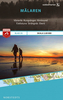
Malawi & Mozambique ITMB

Malawi at 1:900, 000 and Mozambique at 1:1, 900, 000 from ITMB, with each country shown separately on one side of the map, indexed and accompanied by street plans of its two main cities: Blantyre and Lilongwe, plus Maputo and Beira.Bold altitude colouring shows the topography, with elevation in Malawi in metres and in Mozambique in feet. Swamps, marshes, wetlands and seasonal rivers are marked. National parks and protected areas are highlighted. The maps show each country’s road and rail networks, with a range of symbols indicating various places of interest and tourist facilities. Each map is indexed and has latitude and longitude lines at 1° and/or 2°.Large, clear street plans show the central areas in each country’s two main cities, Blantyre and Lilongwe, plus Maputo and
Beira, annotated with places of interest and selected accommodation. The Malawi map also includes additional notes of the country’s history, climate, national parks, etc.
RIP - This product is no longer available on our network. It was last seen on 25.09.2019

This page now acts as a permanent archive for this product. Add more information using the comments box below to ensure it can still be found by future generations.

Use our search facility to see if it is available from an alternative contributor.
  • External links may include paid for promotion
  • Availability: Out Of Stock
  • Supplier: Stanfords
  • SKU: 9781553413103
Availability: In Stock
£9.99

Product Description

Malawi at 1:900, 000 & Mozambique at 1:1, 900, 000 from ITMB, with each country shown separately on one side of the map, indexed & accompanied by street plans of its two main cities: Blantyre & Lilongwe, plus Maputo & Beira. Bold altitude colouring shows the topography, with elevation in Malawi in metres & in Mozambique in feet. Swamps, marshes, wetlands & seasonal rivers are marked. National parks & protected areas are highlighted. The maps show each country’s road & rail networks, with a range of symbols indicating various places of interest & tourist facilities. Each map is indexed & has latitude & longitude lines at 1° and/or 2°. Large, clear street plans show the central areas in each country’s two main cities, Blantyre & Lilongwe, plus Maputo & Beira, annotated with places of interest & selected accommodation. The Malawi map also

Includes::
additional notes of the country’s history, climate, national parks, etc.

Reviews/Comments

Add New

Price History

Vouchers

No voucher codes found.
Do you know a voucher code for this product or supplier? Add it to Insights for others to use.

Facebook

Jargon Buster

Metres - A unit of measure, one metre equals 100 centimetres
History - Anything that happens in the past. An acedemic subject.
Large - something that takes up more space than normal.
Road - a manmade lane or a path that is used to speed up travel.
Altitude - Something that can be quite high in relation to sea or ground level.
Accommodation - A room in which someone can live in, for example in a hotel

Supplier Information

Stanfords
Stanfords was established in 1853 and opened their iconic Covent Garden flagship store in 1901. They have become the top retailer of maps, travel books and accessories in the UK and arguably offer the largest selection of maps and travel books worldwide. Famous names such as Captain Robert Falcon Scott, Ranulph Fiennes and Michael Palin have purchased from Stanfords. They now have a shop in Bristol and both stores together with other venues operate a calendar of events including talks, book signings and exhibitions. As a specialist map retailer, the map selection is comprehensive and includes road maps, street maps and walking maps from worldwide destinations, as well as a selection of world atlases and wall maps. Books include travel guides and travel literature. Stanfords also stock globes, from miniatures made of blue marble to magnificent floor-standing globes. The website features a selection of interesting articles on travel topics.
Page Updated: 2023-11-12 20:15:36

Community Generated Product Tags

Oh No! The productWIKI community hasn't generated any tags for this product yet!
Menu