
 United Kingdom
 France
 Germany
 Netherlands
 Sweden
 USA
USA
 Italy
Italy
 Spain
Spain
More From Contributor


Lytham 1908
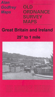
Lytham in 1908 in a fascinating series of reproductions of old Ordnance Survey plans in the Alan Godfrey Editions, ideal for anyone interested in the history of their neighbourhood or family. Selected towns in Great Britain and Ireland are covered by maps showing the extent of urban development in the last decades of the 19th and early 20th century.In this title: the map is double-sided. The main map covers the western part of the town, stretching from Agnew Street and Beach Street westward towards Ansdel, including St Paul's church. Features include Marine Lake, Ansdell goods station, Fairhaven Hotel, St Cuthbert's church, Lowther Gardens. On the reverse is a large part of adjacent sheet 67.03 covering Lytham town centre. Features here include railway with station and goods
station, pier, Market Square, tramways and tram shed, windmill, Assembly Rooms, cottage hospital, Albert Hall. A shipbuilding yard on the Liggard Brook is in the north-eastern corner. About the Alan Godfrey Editions of the 25
station, pier, Market Square, tramways and tram shed, windmill, Assembly Rooms, cottage hospital, Albert Hall. A shipbuilding yard on the Liggard Brook is in the north-eastern corner. About the Alan Godfrey Editions of the 25
Product Description
Reviews/Comments
Add New
Intelligent Comparison
Archived Product

Lytham 1908 Stanfords
£3.50
Archived Product
Lytham Hall 1908 Stanfords
£3.50
Vouchers
No voucher codes found.
Do you know a voucher code for this product or supplier? Add it to Insights for others to use.
Do you know a voucher code for this product or supplier? Add it to Insights for others to use.
 Denmark