
 United Kingdom
 France
 Germany
 Netherlands
 Sweden
 USA
USA
 Italy
Italy
 Spain
Spain
More From Contributor


Lynton & Lynmouth Walking Map
Double-sided waterproof topographic walking map of Lynton & Lynmouth at 1:12, 500 from CroydeCycle, with cycle and riding routes. Bridleways, footpaths, permissive and small permissive paths are prominently indicated, as are cycle lanes, with the National Cycle Network shown in blue. Road networks are shown, with private roads allowing access on foot marked. Topography is indicated through spot heights and contour lines (at 10m intervals), with colour used for different terrain types. Points of interest and local facilities such as information points, pubs, camp sites, accommodation and toilets are highlighted. Limited access, geological, and historical information is marked on some parts of the map.The National Grid is indicated by margin ticks, making the map GPS compatible.
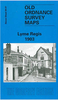
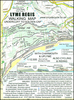
The mapping has been enlarged from 1:10, 560 Ordnance Survey 1894 data, with updates taken from more recent field surveys and photographs.
The mapping has been enlarged from 1:10, 560 Ordnance Survey 1894 data, with updates taken from more recent field surveys and photographs.
Product Description
Reviews/Comments
Add New
Intelligent Comparison
Archived Product
Lynton - Lynmouth & Doone Valley Walking Map Stanfords
£2.99
Vouchers
No voucher codes found.
Do you know a voucher code for this product or supplier? Add it to Insights for others to use.
Do you know a voucher code for this product or supplier? Add it to Insights for others to use.
 Denmark