
 United Kingdom
 France
 Germany
 Netherlands
 Sweden
 USA
USA
 Italy
Italy
 Spain
Spain
More From Contributor


Luxembourg Michelin
Luxembourg at 1:150, 000 in a series of regional road maps of the Benelux countries from Michelin. The mapping is an enlargement of Michelin’s coverage of Luxembourg with southern Belgium at 1:200, 000. Where appropriate, place names are also given in the Luxembourgish language: Echternach/Iechternach, Wiltz/Woltz, etc. A street plan of Luxembourg City indicates main traffic arteries, one way streets, car parks and various important buildings including EU offices, with an accompanying index listing a selection of main streets; an enlargement presents the city’s historic centre in greater detail.Michelin’s regional coverage of the Benelux is available either on indexed road maps at 1:200, 000 or as a Road Atlas of Benelux with the North of France, presented with the same
mapping but enlarged for greater clarity to 1:150, 000; Luxembourg is additionally covered on a similarly enlarged map. The mapping has Michelin’s traditional detailed presentation of the road network, with full or limited motorway interchanges, road width of smaller roads, height and load restrictions, tolls, gradients on steep roads, swing bridges, etc. Scenic routes are highlighted. Ferry routes indicate connections for car transport or pedestrians/cycles only. Railway lines are shown with stations. Symbols mark various places of interest including campsites, bungalow parks and selected other accommodation, sport and recreational facilities, bulb fields and windmills, etc. Also indicated are locations with street plans in the publishers’ Red Guides to hotels and
restaurants in Belgium and Luxembourg and in the Netherlands. Topography is presented by relief shading and colouring for woodlands; national parks and other protected areas are highlighted. Latitude and longitude lines are drawn at 10’ intervals (maps only, not in the atlas). In maps, the index is next to the map. Map legend includes English.To see the list of the titles in this series please click on the series link.
Product Description
Reviews/Comments
Add New
Intelligent Comparison
Archived Product
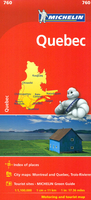
Quebec Michelin Stanfords
£5.99
Vouchers
No voucher codes found.
Do you know a voucher code for this product or supplier? Add it to Insights for others to use.
Do you know a voucher code for this product or supplier? Add it to Insights for others to use.
 Denmark