More From Contributor
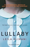
£13.95
Trekking route from Lukla to Namche Bazar, with alternative routes to either Tengboche or Thame in the Nepa Maps series which provides extensive coverage of trekking areas of Nepal on detailed contoured maps with trekking routes & hiking trails, huts & camp sites, local places of interest & other tourist information. Cartography is based on the country’s topographic survey, with contours usually at 40m or 50m intervals, enhanced by relief shading, colouring & graphics to show various features of the terrain, including glaciers, forested or cultivated areas, etc. Numerous peaks, with additional spot heights, plus names of glaciers & mountain ranges are prominently shown. The network of rivers, streams & lakes is shown in great detail, with many smaller rivers & lakes named. Overprint highlights main trekking routes & numerous local trails, with symbols indicating various places of interest & tourist facilities. Most maps are indexed & include additional information such as route profiles, glossaries, etc. All the information is in English & heights are given in metres.* In this title:* trekking route from Lukla to Namche Bazar, with alternative routes to either Tengboche or Thame. Contours are at 40m intervals, with relief shading & vegetation colouring. Index lists places, peaks, lakes & passes. Margin ticks show latitude & longitude at intervals of 5’. Overprint highlights numerous accommodation facilities & places of interest in this popular area in the foothills of Mount Everest. ...
Archived Product
£16.99
Sverigeserien is an outdoor map series consisting of 116 sheets with coverage of southern & central Sweden & the northern coastline. The map is suitable for outdoor activities such as hiking, excursions, trail running, hunting, fishing, riding, cycling, mountain biking, paddling, skating & much more. Every sheet covers an area of 45x 68km. These topographical maps in scale 1:50 000 contain all the information needed for outdoor activities: Terrain information, hiking trails, illuminated tracks, camping, shelters, golf courses, leisure baths, historical remains, roads in different categories, railway lines & much more. Easy to read topography with contour lines, vertical interval 5 m. Sverigeserien is a high-quality map series & is durable for frequent use! Updated content with map data from Lantmäteriet (National Land Survey of Sweden) & printed on Polyart which is water & tear resistant. This means that the map can be folded repeatedly without breaking & can withstand the challenging weather in Sweden during both winter & summer. Legend is in Swedish, English & German. ...
Archived Product
£16.99
Topographic survey of Sweden at 1:100, 000, the Vägkartan, from the Lantmäteriet, covering most of the country in 79 double-sided maps. Please note: the mountainous regions of central & northern Sweden are not covered by this series but presented in a separate “ Fjällkartan
- Mountain Map” series also listed on our website. Each 1:100, 000 topographic survey map covers an area of 75 x 80km. The maps have contours at 10 metre intervals, plus relief shading & colouring for different types of landscape: open l&, forests, alvar, marshes, etc. Boundaries of national parks & nature reserves, areas prohibited to cross-country vehicles, & restricted entry military zones are marked. The maps indicate privately maintained local roads, cycle paths with wind shelters, footpaths, etc, & include all other information expected of topographic survey at this scale. The maps have a 2-km UTM grid, plus latitude & longitude lines 10’ intervals. Map legend

Includes::
English. For coverage of the country’s most visited hiking areas in central & northern Sweden please see Lantmäteriet’s Mountain Map series, listed separately on our website.


...
Archived Product
£16.99
Topographic survey of Sweden at 1:50, 000, the Terrängkartan, from the Lantmäteriet, covering most of the country in 244 double-sided maps. Please note: the mountainous regions of central & northern Sweden are not covered by this series but presented in a separate “ Fjällkartan
- Mountain Map” series also listed on our website. Each 1:50, 000 topographic survey map covers an area of 37.5 x 40km. The maps have contours at 5 metre intervals, plus relief shading & graphics for rocky outcrops & boulders. Further graphics and/or colouring show different types of land use or vegetation (forests, arable l&, orchards, marshes, peat bogs, etc). An unusual feature of this survey is the colouring indicating buildings below or above two storeys high & “leisure/holiday homes”. The maps indicate privately maintained roads & include all other information expected of topographic survey at this scale. The maps have a 1-km UTM grid, plus latitude & longitude lines 5’ intervals. Map legend

Includes::
English. For coverage of the country’s most visited hiking areas in central & northern Sweden please see Lantmäteriet’s Mountain Map series, listed separately on our website.


...
Archived Product
£9.99
In this enchanting collection, favourite bed-time songs for children
- ` Rock-a-bye, Baby`, ` Bye, Baby Bunting`, ` Golden
...
Archived Product
£8.99
Lulu Sawyer arrives in Marrakech hoping to rekindle her romance with businessman Ian Drumm. It`s the perfect cover for her assignment with the CIA: tracing the flow of money from donors to radical Islamic groups. As she navigates the complex interface of East & West, Lulu stumbles into unforeseen intrigues: a young Muslim girl, Suma, is on the run from her brother intent on an honour killing; & a beautiful Saudi woman, Gazi, is vying for Ian`s love, leaving her husband in a desperate bid to escape her repressive society. The more Lulu immerses herself in the workings of Marrakech, the more questions emerge as beneath the surface of this polite expatriate community lies a more sinister world laced with double standards as well as double agents. ...
Archived Product
£16.99
Lulu`s Provencal Table tantalizes the reader with Olney`s descriptions of the regional food served as the vineyard meals at the domaine. Then he lovingly transcribes Lulu`s recipes. She has an empathy with & understanding of Provencal ingredients that is inspirational. There is succulent Pot-Roasted Leg of Lamb with Black Olives served with Courgette Gratin, & Potato & Sorrel Gratin, delicious with just six ingredients. There are plenty of simple recipes, but the recipe for bouillabaisse is a fascinating 10 pages long. Her 150 recipes read like a roll call of the best of Provence; tapenade, anchoiade, brandade, pissaladiere, bagna cauda, sardines grillees, bouillabaisse, bourride, daurade au fenouil, daube, gigot a la ficelle & ratatouille. Starting with aperitifs & amuse-gueule & finishing up with fruit desserts, hers is classic French country cooking, featuring everyday ingredients cooked with respect for their nature & flavour. This is an essential book for any serious food lover`s library. ...
Archived Product
£16.99
Richard Olney, responsible for the legendary Time-Life cooking series as well as other cooking classics such as his wonderful Simple French Food (also published by Grub Street), moved to Provence in 1961 & had the good fortune to befriend Lulu & Lucien Peyraud, the owners of the noted Domaine Tempier vineyard in Provence, not far from Marseilles. Lulu`s Provencal Table tantalizes the reader with Olney`s descriptions of the regional food served as the vineyard meals at the domaine. Then he lovingly transcribes Lulu`s recipes. She has an empathy with & understanding of Provencal ingredients that is inspirational. There is succulent Pot-Roasted Leg of Lamb with Black Olives served with Courgette Gratin, & Potato & Sorrel Gratin, delicious with just six ingredients. There are plenty of simple recipes, but the recipe for bouillabaisse is a fascinating 10 pages long. Her 150 recipes read like a roll call of the best of Provence: tapenade, anchoiade, brandade, pissaladiere, bagna cauda, sardines grillees, bouillabaisse, bourride, daurade au fenouil, daube, gigot a la ficelle & ratatouille. Starting with aperitifs & amuse-gueule & finishing up with fruit desserts, hers is classic French country cooking, featuring everyday ingredients cooked with respect for their nature & flavour. Having been described as `a gastronomic love poem to France`s most exhilarating region`, this is an essential book for any serious food lover`s library. ...
Archived Product
£17.99
Lumbasumba Pass Trek: Kanchenjunga to Makalu map at 1:125, 000, in the Nepa Maps series which provides extensive coverage of trekking areas of Nepal on detailed contoured maps with trekking routes & hiking trails, huts & camp sites, local places of interest & other tourist information. The map covers the north-eastern corner of Nepal extending from the peak & the base camp of Makalu to Kanchenjunga, its base camp & the two Glacier Camps (but without the northernmost part of the Kanchenjunga Conservation Area). The Lumbasumba Pass Trek from Mitlung to Hedanga Gadi is prominently highlighted. Also marked are several other trails in this area, including the spur from the main trek to the Makalu Base Camp, the trek to the Kanchenjunga BC & the Glacier Camps, the Milky Danda trek, & the Yalung Base Camp trek east of Taplejung. Contours are at 40 m intervals, with relief shading & vegetation colouring. Index lists places, peaks, passes, lakes & base camps. Margin ticks show latitude & longitude at intervals of 5’. Additional information

Includes::
a route profile for the Lumbasumba Pass Trek, plus tables with details for it & the Tumlingar to Makalu Base Camp trek. Titles in this series have cartography is based on the country’s topographic survey, with contours usually at 40m or 50m intervals, enhanced by relief shading, colouring & graphics to show various features of the terrain, including glaciers, forested or cultivated areas, etc. Numerous peaks, with additional spot heights, plus names of glaciers & mountain ranges are prominently shown. The network of rivers, streams & lakes is shown in great detail, with many smaller rivers & lakes named. Overprint highlights main trekking routes & numerous local trails, with symbols indicating various places of interest & tourist facilities. Most maps are indexed & include additional information such as route profiles, glossaries, etc. All the information is in English & heights are given in metres.

...
Archived Product
£17.99
Lumbini Buddhist Circuit Tour in the Nepa Maps series which provides extensive coverage of trekking areas of Nepal on detailed contoured maps with trekking routes & hiking trails, huts & camp sites, local places of interest & other tourist information. Cartography is based on the country’s topographic survey, with contours usually at 40m or 50m intervals, enhanced by relief shading, colouring & graphics to show various features of the terrain, including glaciers, forested or cultivated areas, etc. Numerous peaks, with additional spot heights, plus names of glaciers & mountain ranges are prominently shown. The network of rivers, streams & lakes is shown in great detail, with many smaller rivers & lakes named. Overprint highlights main trekking routes & numerous local trails, with symbols indicating various places of interest & tourist facilities. Most maps are indexed & include additional information such as route profiles, glossaries, etc. All the information is in English & heights are given in metres.* In this title:* the Lumbini Buddhist Circuit Tour in southern Nepal including the birthplace of the Buddha. The map highlights the route of the circuit & various temples, locations with tourist accommodation, etc. In the foothills north of Butwal & the tour relief shading & contours at 20m intervals show the terrain. The map is indexed & has margin ticks for latitude & longitude at intervals of 5’. On the reverse is a large detailed plan at 1:12, 000 of the Lumbini Development Trust area with the surrounding villages, indicating within the LDT complex locations of various sacred places, national centres & facilities for visitors. Also included are plans of Bhairahawa & Butwal, both annotated with facilities for visitors. ...
Archived Product

Lullaby

The baby is dead. It only took a few seconds.When Myriam, a French-Moroccan lawyer, decides to return to work after having children, she and her husband look for the perfect caretaker for their two young children. They never dreamed they would find Louise: a quiet, polite and devoted woman who sings to their children, cleans the family`s chic apartment in Paris`s upscale tenth arrondissement, stays late without complaint and is able to host enviable birthday parties.The couple and nanny become more dependent on each other. But as jealousy, resentment and suspicions increase, Myriam and Paul`s idyllic tableau is shattered...
RIP - This product is no longer available on our network. It was last seen on 25.09.2019

This page now acts as a permanent archive for this product. Add more information using the comments box below to ensure it can still be found by future generations.

Use our search facility to see if it is available from an alternative contributor.
  • External links may include paid for promotion
  • Availability: Out Of Stock
  • Supplier: Stanfords
  • SKU: 9780571337538
Availability: In Stock
£12.99

Product Description

The baby is dead. It only took a few seconds. When Myriam, a French-Moroccan lawyer, decides to return to work after having children, she & her husband look for the perfect caretaker for their two young children. They never dreamed they would find Louise: a quiet, polite & devoted woman who sings to their children, cleans the family`s chic apartment in Paris`s upscale tenth arrondissement, stays late without complaint & is able to host enviable birthday parties. The couple & nanny become more dependent on each other. But as jealousy, resentment & suspicions increase, Myriam & Paul`s idyllic tableau is shattered...

Reviews/Comments

Add New

Intelligent Comparison

Oooops!
We couldn't find anything!
Perhaps this product's unique.... Or perhaps we are still looking for comparisons!
Click to bump this page and we'll hurry up.

Price History

Vouchers

No voucher codes found.
Do you know a voucher code for this product or supplier? Add it to Insights for others to use.

Facebook

Jargon Buster

Chic - A design term meaning smart or stylish
Parties - A gathering of people to celebrate and event or occasion
Children - A young life form within the early stages of physical development,
Family - A group of people that live together made up from parents and children.

Supplier Information

Stanfords
Stanfords was established in 1853 and opened their iconic Covent Garden flagship store in 1901. They have become the top retailer of maps, travel books and accessories in the UK and arguably offer the largest selection of maps and travel books worldwide. Famous names such as Captain Robert Falcon Scott, Ranulph Fiennes and Michael Palin have purchased from Stanfords. They now have a shop in Bristol and both stores together with other venues operate a calendar of events including talks, book signings and exhibitions. As a specialist map retailer, the map selection is comprehensive and includes road maps, street maps and walking maps from worldwide destinations, as well as a selection of world atlases and wall maps. Books include travel guides and travel literature. Stanfords also stock globes, from miniatures made of blue marble to magnificent floor-standing globes. The website features a selection of interesting articles on travel topics.
Page Updated: 2023-11-12 20:15:36

Community Generated Product Tags

Oh No! The productWIKI community hasn't generated any tags for this product yet!
Menu