
 United Kingdom
 France
 Germany
 Netherlands
 Sweden
 USA
USA
 Italy
Italy
 Spain
Spain
More From Contributor

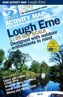
Lough Erne Activity Map
Lough Erne at 1:25, 000 on a large, double-sided Activity Map from the Ordnance Survey of Northern Ireland designed with outdoor enthusiasts in mind: waterproof and tear-resistant, topographic and GPS compatible, with hiking and cycling routes and tourist information for the area. The map covers both Upper and Lower Lough Erne and the Shannon-Erne Waterway. Topographic base has contours at 10m intervals, with altitude colouring and graphics for rocks, scree, marshes, different types of woodlands, etc. Road network indicates scenic routes and shows Sustrans National Cycle Network. Waymarked hiking routes are also highlighted. On the navigable lakes and waterways depths are marked, with colouring for contours of 1.5m and 15m. The map shows public or private jetties and slipways,
racing buoys, navigation markers, hazards, etc, as well as fishing stands and angling sites. Also indicated are service points for fresh water supplies, chemical toilet disposal, sewage pump out, and petrol or diesel supply.A very wide range of symbols provides tourist information, indicating camping and caravan sites, youth hostels, showers/laundry/public toilets, shops, cafes and restaurants, bird sanctuaries and nature reserves, various recreational facilities, museums, etc. Also marked are numerous local antiquities: forts, raths, crannogs, earthworks, megalithic tombs. The map has Irish national grid lines at 1km intervals. This title also includes a large, clear street plan of Enniskillen at 1:5, 000, indicating various facilities in the town, plus a list of
useful addresses for further information.To see the list of titles in this series please click on the series link.

Product Description
Reviews/Comments
Add New
Vouchers
No voucher codes found.
Do you know a voucher code for this product or supplier? Add it to Insights for others to use.
Do you know a voucher code for this product or supplier? Add it to Insights for others to use.
 Denmark