More From Contributor

£15.00
Dorothy Hartley (1893
- 1985) is an author revered by enthusiasts for old English food & cookery & English country life. Her many
...
Archived Product
£29.95
` Lost Worlds: Ruins of the Americas` is a unique visual exploration that vividly captures the haunting mystery & visual poetry of historic ruins throughout the Americas. This extraordinary collection perfectly portrays the architectural, geographic & historical significance of ruins that are considered world wonders & little known gems. Included are monumental temples of Mexico`s Mayan civilization, a Colonial era palace on the island of Haiti, earthquake-ravaged cathedrals in Guatemala, & astonishing Incan citadels in Peru`s Sacred Valley
- culminating with the breathtaking beauty of Machu Picchu.. This unprecedented publication transports the reader on a journey to ancient temples, abandoned palaces & lofty citadels. Evocative & enlightening, ` Lost Worlds` will stir the imagination of those with a passion for photography, travel, history, architecture, & archaeology. Shot in infrared format on a specially adapted digital camera, these images expose crumbling, overgrown walls, broken columns, & cracked arches in ways most readers have never seen. They will offer readers a new way of viewing the landscape as well as an enhanced vision of the collective identity of the Americas.

Includes::
a foreword by noted travel writer Pico Iyer & text by Arthur Drooker explaining each site`s rise, fall & lasting significance.


...
Archived Product
£2.95
Lostock Hall & Farington North in 1909 in a fascinating series of reproductions of old Ordnance Survey plans in the Alan Godfrey Editions, ideal for anyone interested in the history of their neighbourhood or family. Selected towns in Great Britain & Ireland are covered by maps showing the extent of urban development in the last decades of the 19th & early 20th century. In this title: the map covers the Lostock Hall area & also the northern section of Farington. Coverage stretches from Moss Lane Farm eastward to Lostock Fold, & from Tardy Gate southward to Fowler Lane Bridge. The railways are a major feature, including Lostock Hall station, engine shed, Farington station, Farington Fork, Farington Curve, Lostock Hall Connecting Line & many sidings, etc. Other features include Lostock Hall itself, Cuerden Green Mills, Lostock Hall Mill, Woodcock Hall, Cuerden Green, St Paul's church Farington, Tardy Gate Mill, etc. A 1918 directory of Lostock Hall is included on the reverse together with a railway timetable for the Liverpool to Preston service. About the Alan Godfrey Editions of the 25 ...
Archived Product
£3.50
Lostock Hall & Farington North in 1909 in a fascinating series of reproductions of old Ordnance Survey plans in the Alan Godfrey Editions, ideal for anyone interested in the history of their neighbourhood or family. The map covers the Lostock Hall area & also the northern section of Farington. Coverage stretches from Moss Lane Farm eastward to Lostock Fold, & from Tardy Gate southward to Fowler Lane Bridge. The railways are a major feature, including Lostock Hall station, engine shed, Farington station, Farington Fork, Farington Curve, Lostock Hall Connecting Line & many sidings, etc. Other features include Lostock Hall itself, Cuerden Green Mills, Lostock Hall Mill, Woodcock Hall, Cuerden Green, St Paul`s church Farington, Tardy Gate Mill, etc. A 1918 directory of Lostock Hall is included on the reverse together with a railway timetable for the Liverpool to Preston service. About the Alan Godfrey Editions of the 25” OS Series: Selected towns in Great Britain & Ireland are covered by maps showing the extent of urban development in the last decades of the 19th & early 20th century. The plans have been taken from the Ordnance Survey mapping & reprinted at about 15 inches to one mile (1:4, 340). On the reverse most maps have historical notes & many also include extracts from contemporary directories. Most maps cover about one mile (1.6kms) north/south, one & a half miles (2.4kms) across; adjoining sheets can be combined to provide wider coverage.FOR MORE INFORMATION & A COMPLETE LIST OF ALL AVAILABLE TITLES PLEASE CLICK ON THE SERIES LINK. ...
Archived Product
£19.99
The Lot in a series of guides to France’s navigable rivers & canals from Editions du Breil, providing mapping of the waterways with better presentation of the surrounding countryside, including street plans of main towns along the routes. The maps present the waterways with locks, mooring places, etc. & the surrounding localities annotated with symbols indicating various facilities & places of interest. Most map panels cover a full page, enabling the publishers to provide better coverage of the surrounding countryside, showing more local towns & villages plus the connecting roads. The guides also include better street plans of selected larger towns, indicating main sights, etc. Navigating instructions or tips & information about various facilities or places of interest are usually located on a page opposite to the map of the route. The guides also contain general information on rules & regulations for navigating along France’s inland waterways, plus examples of signs & signals. All of the text, explanations & the map legend are in French, English & German. To see the list of other titles in this series please click on the series link. ...
Archived Product
£5.99
Lot & Tarn-et-Garonne départments of France at 1:150, 000 in Michelin’s Local Series, with highlighting for scenic routes, an index, a special panel with best sights & recommended driving tours, & street plans of Cahors & Montauban. The map extends from just north of Sarlat, Soulillac & the central Valley of the Dordogne River to well south of Montauban, & west-east from Villeneuve-sur-Lot to just short of Rodez. Coverage

Includes::
many popular holiday destinations along the Dordoge: Castelnaud-la-Chaplelle, La Roque-Gageac, Domme, Castelnau, as well as Rocamadour, Figeac, Fumel, Moissac, etc. PLEASE NOTE: our coverage image, provided by the publishers, does not take into account which areas along the edge of the map are blocked by the index & the additional features; the north-western corner along the Dordogne is not included. Maps in Michelin’s Local Series of France have the same cartography (road network & place names shown on the maps) as the publishers’ Regional Series at 1;200, 000 but enlarged here to 1:150, 000 to provide greater clarity & larger, easier to read print size. Road network is presented in great detail, indicating width, motorway services & rest areas, dangerous or restricted entry roads, steep gradients, height & weight restrictions, etc. Scenic sections are highlighted. The maps also show selected cycle paths & nature trails. Railway lines are shown with stations & local airports are marked. Symbols indicate various places of interest, with additional star rating for best sights, based on the publishers’ Green Guides for French regions. Satellite-derived base with colouring for the forested areas & boundaries of national or regional parks shows the topography. In the mountainous regions the maps have bold, very effective relief shading, with a large number of names of peaks, passes, & other topographic features. The maps have latitude & longitude lines at 10’ intervals & are indexed. Map legend

Includes::
English. Each title in addition

Includes::
a panel showing the area’s principal roads & places of interest, plus recommendations for sightseeing tours. Also provided are town centre maps of main cities, indicating principal traffic arteries, one way streets & places of interest. Only selected streets are named & listed in the accompanying index. Please click on the series link to see all the titles in this series.


...
Archived Product
£15.99
Lot Aveyron
- Vallée du Tarn Guide Vert *FRENCH Edition* in Michelin’s Green Guide series covering France, with all the regions
...
Archived Product
£20.50
Lot-et-Garonne à pied, FFRP topo-guide Ref. No.D047, with 36 day walks of varying length & difficulty in the department of Lot-et-Garonne, near Agen & the confluence of the two rivers, the Lot & the Garonne. Each walk is presented on a separate colour extract from IGN’s topographic survey of France at 1:25, 000, with its description cross-referenced to the map. Current edition of this title was published in May 2012. To see the list of other FFRP guides with day walks please click on the series link.ABOUT THE FFRP (Fédération française de la randonnée pédestre) TOPOGUIDES: published in a handy A5 paperback format, the guides are the best companions for hiking in France. In addition to their topo-guides to the long-distance GR routes FFRP also publish an extensive range of guides with local day walks. Each walk in presented on a colour extract from IGN`s 1:50, 000 or 1:25, 000 topographic survey mapping overprinted with the route, with important points cross-referenced to the accompanying text, in French only, placed on the adjoining page. For each walk the guides also indicate the degree of difficulty & provide information on length, time & change in altitude, waymarking signs, access by road & parking facilities. An “info practiques” section of the guide indicates where shops, restaurants & accommodation can be found. The guides are published on high quality paper & include descriptions of the most interesting aspects of the surrounding region: historical & cultural sites, local specialties, fauna & flora, etc, all illustrated with colour photos. ...
Archived Product
£12.95
53 varied & family oriented day walks of 2 to 9 miles exploring the magnificent sandy beaches, spectacular cliffs & human history of Scotland`s south-east coast. Routes begin at Bo`ness on the River Forth, take in the delights of Edinburgh & continue east to the holiday destinations of Portobello, North Berwick, Gullane & Dunbar. The wild Berwickshire coast is then described via St Abb`s Head & Eyemouth to Berwick-upon-Tweed. 7 fully described day stages of the 90 mile, long distance Berwickshire Coastal Trail & John Muir Way from Berwick-upon-Tweed to Edinburgh & the Forth Bridges, including details of accommodation & facilities at towns & villages along the route. An ideal guidebook to one of the most accessible, popular & enduring sections of the Scottish coast for traditional family seaside holidays. This guidebook will appeal to a wide range of walkers, families, visitors & committed enthusiasts looking for a long distance challenge from the border with England to the Scottish capital. There is comprehensive coverage of every section of the coast, offering a vast route choice & exceptional value for money ...
Archived Product

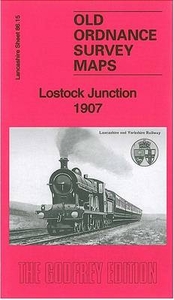
Lostock Junction 1907

Lostock Junction in 1907 in a fascinating series of reproductions of old Ordnance Survey plans in the Alan Godfrey Editions, ideal for anyone interested in the history of their neighbourhood or family. The map covers the area from Lostock Junction westward to Lostock Hall. Features include railways with Lostock Junction station, Industrial School, St Thomas School, Lostock Junction Mills, Lower House, Chorley New Road with tramway, Bessy Brook House, Hollinhurst, numerous detached houses, Bee Hive Mills, Lostock Hall Fold, Pendlebury`s Fold, etc. A 1914 timetable for the Manchester-Wigan service is on the reverse.About the Alan Godfrey Editions of the 25” OS Series:Selected towns in Great Britain and Ireland are covered by maps showing the extent of urban development in the
last decades of the 19th and early 20th century. The plans have been taken from the Ordnance Survey mapping and reprinted at about 15 inches to one mile (1:4, 340). On the reverse most maps have historical notes and many also include extracts from contemporary directories. Most maps cover about one mile (1.6kms) north/south, one and a half miles (2.4kms) across; adjoining sheets can be combined to provide wider coverage.FOR MORE INFORMATION AND A COMPLETE LIST OF ALL AVAILABLE TITLES PLEASE CLICK ON THE SERIES LINK.
RIP - This product is no longer available on our network. It was last seen on 25.09.2019

This page now acts as a permanent archive for this product. Add more information using the comments box below to ensure it can still be found by future generations.

Use our search facility to see if it is available from an alternative contributor.
  • Availability: Out Of Stock
  • Supplier: Stanfords
  • SKU: 9781847846754
Availability: In Stock
£3.50

Product Description

Lostock Junction in 1907 in a fascinating series of reproductions of old Ordnance Survey plans in the Alan Godfrey Editions, ideal for anyone interested in the history of their neighbourhood or family. The map covers the area from Lostock Junction westward to Lostock Hall. Features include railways with Lostock Junction station, Industrial School, St Thomas School, Lostock Junction Mills, Lower House, Chorley New Road with tramway, Bessy Brook House, Hollinhurst, numerous detached houses, Bee Hive Mills, Lostock Hall Fold, Pendlebury`s Fold, etc. A 1914 timetable for the Manchester-Wigan service is on the reverse. About the Alan Godfrey Editions of the 25” OS Series: Selected towns in Great Britain & Ireland are covered by maps showing the extent of urban development in the last decades of the 19th & early 20th century. The plans have been taken from the Ordnance Survey mapping & reprinted at about 15 inches to one mile (1:4, 340). On the reverse most maps have historical notes & many also include extracts from contemporary directories. Most maps cover about one mile (1.6kms) north/south, one & a half miles (2.4kms) across; adjoining sheets can be combined to provide wider coverage.FOR MORE INFORMATION & A COMPLETE LIST OF ALL AVAILABLE TITLES PLEASE CLICK ON THE SERIES LINK.

Reviews/Comments

Add New

Intelligent Comparison

Oooops!
We couldn't find anything!
Perhaps this product's unique.... Or perhaps we are still looking for comparisons!
Click to bump this page and we'll hurry up.

Price History

Vouchers

No voucher codes found.
Do you know a voucher code for this product or supplier? Add it to Insights for others to use.

Facebook

Jargon Buster

Contemporary - Modern era design
Contemporary - A design reference to indicate post war modern design
History - Anything that happens in the past. An acedemic subject.
Railways - A set of tracks that have been laid for the purpose of trains to travel up and down them
Road - a manmade lane or a path that is used to speed up travel.
Contemporary - An object that is living in the same time.
Junction - A point where two or more things come together, typically used to describe roads
Hall - A room at the inside of an entrance of a house.
Ideal - Something that satisfies a perfect criteria.
Family - A group of people that live together made up from parents and children.

Supplier Information

Stanfords
Stanfords was established in 1853 and opened their iconic Covent Garden flagship store in 1901. They have become the top retailer of maps, travel books and accessories in the UK and arguably offer the largest selection of maps and travel books worldwide. Famous names such as Captain Robert Falcon Scott, Ranulph Fiennes and Michael Palin have purchased from Stanfords. They now have a shop in Bristol and both stores together with other venues operate a calendar of events including talks, book signings and exhibitions. As a specialist map retailer, the map selection is comprehensive and includes road maps, street maps and walking maps from worldwide destinations, as well as a selection of world atlases and wall maps. Books include travel guides and travel literature. Stanfords also stock globes, from miniatures made of blue marble to magnificent floor-standing globes. The website features a selection of interesting articles on travel topics.
Page Updated: 2023-11-12 20:15:36

Community Generated Product Tags

Oh No! The productWIKI community hasn't generated any tags for this product yet!
Menu