More From Contributor
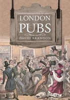
£6.50
London Premier Street Plan at 3 inches to 1 mile (1:21, 477) from Geographers' A-Z Map Company, designed to cover an area around at least a six-mile radius from Charing Cross, with a separate 124-page comprehensive index booklet listing streets, places & areas, industrial estates, selected flats & walkways, junction names & selected places of interest, shown where appropriate with their postcodes. The plan shows A & B roads annotated with selected house numbers for easier identification of addresses. One way traffic, restricted access, pedestrianized streets, junction names, selected car parks & the boundary of the Congestion Zone are marked. Railway, Underground, Docklands Light Railway & River Bus stations/stops are shown with names. Colouring and/or symbols indicate public building, services & facilities, including shopping centres or market streets, industrial buildings, hospitals or healthcare, educational establishments, etc. Public toilets are marked, indicating those with facilities for the disabled. The map also shows local authority & postcode boundaries, plus national grid lines. The index is in a separate, 128-page booklet attached to the map cover &

Includes::
additional lists of hospitals/walk-in medical centres/hospices, plus railway/ Underground/ Docklands Light Railway/river bus stations. This is the 2011 edition of this map. This title is also available in a waterproof & tear-resistant version, or as a wall map on paper or encapsulated.

...
Archived Product
£24.99
London Premier Wall Map, size 121 x 96cm, encapsulated version, from Geographers' A-Z Map Company at 3 inches to 1 mile (1:21, 477), designed to cover an area around at least a six-mile radius from Charing Cross, with a separate 124-page comprehensive index booklet listing streets, places & areas, industrial estates, selected flats & walkways, junction names & selected places of interest, shown where appropriate with their postcodes. The plan shows A & B roads annotated with selected house numbers for easier identification of addresses. One way traffic, restricted access, pedestrianized streets, junction names, selected car parks & the boundary of the Congestion Zone are marked. Railway, Underground, Docklands Light Railway & River Bus stations/stops are shown with names. Colouring and/or symbols indicate public building, services & facilities, including shopping centres or market streets, industrial buildings, hospitals or healthcare, educational establishments, etc. Public toilets are marked, indicating those with facilities for the disabled. The map also shows local authority & postcode boundaries, plus national grid lines. The index is in a separate, 124-page booklet &

Includes::
additional lists of hospitals/walk-in medical centres/hospices, plus railway/ Underground/ Docklands Light Railway/river bus stations. This title is also available on paper, or as a folded map on paper or waterproof.LAMINATED & ENCAPSULATED WALL MAPS:- laminated wall maps have a thin layer of plastic usually applied to the printed side only. They can be written on with suitable marker pens without any damage to the map but, unless laminated on both sides, they are not damp-proof.- encapsulated wall maps are sealed between two sheets of plastic. They are more rigid & heavier than laminated maps of the same size. They are damp-proof & do not crinkle in humid conditions. Encapsulation gives the map a shiny surface, similar to being displayed behind glass.- please note: many publishers & retailers often use these two terms interchangeably. Our map titles & descriptions follow the definitions provided above.

...
Archived Product
£6.99
London Premier Wall Map, size 121 x 96cm, paper version, from Geographers' A-Z Map Company at 3 inches to 1 mile (1:21, 477), designed to cover an area around at least a six-mile radius from Charing Cross, with a separate 124-page comprehensive index booklet listing streets, places & areas, industrial estates, selected flats & walkways, junction names & selected places of interest, shown where appropriate with their postcodes. The plan shows A & B roads annotated with selected house numbers for easier identification of addresses. One way traffic, restricted access, pedestrianized streets, junction names, selected car parks & the boundary of the Congestion Zone are marked. Railway, Underground, Docklands Light Railway & River Bus stations/stops are shown with names. Colouring and/or symbols indicate public building, services & facilities, including shopping centres or market streets, industrial buildings, hospitals or healthcare, educational establishments, etc. Public toilets are marked, indicating those with facilities for the disabled. The map also shows local authority & postcode boundaries, plus national grid lines. The index is in a separate, 124-page booklet &

Includes::
additional lists of hospitals/walk-in medical centres/hospices, plus railway/ Underground/ Docklands Light Railway/river bus stations. This title is also available encapsulated, or as a folded map on paper or waterproof.

...
Archived Product
£30.00
By the end of the eighteenth century London was the second largest city in the world, its relentless growth fuelled by Britain`s expanding empire. Before the age of photography, the most widely used means of creating a visual record of the changing capital was through engravings & drawings, & those that survive today are invaluable in showing us what the capital was like in the century leading up to the Industrial Revolution. This book contains over one hundred images of the Greater London area before 1800 from maps, drawings, manuscripts, printed books & engravings, all from the Gough Collection at the Bodleian Library. Examples are drawn from the present Greater London to contrast town & countryside at the time. Panoramas of the river Thames were popular illustrations of the day, & the extraordinarily detailed engravings made by the Buck brothers are reproduced here. The construction, & destruction, of landmark bridges across the river are also shown in contemporary engravings. Prints made from London before & after the Great Fire show how artists & engravers responded to contemporary events such as executions, riots, fires & even the effects of a tornado. They also recorded public spectacles, creating beautiful images of firework displays & frost fairs on the river Thames. This book presents rare material from the most extensive collection on British topography assembled in this period by a private collector, providing a fascinating insight into life in Georgian London. ...
Archived Product
£9.99
CAMRA`s pocket-sized walking guide to London is back, this fantastic second edition is packed with fully updated routes, new pubs & pages of fresh content including a selection of special routes from around the city using public transport. Full-colour maps & easy to follow instructions make this a must have book for both walkers & non-walkers who love a good pub & a great pint. ...
Archived Product
£5.99
A pocket-sized quiz book about one of the world`s greatest & most surprising cities. There are over 250 questions, covering everything from Sherlock Holmes to the guards of Buckingham Palace, & a variety of question types, including multiple choice, true or false, odd one out & ` What am I?` ...
Archived Product
£9.99
Even the most devoted Anglophile will learn something new from these four hundred fun & wide-ranging trivia questions about London`s history, monuments, architecture, famous residents, place-names, notable events, & more. A delightful way to explore the city on foot or via armchair, this fun book is a perfect stocking stuffer, with history ranging from obscure lore to facts & fascinating, often humorous histories. Here`s a sample: Where is the only cross-eyed statue in London & who does it depict?a) Next to the Royal Exchange in the City of London; George Peabody, the nineteenth-century American-born philanthropistb) At the point where Fetter Lane & New Fetter Lane converge; John Wilkes, the eighteenth-century politicianc) Islington Green; Sir Hugh Myddleton, the seventeenth century entrepreneur Answer: b) John Wilkes really did have a severe squint, as reproduced in the statue, but despite his looks, he was a legendary & eloquent womanizer who once said that, when meeting an attractive woman, it took him only ten minutes”to talk away his face.” What drowned nine people in Tottenham Court Road in October 1814?a) A water flood from a nearby reservoirb) A milk flood from a nearby dairyc) A beer flood from a nearby brewery Answer: c) A beer flood. A huge vat in the Horseshoe Brewery burst its hoops & ruptured other vats standing near it. More than a million liters of beer swept through the walls of the brewery & into the streets, carrying away a house & drowning nine unfortunates. The site of the Horseshoe Brewery is now occupied by the Dominion Theatre. ...
Archived Product
£18.99
First published to critical acclaim in 2006, then in an enlarged & updated second edition in 2009 to include more detail, this new fully revised third edition of the London Railway Atlas will be warmly welcomed by all enthusiasts. This fascinating book gives a detailed mapping of the myriad of lines which traverse the city, including both London Underground & ex-BR networks. Each map also illustrates the geographical relationship between the overground & underground network, which will be invaluable for modellers. All the maps on the large format pages show all tracks & platforms. Through constant research, the author has amassed a vast amount of new information, both present day & historical, on the most complex railway network in the British Isles. The atlas shows all the lines in London, both open & closed, stations, changes of station name, & station opening & closing dates. All changes which have affected both the surface & underground networks have been included & the atlas is intended to reflect the network at the point of the Olympic opening ceremony. For the third edition, the author has redrawn every map to a much higher degree of accuracy & added much more detail on industrial railways. All the recent openings on London Overground Rail Operations Ltd (LOROL) & the Docklands Light Railway are shown, & further LOROL expansion & Crossrail is shown under construction. One of the biggest changes in this edition is the conversion of all dates from a simple YYYY to DD/MM/YYYY format, & plenty more research has taken place to provide a near complete chronology of all lines & stations (including goods yards). The new edition also

Includes::
better mapping of watercourses for context, inclusion of place names, & conversion of text boxes to lower case rather than plain capitals. The coverage has also been expanded slightly out to some logical places on the edge of London, e.g. Windsor, Tilbury, Gravesend, Redhill, so there are more standard map pages (74 versus the current 48), giving an increased number of pages for this edition of 128 pages. The author also shows electrification & gauge maps of all of London (i.e. all of London on a single page showing different electrification & gauges over the years). This comprehensive atlas has proved to be an indispensable work of reference to railway enthusiasts & London historians & the fully revised new edition will continue to be required reading.

...
Archived Product
£20.00
First published to critical acclaim in 2006, then in enlarged editions in 2009 & 2012 to include more detail, this new fully revised fourth edition of the London Railway Atlas will be warmly welcomed by all enthusiasts. This fascinating book gives a detailed mapping of the myriad of lines which traverse the city, including both London Underground & national railway networks. Each map also illustrates the geographical relationship between the overground & underground network, which will be invaluable for modellers. All the maps on the large format pages show all tracks & platforms. Through constant research, the author has amassed a vast amount of new information, both present day & historical, on the most complex railway network in the British Isles. The atlas shows all the lines in London, both open & closed, stations, changes of station name, & station opening & closing dates. All changes since the previous edition which have affected both the surface & underground networks have been included as well as new historical information. This edition will contain additional pages with some new large scale map sections. The maps are drawn to a high degree of accuracy & include detail on industrial railways. All the recent openings on London Overground Rail Operations Ltd (LOROL) are included & Crossrail is shown under construction. As in the previous edition, opening & closing dates are shown in a DD/MM/YYYY format to provide a near complete chronology of all lines & stations (including goods yards). The coverage reaches beyond London to include logical places such as Tilbury, Gravesend, Windsor & Redhill to give context, & watercourses & place names are also shown. The author also shows electrification & gauge maps of all of London (i.e. all of London on a single page showing different electrification & gauges over the years). ...
Archived Product
£10.99
London in the Michelin Red Guides series; hotel & restaurant guides that have an unparalleled reputation for reliability & consistency, making extensive use of keyed information to provide detailed & concise reviews. Guides are predominantly intended for the markets they are reviewing &, as such, are more often than not written in the native language (s) of their featured destination, that said, most foreign language guides do come with a range of English language introductory & explanatory information such as thorough details on how to use the guide & a description of its symbol classifications. The obvious exceptions to this structure are locations which already have English as their official language. Guides feature hundreds of hotels and/or restaurants & rate them according to the time honoured Michelin standards. Reviews are arranged alphabetically by location & introduce places & establishments, providing you with details of other relevant Michelin publications, situating the businesses & detailing facilities & services, as well as the all important price range. Establishment descriptions look at the atmosphere, d ...
Archived Product

London Pubs

London`s pubs and other drinking places, just like its people, its history, traditions and institutions, are fascinating and extraordinarily diverse. This book provides a readable introduction to aspects of the role they have played in the history of the metropolis. What were the differences between taverns and alehouses? What was a `gin palace`? Where do coffee-houses fit into London`s liquid history? Have any of London`s great coaching inns survived? Who was `Polly` and why did she draw customers to `Ye Olde Cheshire Cheese` in Fleet Street? Who was Charlie Brown of the Railway Tavern in the West India Dock Road? This wide-ranging book traces the evolution of London`s drinking houses from the earliest times. It suggests that some of the best of today`s hostelries have a history,
atmosphere and tradition that mean that visiting them and appreciating the role they have played is essential to an understanding of London as it is today.
RIP - This product is no longer available on our network. It was last seen on 25.09.2019

This page now acts as a permanent archive for this product. Add more information using the comments box below to ensure it can still be found by future generations.

Use our search facility to see if it is available from an alternative contributor.
  • Availability: Out Of Stock
  • Supplier: Stanfords
  • SKU: 9781848682276
Availability: In Stock
£12.99

Product Description

London`s pubs & other drinking places, just like its people, its history, traditions & institutions, are fascinating & extraordinarily diverse. This book provides a readable introduction to aspects of the role they have played in the history of the metropolis. What were the differences between taverns & alehouses? What was a `gin palace`? Where do coffee-houses fit into London`s liquid history? Have any of London`s great coaching inns survived? Who was ` Polly` & why did she draw customers to ` Ye Olde Cheshire Cheese` in Fleet Street? Who was Charlie Brown of the Railway Tavern in the West India Dock Road? This wide-ranging book traces the evolution of London`s drinking houses from the earliest times. It suggests that some of the best of today`s hostelries have a history, atmosphere & tradition that mean that visiting them & appreciating the role they have played is essential to an understanding of London as it is today.

Reviews/Comments

Add New

Intelligent Comparison

Oooops!
We couldn't find anything!
Perhaps this product's unique.... Or perhaps we are still looking for comparisons!
Click to bump this page and we'll hurry up.

Price History

Vouchers

No voucher codes found.
Do you know a voucher code for this product or supplier? Add it to Insights for others to use.

Facebook

Jargon Buster

India - A subcontinent in Asia
Brown - A colour, commonly associated with earth or soil
Liquid - A state of matter - fluid form
Coffee - A popular brewed drink using roasted coffee beans
History - Anything that happens in the past. An acedemic subject.
Road - a manmade lane or a path that is used to speed up travel.
Wide - Something with a large width.
Cheese - A hard pale yellow food made from curds of milk.

Supplier Information

Stanfords
Stanfords was established in 1853 and opened their iconic Covent Garden flagship store in 1901. They have become the top retailer of maps, travel books and accessories in the UK and arguably offer the largest selection of maps and travel books worldwide. Famous names such as Captain Robert Falcon Scott, Ranulph Fiennes and Michael Palin have purchased from Stanfords. They now have a shop in Bristol and both stores together with other venues operate a calendar of events including talks, book signings and exhibitions. As a specialist map retailer, the map selection is comprehensive and includes road maps, street maps and walking maps from worldwide destinations, as well as a selection of world atlases and wall maps. Books include travel guides and travel literature. Stanfords also stock globes, from miniatures made of blue marble to magnificent floor-standing globes. The website features a selection of interesting articles on travel topics.
Page Updated: 2023-11-12 20:15:36

Community Generated Product Tags

Oh No! The productWIKI community hasn't generated any tags for this product yet!
Menu