More From Contributor

£14.99
London North: The City, West End, Enfield, Ealing, Harrow & Watford area on a detailed topographic & GPS compatible map No. 173, waterproof version, from the Ordnance Survey’s 1:25, 000 Explorer series. MOBILE DOWNLOADS: this title & all the other OS Explorer maps include a code for downloading after purchase the digital version onto your smartphone or tablet for viewing on the OS smartphone app.OS EXPLORER SERIES: to see the list of all the titles in the OS Explorer series, both paper & waterproof versions, please click on the series link. The Explorer series, Ordnance Survey’s most detailed maps recommended for anyone enjoying outdoor activities, provides topographic coverage of Great Britain at 1:25, 000 on GPS compatible maps with hiking trails, cycling routes & extensive tourist information. Each printed map is available either on paper or as a waterproof & tear-resistant OS Active Map, as indicated in its title. Britain’s National Parks & other areas of particular tourist interest are presented on often double-sided OL (Outdoor Leisure) maps, whilst most standard format Explorers cover an area of 30 x 20km (approx. 19 x 12 miles). All three versions (paper, waterproof & digital) are the same & provide plenty of recreational & tourist information, indicating the traditional public right of way paths (except in Scotland where different laws apply), including bridleways & byways. National Trails & other long-distance paths are marked, as well as permissive footpaths or bridleways & on-road or traffic-free cycle routes with, where appropriate, their National/ Regional Cycle Network numbers. Boundaries of access land are clearly marked. A wide range of symbols provides additional tourist information, highlighting camping & caravanning sites, information offices & visitors’ centres, parking & picnicking places, country pubs, sport & recreational facilities including cycle hire locations & mountain biking trails, historic buildings & museums, etc. Exceptionally clear presentation of the landscape is provided by contours at 5m or in the uplands at 10m intervals, with additional spot heights plus colouring and/or graphics for different types of woodlands, orchards, heath, marshl&, scree or boulders, & other topographic features. For GPS users the maps have British National Grid lines at 1km intervals, with latitude & longitude given by margin ticks at 1`. Clearly laid out map legend

Includes::
French & German translations for the tourist information symbols.

...
Archived Product
£8.99
London North: The City, West End, Enfield, Ealing, Harrow & Watford area on a detailed topographic & GPS compatible map No. 173, paper version, from the Ordnance Survey’s 1:25, 000 Explorer series. MOBILE DOWNLOADS: this title & all the other OS Explorer maps include a code for downloading after purchase the digital version onto your smartphone or tablet for viewing on the OS smartphone app.OS EXPLORER SERIES: to see the list of all the titles in the OS Explorer series, both paper & waterproof versions, please click on the series link. The Explorer series, Ordnance Survey’s most detailed maps recommended for anyone enjoying outdoor activities, provides topographic coverage of Great Britain at 1:25, 000 on GPS compatible maps with hiking trails, cycling routes & extensive tourist information. Each printed map is available either on paper or as a waterproof & tear-resistant OS Active Map, as indicated in its title. Britain’s National Parks & other areas of particular tourist interest are presented on often double-sided OL (Outdoor Leisure) maps, whilst most standard format Explorers cover an area of 30 x 20km (approx. 19 x 12 miles). All three versions (paper, waterproof & digital) are the same & provide plenty of recreational & tourist information, indicating the traditional public right of way paths (except in Scotland where different laws apply), including bridleways & byways. National Trails & other long-distance paths are marked, as well as permissive footpaths or bridleways & on-road or traffic-free cycle routes with, where appropriate, their National/ Regional Cycle Network numbers. Boundaries of access land are clearly marked. A wide range of symbols provides additional tourist information, highlighting camping & caravanning sites, information offices & visitors’ centres, parking & picnicking places, country pubs, sport & recreational facilities including cycle hire locations & mountain biking trails, historic buildings & museums, etc. Exceptionally clear presentation of the landscape is provided by contours at 5m or in the uplands at 10m intervals, with additional spot heights plus colouring and/or graphics for different types of woodlands, orchards, heath, marshl&, scree or boulders, & other topographic features. For GPS users the maps have British National Grid lines at 1km intervals, with latitude & longitude given by margin ticks at 1`. Clearly laid out map legend

Includes::
French & German translations for the tourist information symbols.

...
Archived Product
£9.99
The London Notebook with lined pages features over 50 drawings & watercolours by artist Graham Byfield, who turns his keen eye & delicate brush to recording people going about their daily business & the enchanting architecture of this fascinating city. Carefully produced the notebook offers a couple of pages to introduce the city, followed by lined pages adorned with drawings & watercolour illustrations providing ample space to write your notes. A delicate red ribbon can be used to mark where you left off. The notebook ends with a London at a Glance page offering the figures on the city like population, area, airports etc & a yearly view of 2015, 2016 & 2017 calendars. The perfect gift for stationery lovers & art enthusiasts alike, & works well as a memento of your visit to this wonderful city. Truly beautiful, inspiring & precious ...
Archived Product
£8.99
This is a unique notebook from Cavallini & Co. with a beautiful & robust cover featuring a vintage illustration of London. It


...
Archived Product
£6.66
A high-quality, hard back A5 london notebook, featuring Marion Billet`s illustrations of London icons. With a flick-book-style Queen`s Guard marching through its 148 lined pages plus a nifty elastic wrap-around fastening, this is a right royal treat for all fans of London. ...
Archived Product
£12.99
The philosopher & writer Krystin Lach-Szyrma came to Britain in 1820 as tutor to two Polish princes, as their Grand Tour took them to Enlightenment Scotl&, where they spent two years studying at Edinburgh University. After a short tour of continental Europe they returned in 1822 to England to enjoy the delights of London & observe its monuments & people. With insatiable curiosity & good humour, Lach-Szyrma recorded his impressions of London & Londoners in perceptive & readable style. Of peasant origins, Lach-Szyrma was no snob. His observations are shrewd, witty & irradiated by the enthusiasm of a Romantic. ...
Archived Product
£6.99
The first two London Olympics offer food for thought in the run-up to London 2012, with its multi-billion pound budget during a global economic recession, new sporting arenas, Olympic villages, & high-speed rail links. When Vesuvius erupted in 1906, Italy had to pull out of hosting the Games. London stepped in & delivered new stadia without any government assistance in just two years. In 1948, still recovering from the ravages of war, London hosted the Olympics again. The entire budget for the 1948 Games was 760, 000, & they turned a profit of 29, 000. This history of the London Olympics, which concludes with a look ahead to 2012, is a timely & fascinating chronicle of the Games of another age. ...
Archived Product
£9.99
London on Foot by Celia Woolfrey is an illustrated guide to fifteen walks distributed throughout central, south, east & west London. The distinguishing feature of this guide is that each of the fifteen walks is accompanied by an illustrated aerial view map that clearly depicts the proposed walking route. Each map is marked by a series of numbers that correspond to the descriptive text. The text provides route directions as well as background information on the areas history, buildings & attractions. Included in the guide is additional information on exploring London on foot, getting around London by other means, as well as general Tourist information. The guide is accompanied by full-colour photographs throughout. ...
Archived Product
£9.99
Oh! I do like to be beside the seaside. An inspirational illustrated guide to 50 coastal days out, all within easy reach of London. Swap your oyster card for fresh oysters at Whistable, & trade in city parks for the wide open spaces of Camber Sands. Written by ex-Time Out editor Sarah Guy, London on Sea offers 50 fun days out on the coast with whimsical tone of voice that captures the magic of a day out on the beach. Timeless entries will feature the best walking routes, where to see breath-taking views, interesting architectural quirks & those local institutions that make each town unique. Destinations include: Southwold, Walberswick, Thorpeness, Aldeburgh, Walton-on-the-Naze, Frinton-on-Sea, Clacton-on-Sea, Southend, Leigh-on-Sea, Whitstable, Herne Bay, Margate, Broadstairs, Ramsgate, Sandwich, Deal, Dover, Folkestone, Hythe, Camber, Hastings, St Leonards, Bexhill, Eastbourne, Seaford, Rottingdean, Brighton, Worthing, Littlehampton, Bognor Regis, East & West Wittering, Bournemouth. ...
Archived Product
£9.99
In partnership with Santander, the sponsors of London’s cycle hire scheme, this book provides information on hiring the bikes & cycling etiquette as well as 25 h&-picked rides around London that will take you from docking station to docking station while enjoying the best of London in-between. The 25 routes are divided into the regions of North, South, East, West & Central London & for the more adventurous, a further afield section. Rides include; the sights of the Southbank, crawling Camden, by water to Chiswick House & many more. Each ride featured contains information including; distance, a profile saying whether it is flat, downhill or hilly, pick up & drop off docking stations, a list of directions, an overview map including marked out places of interest which are then described in more detail & approximate cycling time. This book will suit casual & regular cyclists alike & help you discover a fresh & healthy alternative to tubes & busses. ...
Archived Product

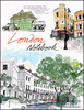
London Notebook A6: London Bus

A high-quality, hard-back A6 london notebook featuring Marion Billet`s illustrations of a London bus loaded with iconic passengers. With a flick-book-style bus whizzing through its 148 unlined pages plus a nifty elastic wrap-around fastening, this is a right royal treat for all fans of London.
RIP - This product is no longer available on our network. It was last seen on 25.09.2019

This page now acts as a permanent archive for this product. Add more information using the comments box below to ensure it can still be found by future generations.

Use our search facility to see if it is available from an alternative contributor.
  • Availability: Out Of Stock
  • Supplier: Stanfords
  • SKU: 9781509817450
Availability: In Stock
£3.99

Product Description

A high-quality, hard-back A6 london notebook featuring Marion Billet`s illustrations of a London bus loaded with iconic passengers. With a flick-book-style bus whizzing through its 148 unlined pages plus a nifty elastic wrap-around fastening, this is a right royal treat for all fans of London.

Reviews/Comments

Add New

Intelligent Comparison

Oooops!
We couldn't find anything!
Perhaps this product's unique.... Or perhaps we are still looking for comparisons!
Click to bump this page and we'll hurry up.

Price History

Vouchers

No voucher codes found.
Do you know a voucher code for this product or supplier? Add it to Insights for others to use.

Facebook

Jargon Buster

Quality - An object that has quality is superior in function and finish than a less quality object.
Treat - A reward, also can be away which someone is dealt with to change behaviour.
Fastening - A component hat closes or secures, e.g. a coat zip.
illustrations - Pictures typically in books and newspapers.

Supplier Information

Stanfords
Stanfords was established in 1853 and opened their iconic Covent Garden flagship store in 1901. They have become the top retailer of maps, travel books and accessories in the UK and arguably offer the largest selection of maps and travel books worldwide. Famous names such as Captain Robert Falcon Scott, Ranulph Fiennes and Michael Palin have purchased from Stanfords. They now have a shop in Bristol and both stores together with other venues operate a calendar of events including talks, book signings and exhibitions. As a specialist map retailer, the map selection is comprehensive and includes road maps, street maps and walking maps from worldwide destinations, as well as a selection of world atlases and wall maps. Books include travel guides and travel literature. Stanfords also stock globes, from miniatures made of blue marble to magnificent floor-standing globes. The website features a selection of interesting articles on travel topics.
Page Updated: 2023-11-12 20:15:36

Community Generated Product Tags

Oh No! The productWIKI community hasn't generated any tags for this product yet!
Menu