More From Contributor

£20.00
The Thames from its source to London Bridge on a cloth-backed reproduction of an “ Oarsman’s & Angler’s” map, published in 1889 by James Reynolds & Sons. The map, 170cm / 67” long, shows locations along the river with the network of roads & railway lines. Locks & bridges are annotated with measurements for clearance, etc, & the map also provides recommendations for nearby hotels. Place names & accompanying notes are easy to read in this size reproduction. Each individual cloth-backed map is sold folded in a colourful case covered with a unique design marbled paper – no two cases are identical.PLEASE NOTE: to see the list of all the titles in this series from the Old Folding Maps please click on the series link. ...
Archived Product
£9.99
This exquisite book, a design object in its own right, contains 45 stylish depictions of London`s best buildings, created by influential design duo Robin Farquhar & Hannah Dipper of People Will Always Need Plates. These outstanding graphic illustrations, with their clean lines & bold blocks of colour, have been used by the company on a successful range of plates, mugs & other objects, but this is the first time they have appeared in book form. This long-awaited collection covers a range of architectural styles, from Sir Christopher Wren`s 1675 Greenwich Royal Observatory to Richard Rogers` 2000 Montevetro development, taking in the glorious 19th-century Victoria & Albert Museum, 20s modernist masterpieces such as the Isokon Building & 1960s concrete Brutalist icons like the National Theatre. Buildings of all types are included, from art galleries to gas holders to tower blocks. The authors have included some of the images for which they are best known, such as those of the Trellick Tower & the Barbican, but the book also contains a selection of new images. Each is accompanied by succinct text that sums up why the authors love the buildings they depict.
Includes: a foreword by design expert Max Fraser.
...
Archived Product
£7.99
This exquisite colouring book, a design object in its own right, contains 45 stylish line illustrations of London`s most iconic buildings, created by influential design duo Robin Farquhar & Hannah Dipper of People Will Always Need Plates. These outstanding graphic illustrations, with their clean lines, are just waiting for a touch of colour to bring them to life & make your own. Whether you`ve got a spare 10 minutes on your commute to work or a few lazy hours on a Sunday, you can paint the town red, yellow, blue, or any other colours you want! This fabulous collection covers a range of architectural styles, from Sir Christopher Wren`s 1675 Greenwich Royal Observatory to Richard Rogers` 2000 Montevetro development, taking in the glorious 19th-century Victoria & Albert Museum, 1920s modernist masterpieces such as the Isokon Building & 1960s concrete brutalist icons like the National Theatre. Buildings of all types are included, from art galleries to gas holders to tower blocks. The authors have included some of the images for which they are best known, such as those of the Trellick Tower & the Barbican, but the book also contains a selection of new images. Each is accompanied by succinct text that sums up why the authors love the buildings they depict.

Includes::
a foreword by design expert Max Fraser.

...
Archived Product
£9.99
Grab a seat on the top deck & get set for a ride through London on a bright red bus! This fantastic book contains everything you need to build your very own model of an iconic London Routemaster. No cutting or gluing is required
- simply press out the pieces & slot them together. It`s also packed with facts about some of the capital`s most famous landmarks, so you can learn all about the city while you build your bus. Perfect for transport enthusiasts & London lovers of all ages.
...
Archived Product
£22.50
London Bus Litho Print by British illustrator Alice Tait, in a series of quirky & stylish designs. This is an artistic print of the iconic Routemaster bus, the double-decker evocative of the bustling streets of London. Individually hand signed by the artist for a unique feel, comes in a plastic sleeve & back board; printed in the UK on high quality paper. The print is suitable for framing & will brighten any room in the home adding a stylish touch. ...
Archived Product
£1.95
Street plan on on side (at 1:11, 800)extends from Earl's Court in the south-west to Hoxton in the north-east, with an enlargement of Covent Garden/ Soho area (nb. much of Southwark, south of Borough tube station, is obscured by this inset). On the reverse the same area is depicted at a smaller scale & indicating bus routes. Diagrams show bus stops at main interchanges eg. Oxford Circus, Victoria Station, Trafalgar Sq. Bus routes are listed. Indexed for streets & various landmarks. Tube map on the back cover. ...
Archived Product
£2.25
London Street Plan & Bus Map from Bensons Map Guides in their range of street plans of central London, with an enlargement of the theatreland area, a large map of the bus network with a list of routes, etc. On one side is the main map with the publishers’ standard cartography presented at 1:11, 800 approx., plus an enlargement showing London’s theatereland (including the Chinatown & Covent Garden with Stanfords marked in square T2) in greater detail. Coverage extends, roughly, from Earl’s Court to The Tower & north/south from London Zoo & St Pancras International Eurostar terminal to the southern bank of the Thames between the Vauxhall & the Tower bridges, including the Imperial War Museum. On the reverse is a slightly simplified version of the main plan highlighting bus routes & showing main bus hubs with route numbers. The bus map is accompanied by a detailed list of routes within its area, plus enlargements with locations of bus stops in the immediate vicinity of Piccadilly Circus, Oxford Circus, Trafalgar Square, Baker Street, Victoria Station & Waterloo Station. Also included here are indexes of streets & places of interest, plus a diagram of the Underground network. Current edition of this title was published in 2012. About Bensons range of street plans of central London: The plans offer the clearest, most accurate & most informative street mapping of the capital, particularly for those who wish to explore London on foot. The same style of presentation of the street network is used in different titles with varying degree of detail. Excellent placing of names & the use of colours or symbols enable the publishers to provide a wealth of information whilst retaining the clarity of small detail: streets with bus services, Underground/railway stations & riverboat piers, prime shopping areas, places of entertainment & main services, selected hotels & pubs, etc. The capital’s main sights are prominently highlighted & other important buildings are named. For drivers the maps indicate main traffic routes & show entry restrictions for motorized traffic & car parks. One way streets are not marked. For those exploring London on foot the Bensons plans offer information not often found on other street maps: small passages, steps or stairways, foot access onto bridges from streets below them, etc. Additional panels, varying from title to title, provide more information: enlargements of the West End & the City, bus routes, places of entertainment, descriptions of sights, sightseeing walks, a shopping guide, etc. For more information please see the individual description. The most detailed coverage is offered by the London Street Map. ...
Archived Product
£6.50
The London Bus Pencil Case by Blues Apparel is a colourful plastic case where you can keep your pens & pencil & anything else you need. It features the iconic London red double decked bus & a red fabric loop to easily carry it. It is a great souvenir of your trip to London & is ideal as a unique gift idea. ...
Archived Product
£2.99
Navigate yourself around the hectic capital city of London with this genuinely pocket-sized pop-up map. Small in size yet big on detail, this compact, dependable London transport map will ensure you don`t miss a thing. *
Includes: 2 pop-up maps covering London bus routes & the whole London underground network * Additional quick reference maps are also included showing main bus routes, the heart of the underground & an overview map of central London * Handy, self-folding tourist map is small enough to fit in your pocket yet offers extensive coverage of the city in an easy-to-use format * Places of interest are listed with the relevant tube station or bus route so you can easily find your way around * Underground stations are listed with connecting bus routes Ideal to pop in a pocket or bag for quick reference while exploring the city. Contents include: * London bus route Pop Out Map * London underground Pop Out Map * Quick reference main bus route map * Quick reference heart of the underground map * Central London overview map
...
Archived Product
£20.00
Curated & designed by the experts at The London Transport Museum, this collection showcases London`s 100 greatest transport design icons from the past 150 years. From Tf L`s exclusive Johnston font; Westminster Station`s ground breaking architecture; Paolozzi`s Tottenham Court Road Station mosaics; the classic S-Stock Underground train; Henry Beck`s original tube map, & even Oxford Circus` ` Scramble Crossing`, to the Black Cab, & the Routemaster
- old & new
- London by Design delivers behind-the-scenes analysis of these iconic designs from industry experts, accompanied throughout by beautiful images, drawings, artwork & photography, from the London Transport Museum`s archive. This beautiful book is a ideal for any art, architecture or design lover, as well as any passionate Londoner or tourist to our world-famous capital.

...
Archived Product

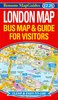
London Bus And Underground Popout Map

London Bus and Underground PopOut Map: pop-up city map of London Bus and Underground transit systems Contents include: London bus route PopOut Map London underground PopOut Map Quick reference main bus route map Quick reference heart of the underground map Central London overview map Explore London with the help of this genuinely pocket-sized, pop-up map. Small in size, yet big on detail, this compact, dependable transit map will ensure you don't miss a thing. Includes two pop-up maps covering London bus routes and the whole underground network Additional quick reference maps are also included showing main bus routes, the heart of the underground and an overview map of central London Handy, self-folding tourist map is small enough to fit in your pocket yet offers extensive coverage
of the city in an easy-to-use format Places of interest are listed with the relevant tube station or bus route so you can easily find your way around Underground stations are listed with connecting bus routes
RIP - This product is no longer available on our network. It was last seen on 25.09.2019

This page now acts as a permanent archive for this product. Add more information using the comments box below to ensure it can still be found by future generations.

Use our search facility to see if it is available from an alternative contributor.
  • External links may include paid for promotion
  • Availability: Out Of Stock
  • Supplier: Stanfords
  • SKU: 9781845879501
Availability: In Stock
£2.99

Product Description

London Bus & Underground Pop Out Map: pop-up city map of London Bus & Underground transit systems Contents include: London bus route Pop Out Map London underground Pop Out Map Quick reference main bus route map Quick reference heart of the underground map Central London overview map Explore London with the help of this genuinely pocket-sized, pop-up map. Small in size, yet big on detail, this compact, dependable transit map will ensure you don't miss a thing.

Includes::
two pop-up maps covering London bus routes & the whole underground network Additional quick reference maps are also included showing main bus routes, the heart of the underground & an overview map of central London Handy, self-folding tourist map is small enough to fit in your pocket yet offers extensive coverage of the city in an easy-to-use format Places of interest are listed with the relevant tube station or bus route so you can easily find your way around Underground stations are listed with connecting bus routes

Reviews/Comments

Add New

Intelligent Comparison

Oooops!
We couldn't find anything!
Perhaps this product's unique.... Or perhaps we are still looking for comparisons!
Click to bump this page and we'll hurry up.

Price History

Vouchers

No voucher codes found.
Do you know a voucher code for this product or supplier? Add it to Insights for others to use.

Facebook

Jargon Buster

compact - Carefuly designed to ensure an item has a minimal physical size
Size - is the measurement of how big an object is in space.
Heart - An organ that pumps blood around the body. Usually related to love.
Quick - Something that is fast
Network - A link and communication between things. Often computers or people.
Small - something that takes up less space than normal.
Compact - something that has a lot combined within a small space.
Pocket - A bag shaped insert in clothing used to carry items
Reference - To prove evidence with a back up source.

Supplier Information

Stanfords
Stanfords was established in 1853 and opened their iconic Covent Garden flagship store in 1901. They have become the top retailer of maps, travel books and accessories in the UK and arguably offer the largest selection of maps and travel books worldwide. Famous names such as Captain Robert Falcon Scott, Ranulph Fiennes and Michael Palin have purchased from Stanfords. They now have a shop in Bristol and both stores together with other venues operate a calendar of events including talks, book signings and exhibitions. As a specialist map retailer, the map selection is comprehensive and includes road maps, street maps and walking maps from worldwide destinations, as well as a selection of world atlases and wall maps. Books include travel guides and travel literature. Stanfords also stock globes, from miniatures made of blue marble to magnificent floor-standing globes. The website features a selection of interesting articles on travel topics.
Page Updated: 2023-11-12 20:15:36

Community Generated Product Tags

Oh No! The productWIKI community hasn't generated any tags for this product yet!
Menu