
 United Kingdom
 France
 Germany
 Netherlands
 Sweden
 USA
USA
 Italy
Italy
 Spain
Spain
More From Contributor


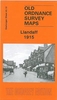


Llanberis 1913
Llanberis in 1913 in a fascinating series of reproductions of old Ordnance Survey plans in the Alan Godfrey Editions, ideal for anyone interested in the history of their neighbourhood or family. The map is double-sided. The main map covers Llanberis, extending westward to Ffridd-glyn Slate Quarry, eastward across Llyn Padarn to Vivian Slate Quarry and northward to Vaynol Slate Quarry. Features include the town centre, LNWR railway with station, tramway, Padarn Villa Hotel, Ffridd-glyn Slate Quarry, Chwarel Cae`r-meinciau, Glyn-rhonway Slate Quarry, old inclines and workings, Dinorwic Quarry Railway, Vivian Slate Quarry, Allt Wen, Vaynol Slate Quarry (disused), old quarries, etc. On the reverse is part of the adjacent sheet 16.12 extending coverage south to include Snowdon
Mountain Railway as far as Hebron station, including Waterfall station, engine shed, viaduct; also Coed Victoria, Pentre-castell, Royal Victoria Hotel, St Padarn`s church, etc. About the Alan Godfrey Editions of the 25” OS Series:Selected towns in Great Britain and Ireland are covered by maps showing the extent of urban development in the last decades of the 19th and early 20th century. The plans have been taken from the Ordnance Survey mapping and reprinted at about 15 inches to one mile (1:4, 340). On the reverse most maps have historical notes and many also include extracts from contemporary directories. Most maps cover about one mile (1.6kms) north/south, one and a half miles (2.4kms) across; adjoining sheets can be combined to provide wider coverage.FOR MORE INFORMATION AND
A COMPLETE LIST OF ALL AVAILABLE TITLES PLEASE CLICK ON THE SERIES LINK.

Product Description
Reviews/Comments
Add New
Intelligent Comparison
Archived Product
Barnes 1913 Stanfords
£3.50
Vouchers
No voucher codes found.
Do you know a voucher code for this product or supplier? Add it to Insights for others to use.
Do you know a voucher code for this product or supplier? Add it to Insights for others to use.
 Denmark