More From Contributor
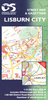
£12.99
Lisbon's once fusty, if charming, image has had a massive facelift over the past decade, though much remains to be done to preserve the city's heritage. In the more recent past, there have been other changes too. Thanks to the long-awaited arrival of cheap flights, but also to cruise ships & a booming conference business, Lisbon recently overtook the Algarve in tourist visitor numbers. Locals are keen to welcome more. Euro 2004 was the latest in a series of big events proving their talent for hospitality &
- surprising to many lisboetas themselves
- organisation. This guide brings you bang up to date with the changes, while helping you find those corners of the city unaffected by them.

...
Archived Product
£6.95
Lisbon in the Wallpaper City Guide series, published by Phaidon & encompassing a collection of pocket-size guides dedicated to the best design elements in major cities. Compiled by experts at the Wallpaper magazine, the guides are widely recognized for appealing to design-conscious travellers & are aimed at those interested in art, design & architecture. Each guide identifies the best bars, restaurants, hotels, places to shop, leisure activities & excursions with a unique emphasis on the finest examples of unusual architecture & design. Each Wallpaper City Guide has the same layout, with separate tabs allowing readers & travellers to access individual sections easily. The tabs consist of Landmarks, Hotels, 24 Hours, Urban Life, Architour, Shopping, Sports & Escapes. High quality colour photographs appear alongside brief descriptions of each hotel, bar or attraction, highlighting distinctive & unusual styles of architecture & design. Extra pages are provided at the back of each guide, allowing readers to record their own notes & sketches. ...
Archived Product
£15.00
The Lisbon Wait For Me Travel guide will help you discover this city. It will show you its historical routes, reveal the secrets of its monuments, & show you the bustling nightlife, & help you make the most of the city. To get you started the inside front cover has a fold out map of Lisbon’s Metro & some handy Portuguese words & phrases. The guide is the divided into sections including, Visiting the City, Urban Life, Food & Drink, & Let’s Go Shopping. For each one you will be presented with an introduction to the particular topic, lots of facts, curiosities, important information accompanied by photographs, illustrations & drawings. Colour referenced throughout, the guide

Includes::
sketch maps for the main districts of Baixa, Alfama, Bairro Alto, Belém & Parque das Nações. For each neighbourhood the main attractions come with a concise description, opening times contact details, etc.; each entry is referenced with a number & located in the district map. There is also a brief listing of places to stay with price range & contact details. This is no ordinary guide. Its editorial signature, falling between a magazine & a comic book, mixes illustration, cartoons & photographs with informative text, & will particularly appeal to the arty & quirky travellers.

...
Archived Product
£35.00
This book features covers that are precision die-cut with an outline of the city. It features emotive & inspiring images that capture the heart & soul of some the world`s most exciting & vibrant cities. City Impressions is an exceptional collection of illustrated books. Filled with stunning photographs, these books guide readers through some of the world`s most exciting & vibrant cities, offering unsurpassed & often revealing glimpses of the heart & soul of each city. Each volume is accompanied by the stories of travellers whose lives have changed in remarkable ways during their visits to each city. Together, the stories & photographs provide a lasting impression that will inspire the soul & stimulate the mind. ...
Archived Product
£25.00
Accessible & authentic recipes from the beautiful Portuguese capital. Full of history, great food, & bursting with character, ...
Archived Product
£6.30
Lisburn City on an indexed street plan at 1:10, 000 from the Ordnance Survey of Northern Irel&, with insets covering Moira & Hillsborough, plus on the reverse an indexed road map at 1:50, 000 of the town & its environs.OSNI street plans highlight main traffic arteries in each town, indicating motorways, A or B roads, one way or pedestrianized streets & car parks. The plans show Sustrans National Cycle Network with route numbers, tow paths & waymarked walks. Also marked are boundaries of local government districts. Public buildings are highlighted by colour & named. Symbols indicate tourist information offices, bus & or railway stations, public toilets & golf courses. Each plan has Irish national grid lines. On the reverse the plans have an indexed road map of the relevant local government district. ...
Archived Product
£2.95
Liscard & Egremont in 1898 in a fascinating series of reproductions of old Ordnance Survey plans in the Alan Godfrey Editions, ideal for anyone interested in the history of their neighbourhood or family. Selected towns in Great Britain & Ireland are covered by maps showing the extent of urban development in the last decades of the 19th & early 20th century. In this title: this detailed map covers the village of Liscard, which became part of Wallasey in 1910. Coverage stretches from Belvidere Road & Mount Pleasant Road eastward to the Mersey, & from Fort Street southward to Tobin Street. Features include Mariners Home, Clifton Hall, Egremont area with pier, Manor House, Marine Terrace, part of Upper Brighton, tramways, Liscard Castle, Massey Park, Oarside Dairy Farm, cemetery, Earlston, Zigzag Hall, St Mary's church, etc. On the reverse are street directory extracts, for Charlotte Road, King Street, Liscard Road, Liscard Village, Sea Bank Road, Trafalgar Road, Union Street. About the Alan Godfrey Editions of the 25 ...
Archived Product
£6.99
What do you wear to Paris? Ami & I discussed it for hours but I still couldn`t think of anything suitable. Ami said a trench coat with nothing underneath but your best underwear. That was only if some boy was meeting you at the airport, I said. Eighteen-year-old Lisette has just arrived in Paris (France!)
- the city of haute couture & all things stylish
- to practise her French & see great works of art. Her clairvoyant landlady Madame Christophe forces her to attend language lessons with a bunch of international students but soon Lise discovers she`s more interested in studying boys than art or verbs.. . When the undeniably hot Anders jogs into her life it feels too good to be true. Things get even more complicated when she is pursued by Hugo, a charming English antiques dealer. Can she take a chance & follow her own dreams? How far into the future can Madame Christophe see? & could Lise really be falling in love
- in Paris?


...
Archived Product
£12.99
Topographic survey of France at 1:25, 000 in IGN`s excellent TOP25 / Série Bleue series. All the maps are GPS compatible, with a 1km UTM grid plus latitude & longitude lines at 5’ intervals. Contours are at 5m intervals except for mountainous areas where the maps have contours at 10m intervals, vividly enhanced by hill shading & graphics for rocky terrain. Colouring with graphics indicates different types of vegetation or land use (deciduous or coniferous forests, moors, orchards, vineyards, etc). PLEASE NOTE: coverage of France at this scale is currently being revised – the format & the presentation of each title are indicated by the letters at the end of its Sheet Reference number (e.g. 0416ET, 3531ETR, 1923SB, etc.)MAPS WITH FULL TOURIST OVERPRINT & AN ENGLISH MAP LEGEND: all TOP25 maps & the SB editions of Série Bleue have an overprint highlighting waymarked walking trails including long-distance GR routes &, where appropriate, ski routes. Symbols indicate campsites, gîtes d’etape, refuges, equestrian centres & other recreational facilities or sites, tourist information centres, cultural heritage, etc. Towns & locations of particular interest are highlighted.- ET or OT = single-sided TOP25 map covering approx. 29x 21 km / 18x 13 miles.- ETR or OTR = waterproof & tear resistant TOP25 map covering the same area as the corresponding ET or OT number, but double-sided, printed on a smaller size sheet with a good overlap between the sides.- SB = Série Bleue map with full tourist overprint; these maps, first introduced in summer 2014, each cover approx. 29x 24km / 18x 15 miles.SÉRIE BLEUE maps with numbers ending in E (Est) or O (Ouest): most editions now indicate the GR routes, but do not show any other tourist information. Map legend is in French only. Each map covers approx. 14x 20km / 9x 12 miles. ...
Archived Product
£3.50
Lisnaskea, Newtownbutler & the Upper Erne in 1900 in the Alan Godfrey Edition of historical Ordnance Survey mapping at one inch to one mile. The map covers much of southern Co. Fermanagh, with small sections of Counties Cavan & Monaghan. Most of Upper Lough Erne is covered & coverage stretches from Kinawley eastward to Munnilly House, & from Derryharney southward to Bawnboy. The main settlements are Lisnaskea & Newtown Butler. Other features include stretches of the Ulster Canal, the Great Northern Railway, & the GNR Cavan & Clones Branch; Crom Castle, Lanesborough Lodge. On the reverse we are town plans for Lisnaskea & Newtown Butler, at a scale of 18 inches to the mile & presenting them in detail. The map for Lisnaskea

Includes::
Main Street with houses/shops neatly shown either side, churches, workhouse, Town Hall, Balfour Castle, creamer, with extracts from the town directory. The map for Newtown Butler

Includes::
Court House, railway with station, St Congall`s church, Lurganboy Cottage, etc.* About Alan Godfrey Editions of OS 1” to 1 mile maps of Ireland:* The maps provide an invaluable overview of a wider area, typically 18 x 12 miles (29 x 19kms approx.), & offer historical mapping for small villages not covered by the more detailed series for which the Godfrey Editions are better known. All the maps include historical notes & all, unless indicated in the individual description, also include a large scale map of a small town or village in the area.


...
Archived Product

Lisburn 1902

Lisburn in 1902 in a fascinating series of reproductions of old Ordnance Survey plans in the Alan Godfrey Editions, ideal for anyone interested in the history of their neighbourhood or family. Selected towns in Great Britain and Ireland are covered by maps showing the extent of urban development in the last decades of the 19th and early 20th century.In this title: this very detailed map covers the busy town (today city) of Lisburn, with coverage stretching from Longstone Street and Longstone Lane eastward to Grove Street and Grove House; and from North Circular Road southward to the Workhouse and Cemetery. Note that the Co Down part of the map is left blank but the map does include the Largymore area east of the Lagan, which was part of Lisburn UDC. The many features include Christ
Church Cathedral, Market Square, town centre with all buildings neatly delineated, Castle Gardens, Millbrook and Beetling Mill, cattle market, Smithfield, St Patrick's RC church, flax spinning mill, railway with station, Christ Church, handkerchief works, Union Workhouse, Manor House, River Lagan and Lagan Navigation, Largymore, Largymore Factory, Ballymullan area, Lagan Factory, The Island, Roseville, etc. On the reverse is included a list of private residents from a contemporary directory.About the Alan Godfrey Editions of the 25
RIP - This product is no longer available on our network. It was last seen on 25.09.2019

This page now acts as a permanent archive for this product. Add more information using the comments box below to ensure it can still be found by future generations.

Use our search facility to see if it is available from an alternative contributor.
  • Availability: Out Of Stock
  • Supplier: Stanfords
  • SKU: X186054
Availability: In Stock
£2.95

Product Description

Lisburn in 1902 in a fascinating series of reproductions of old Ordnance Survey plans in the Alan Godfrey Editions, ideal for anyone interested in the history of their neighbourhood or family. Selected towns in Great Britain & Ireland are covered by maps showing the extent of urban development in the last decades of the 19th & early 20th century. In this title: this very detailed map covers the busy town (today city) of Lisburn, with coverage stretching from Longstone Street & Longstone Lane eastward to Grove Street & Grove House; & from North Circular Road southward to the Workhouse & Cemetery. Note that the Co Down part of the map is left blank but the map does include the Largymore area east of the Lagan, which was part of Lisburn UDC. The many features include Christ Church Cathedral, Market Square, town centre with all buildings neatly delineated, Castle Gardens, Millbrook & Beetling Mill, cattle market, Smithfield, St Patrick's RC church, flax spinning mill, railway with station, Christ Church, handkerchief works, Union Workhouse, Manor House, River Lagan & Lagan Navigation, Largymore, Largymore Factory, Ballymullan area, Lagan Factory, The Isl&, Roseville, etc. On the reverse is included a list of private residents from a contemporary directory. About the Alan Godfrey Editions of the 25

Reviews/Comments

Add New

Intelligent Comparison

Oooops!
We couldn't find anything!
Perhaps this product's unique.... Or perhaps we are still looking for comparisons!
Click to bump this page and we'll hurry up.

Price History

Vouchers

No voucher codes found.
Do you know a voucher code for this product or supplier? Add it to Insights for others to use.

Facebook

Jargon Buster

Contemporary - Modern era design
Contemporary - A design reference to indicate post war modern design
History - Anything that happens in the past. An acedemic subject.
Road - a manmade lane or a path that is used to speed up travel.
Contemporary - An object that is living in the same time.
Mill - A building which can grind grain into flour.
Ideal - Something that satisfies a perfect criteria.
Family - A group of people that live together made up from parents and children.

Supplier Information

Stanfords
Stanfords was established in 1853 and opened their iconic Covent Garden flagship store in 1901. They have become the top retailer of maps, travel books and accessories in the UK and arguably offer the largest selection of maps and travel books worldwide. Famous names such as Captain Robert Falcon Scott, Ranulph Fiennes and Michael Palin have purchased from Stanfords. They now have a shop in Bristol and both stores together with other venues operate a calendar of events including talks, book signings and exhibitions. As a specialist map retailer, the map selection is comprehensive and includes road maps, street maps and walking maps from worldwide destinations, as well as a selection of world atlases and wall maps. Books include travel guides and travel literature. Stanfords also stock globes, from miniatures made of blue marble to magnificent floor-standing globes. The website features a selection of interesting articles on travel topics.
Page Updated: 2023-11-12 20:15:36

Community Generated Product Tags

Oh No! The productWIKI community hasn't generated any tags for this product yet!
Menu