
 United Kingdom
 France
 Germany
 Netherlands
 Sweden
 USA
USA
 Italy
Italy
 Spain
Spain
More From Contributor


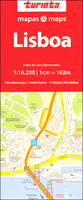
Lisbon Pocket Map
Lisbon on an informative and clear street plan at 1:16, 200 from Turinta, Portugal’s leading map publisher. Map coverage extends from Doca de Alcantara in the south to Ameixoeira in the north, and from Parque das Nações in the east to Linda a Velha in the west. Main sites and places of interest are prominently highlighted.Colours distinguish different road sizes, zones and parks. Specific detail includes metro underground lines and stations, railways and ferry locations. Arterial traffic routes and car parks are also highlighted. A range of symbols indicate tourist information centres, churches, municipal buildings and local public services. The map is fully indexed alphabetically. Detailed insets depict central Lisbon in greater detail as well as the entire Metro station
network. Map legend includes English.
network. Map legend includes English.

Product Description
Reviews/Comments
Add New
Vouchers
No voucher codes found.
Do you know a voucher code for this product or supplier? Add it to Insights for others to use.
Do you know a voucher code for this product or supplier? Add it to Insights for others to use.
 Denmark