-
Home
-
Contributors
-
International
-
Account
-
Information
More From Contributor
...
- from the top 10 museums to the top 10 events & festivals
- there`s even a list of the top 10 things to avoid. This guide is divided by area with restaurant reviews for each, as well as recommendations for hotels, bars & places to shop. In this book, you will find the insider knowledge every visitor needs & explore every corner effortlessly with DK Eyewitness Top 10 Travel Guide: Lisbon, & its free pull-out map. DK Eyewitness Top 10 Travel Guide: Lisbon
- showing you what others only tell you. ...
- New York Times` Lonely Planet. It`s on everyone`s bookshelves; it`s in every traveller`s hands. It`s on mobile phones. It`s on the Internet. It`s everywhere, & it`s telling entire generations of people how to travel the world.`
- Fairfax Media (Australia)* Source: Nielsen Book Scan: Australia, UK, USA, 5/2016-4/2017 ...

Lisbon F&B
This page now acts as a permanent archive for this product. Add more information using the comments box below to ensure it can still be found by future generations.
Use our search facility to see if it is available from an alternative contributor.
- External links may include paid for promotion
- Availability: Out Of Stock
- Supplier: Stanfords
- SKU: 9783707900774
Product Description
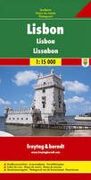
This street map covers the same area as that found on the map by Geo Center, ie. from Torré de Belem in the south west to the airport & international ferry terminal in the north east. One-way streets are not indicated on this map but otherwise the street detail is good & pedestrian zones, car parks & public transport routes are clearly highlighted. Selected points of interest & notable buildings are marked. Other symbols show tourist information points, campsites & post offices. A small inset map shows the city centre at 1:10, 000 & another map shows an overview of the city highlighting major approach roads & through-routes. There is also an index of places of interest & shopping centres. Street index on reverse.
Reviews/Comments
Add New
Intelligent Comparison
We couldn't find anything!
Perhaps this product's unique.... Or perhaps we are still looking for comparisons!
Click to bump this page and we'll hurry up.
Price History
Vouchers
Do you know a voucher code for this product or supplier? Add it to Insights for others to use.


 United Kingdom
 France
 Germany
 Netherlands
 Sweden
 USA
USA
 Italy
Italy
 Spain
Spain


 Denmark