More From Contributor

£16.99
Topographic survey of Sweden at 1:50, 000, the Terrängkartan, from the Lantmäteriet, covering most of the country in 244 double-sided maps. Please note: the mountainous regions of central & northern Sweden are not covered by this series but presented in a separate “ Fjällkartan
- Mountain Map” series also listed on our website. Each 1:50, 000 topographic survey map covers an area of 37.5 x 40km. The maps have contours at 5 metre intervals, plus relief shading & graphics for rocky outcrops & boulders. Further graphics and/or colouring show different types of land use or vegetation (forests, arable l&, orchards, marshes, peat bogs, etc). An unusual feature of this survey is the colouring indicating buildings below or above two storeys high & “leisure/holiday homes”. The maps indicate privately maintained roads & include all other information expected of topographic survey at this scale. The maps have a 1-km UTM grid, plus latitude & longitude lines 5’ intervals. Map legend

Includes::
English. For coverage of the country’s most visited hiking areas in central & northern Sweden please see Lantmäteriet’s Mountain Map series, listed separately on our website.


...
Archived Product
£14.95
Map No. K-27B in the TPC series: military topographic survey mapping covering the world's land masses & significant islands at 1:500, 000. The maps are useful as general topographical coverage where nothing else is available, although they are designed primarily as flying charts for military aircraft. TPC stands for Tactical Pilotage Chart. Relief is portrayed by a combination of contours (basic interval 500ft, intermediate contours shown where appropriate), elevation tinting & relief shading, plus spot heights. Towns, villages, major roads, railways & airports are shown but please note that many of the smaller settlements are not named & the road information is not necessarily up to date, as compilation & revision dates vary. Some air navigation information also appears on the map, such as radio beacons & restricted flying zones. Each TPC chart has both UTM & latitude/longitude grids overprinted on it, with additional margin ticks. IMPORTANT
- PLEASE NOTE: The series is gradually being withdrawn from sale to the general public & some sheets may no longer be available when ordered by us. Due to the nature of the map projection assembling these sheets to make a larger map is not recommended. in addition, colours used for relief are not constant throughout the series. In some areas of central Africa & South America the maps have blank spaces, reflecting localized deficiencies or inconsistencies in the survey data.
...
Archived Product
£10.95
Fully titled Petites Antilles ou Isles de Vent, this French map stretches from St John in the Virgin Islands to Barbuda, Antigua & Montserrat. Some small islets & harbours are named, pictorial representations of hills are drawn on the l&, & latitude & longitude scales are marked in the south & west borders. Reproduced on heavyweight, parchment effect paper, with a generous border area. Paper

Size:
38.3 x 29 cm (15 1/16 x 11 7/16 inches) Map

Size:
31.8 x 21.6 cm (8 1/2 x 12 1/2 inches)


...
Archived Product
£10.99
Indexed maps at various scales portraying Martinique, Dominica, St. Lucia, St. Martin, St Barthélemy & Guadeloupe (La Désirade, Les Saintes & Marie-Galante in insets). The most striking characteristic is the vivid representation of the general relief, using hill-shading. Some peak heights are marked & national parks, & reefs are shown. Road detail

Includes::
some secondary roads & tracks, & shows intermediate distances on major routes, with scenic routes highlighted. Airports & ferry links are also marked. Symbols show various features, landmarks & recreation sites eg. places of interest, viewpoints, churches, lighthouses, ruins, beaches, campsites, golf courses & watersport locations. Latitude & longitude lines are drawn at 10’ intervals. Map scales: Guadeloupe, Basse-Terre & Gr&-Terre 1:165, 000 Marie-Galante & La Désirade 1:130, 000 Les Saintes & St Barthélemy 1:60, 000 St. Martin 1:100, 000 Martinique 1:125, 000 Dominica & St. Lucia 1:180, 000 Also included is a 1:7, 000, 000 general map of the Caribbean region. On the reverse are notes on the selected islands’ history, geography & attractions. Notes & legend are in French, German & English.

...
Archived Product
£9.99
Photographer Dominic Greyer has spent the last twenty years roaming the British landscape in search of the country`s most unusual place names. He has an eye for quirky, rude & downright ridiculous name signs, & has photographed them all. Place names include the famous Twice Brewed (Northumberland), Fryup (North Yorkshire), Long Length (Kent) & Camptown (Borders). There will be a few rude street names too obviously. This book makes the perfect gift for anyone who loves the quirky side of the country. ...
Archived Product
£15.99
Bring home the chic Parisian world of style & charm When Jennifer Scott arrived at the doorstep of a grand Sixteenth Arrondissement apartment as a foreign exchange student, she was greeted by Madame Chic, the woman who would become her mentor & the inspiration for the way she lived long after her time abroad was over. Each chapter of Lessons from Madame Chic reveals a valuable secret Jennifer learned while under Madame Chic`s tutelage in Paris-tips you can incorporate into your own life, no matter where you live or the size of your budget. Embracing the classically French aesthetic of quality over quantity, aspiring Parisiennes will learn to master the art of eating (deprive yourself not), dressing (the ten-item wardrobe), grooming (le no-makeup look), & living a la francaise. Lessons from Madame Chic is the essential handbook for anyone wanting to incorporate that Parisian je ne sais quoi into her daily life. ...
Archived Product
£17.99
The 1:50 000 topographic map gives a more general picture of the ground features than a basic map. It shows settlements, houses, roads, cultivated areas, waterways, cutting areas, mires, rock exposures, & relief. One map sheet covers an area of 30 x 40 km & one centimetre corresponds to 500 metres on the ground. The 1:50, 000 topographic map is also an ideal complement to nautical charts as it provides useful information about the land areas adjacent to waterways. For example, all Finnish sea areas are covered by 1:50 000 topographic map sheets. ...
Archived Product
£8.99
`A humane, humorous & ultimately extremely moving novel` Guardian Louis Lasker loves his family dearly
- apart from when he doesn`t.
...
Archived Product
£14.99
Guardian pick as one of the biggest & most interesting books of the year The story of the father who inspired the phenomenon For over twenty years, Ziauddin Yousafzai has been fighting for equality
- first for Malala, his daughter
- & then for all girls throughout the world living in patriarchal societies. Taught as a young boy in Pakistan to believe that he was inherently better than his sisters, Ziauddin rebelled against inequality at a young age. & when he had a daughter himself he vowed that Malala would have an education, something usually only given to boys, & he founded a school that Malala could attend. Then in 2012, Malala was shot for standing up to the Taliban by continuing to go to her father`s school, & Ziauddin almost lost the very person for whom his fight for equality began. Let Her Fly is Ziauddin`s journey from a stammering boy growing up in a tiny village high in the mountains of Pakistan, through to being an activist for equality & the father of the youngest ever recipient of the Nobel Peace Prize, & now one of the most influential & inspiring young women on the planet. Told through intimate portraits of each of Ziauddin`s closest relationships
- as a son to a traditional father; as a father to Malala & her brothers, educated & growing up in the West; as a husband to a wife finally learning to read & write; as a brother to five sisters still living in the patriarchy
- Let Her Fly looks at what it means to love, to have courage & fight for what is inherently right. Personal in its detail & universal in its themes, this landmark book shows why we must all keep fighting for the rights of girls & women everywhere.


...
Archived Product
£8.99
A young journalist, recently married with a young child, is seeking a quieter life away from the city & has bought a large new home in his parent`s hometown. It`s a complicated return
- his wife hates his parents
- but they are also moving back to live in an Arab village in Israel. Nothing is as they remember: everything is smaller, the people petty & provincial & the villagers divided between sympathy for the Palestinians & dependence on the Israelis. Suddenly & shockingly, the village becomes a pawn in the never-ending power struggles of the Middle East. When Israeli tanks surround the village without warning or explanation, everyone inside is cut off from the outside world. As the situation grows increasingly dire, paranoia begins to threaten the community`s fragile equilibrium, forcing the hero to decide what it means to be human in an inhuman situation.

...
Archived Product

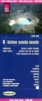
Lesser Sunda Islands - Bali To East Timor Reise Know-How

Lesser Sunda Islands of Indonesia at 1:800, 000 on light, waterproof and tear-resistant plastic paper, with both topographic and tourist information. The map, part of Reise Know-How`s highly acclaimed ”World Mapping Project”, is double-sided to provide the best balance between a good scale and a convenient size sheet. On one side are Bali, Lombok, Sumbawa, Sumba and the western part of Flores, and on the reverse eastern Flores and Timor, plus the smaller islands of Sawu Sea and the Wetar Straights (Adonara, Lembata, Pantar, Alor, Aruaro, Liran, Wetar, Romang and Kisar), plus Sawu and Rote Islands.Topography is shown by altitude colouring with spot heights and graphics indicating volcanoes and coastal coral reefs. Road network on individual islands includes selected
local tracks. Local airports and ferry connections to other islands of the Indonesian archipelago are also shown. Internal administrative units within Indonesia are shown with their boundaries and names. National parks and other protected areas are highlighted. A wide range of symbols shows various places of interest including UNESCO sites, temples, hot springs and other natural features, beaches and diving sites, etc. The map is indexed and has latitude and longitude lines are drawn at 1° intervals. Map legend includes English. Also provided is an inset showing the whole of Indonesia at 1:14, 500, 000.To see other Reise Know-How maps covering the islands of Indonesia please click on the series link.
RIP - This product is no longer available on our network. It was last seen on 25.09.2019

This page now acts as a permanent archive for this product. Add more information using the comments box below to ensure it can still be found by future generations.

Use our search facility to see if it is available from an alternative contributor.
  • Availability: Out Of Stock
  • Supplier: Stanfords
  • SKU: 9783831772391
Availability: In Stock
£10.50

Product Description

Lesser Sunda Islands of Indonesia at 1:800, 000 on light, waterproof & tear-resistant plastic paper, with both topographic & tourist information. The map, part of Reise Know-How`s highly acclaimed ” World Mapping Project”, is double-sided to provide the best balance between a good scale & a convenient size sheet. On one side are Bali, Lombok, Sumbawa, Sumba & the western part of Flores, & on the reverse eastern Flores & Timor, plus the smaller islands of Sawu Sea & the Wetar Straights (Adonara, Lembata, Pantar, Alor, Aruaro, Liran, Wetar, Romang & Kisar), plus Sawu & Rote Islands. Topography is shown by altitude colouring with spot heights & graphics indicating volcanoes & coastal coral reefs. Road network on individual islands

Includes::
selected local tracks. Local airports & ferry connections to other islands of the Indonesian archipelago are also shown. Internal administrative units within Indonesia are shown with their boundaries & names. National parks & other protected areas are highlighted. A wide range of symbols shows various places of interest including UNESCO sites, temples, hot springs & other natural features, beaches & diving sites, etc. The map is indexed & has latitude & longitude lines are drawn at 1° intervals. Map legend

Includes::
English. Also provided is an inset showing the whole of Indonesia at 1:14, 500, 000. To see other Reise Know-How maps covering the islands of Indonesia please click on the series link.

Reviews/Comments

Add New

Intelligent Comparison

Oooops!
We couldn't find anything!
Perhaps this product's unique.... Or perhaps we are still looking for comparisons!
Click to bump this page and we'll hurry up.

Price History

Vouchers

No voucher codes found.
Do you know a voucher code for this product or supplier? Add it to Insights for others to use.

Facebook

Jargon Buster

Paper - A thin sheet mainly used for writing. Available in a variety of colours. Made mainly from wood pulp.
Plastic - A generic term for a synthetic product used in the manufacture of products
hot - An indication of the temperature being high and a sensation of heat to the tough
Graphics - A general term for visual aspects of an item/display
Waterproof - Resistant to water, usualy specified by depth in metres
World - A physical grouping, commonly used to describe earth and everything associated with ti
Size - is the measurement of how big an object is in space.
Natural - not manmade
Network - A link and communication between things. Often computers or people.
Road - a manmade lane or a path that is used to speed up travel.
Resistant - Something that can repel against something.
Altitude - Something that can be quite high in relation to sea or ground level.
Wide - Something with a large width.
Balance - Something that is evenly weighted to keep something upright.
Individual - A single separate item or person.
Convenient - Something that suits and fits well to other activities.

Supplier Information

Stanfords
Stanfords was established in 1853 and opened their iconic Covent Garden flagship store in 1901. They have become the top retailer of maps, travel books and accessories in the UK and arguably offer the largest selection of maps and travel books worldwide. Famous names such as Captain Robert Falcon Scott, Ranulph Fiennes and Michael Palin have purchased from Stanfords. They now have a shop in Bristol and both stores together with other venues operate a calendar of events including talks, book signings and exhibitions. As a specialist map retailer, the map selection is comprehensive and includes road maps, street maps and walking maps from worldwide destinations, as well as a selection of world atlases and wall maps. Books include travel guides and travel literature. Stanfords also stock globes, from miniatures made of blue marble to magnificent floor-standing globes. The website features a selection of interesting articles on travel topics.
Page Updated: 2023-11-12 20:15:36

Community Generated Product Tags

Oh No! The productWIKI community hasn't generated any tags for this product yet!
Menu