
 United Kingdom
 France
 Germany
 Netherlands
 Sweden
 USA
USA
 Italy
Italy
 Spain
Spain
More From Contributor


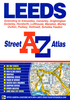

Leeds And Bradford
Map No. 104, Leeds and Bradford, in the Ordnance Survey Landranger series at 1:50, 000, including Harrogate, Halifax, Sowerby Bridge, Elland, Batley, Dewsbury, Ossett, Wakefield, Stanley, Morley, Cleckheaton, Mytholmroyd, Queensbury, Shelf, New Farnley, Rothwell, Swillington, Pudsey, Shipley, Thornton, Oxenhope, Haworth, Bingley, Rawdon, Horsforth, Scholes, Thorner, Harewood, Guiseley, Baildon, Keithley, Menston, Otley, Ilkley, Silsden, Denton, Farnley, Huby, Collingham, Spofforth, Follifoot, Beckwithshaw, Addingham, Embsay, Bolton Abbey, Brebley, Bluberhouses, Thornthwaite and Knaresborough, with the south-eastern tip of the Yorkshire Dales National Park. Edition C4; Revised for selected changes 2009; Copyright date 2009 This title is
also available on our website in a waterproof and tear-resistant version.Maps in this series are only published folded. Stanfords can also print flat versions of Ordnance Survey maps through the OS Select system, centring the map on a location of your choice and with a picture provided by you on the cover. For more information please click on the link at the bottom of this description.About Ordnance Survey
also available on our website in a waterproof and tear-resistant version.Maps in this series are only published folded. Stanfords can also print flat versions of Ordnance Survey maps through the OS Select system, centring the map on a location of your choice and with a picture provided by you on the cover. For more information please click on the link at the bottom of this description.About Ordnance Survey
Product Description
Reviews/Comments
Add New
Intelligent Comparison
Archived Product

Leeds And Bradford 1925 Stanfords
£9.99
Archived Product
Leeds And Bradford 1841-1859 Stanfords
£7.99
Archived Product

Leeds And Bradford 1903-1904 Stanfords
£7.99
Archived Product
Leeds And Bradford WATERPROOF Stanfords
£10.39
Archived Product
Leeds And Bradford OS ACTIVE Map Stanfords
£9.09
Vouchers
No voucher codes found.
Do you know a voucher code for this product or supplier? Add it to Insights for others to use.
Do you know a voucher code for this product or supplier? Add it to Insights for others to use.
 Denmark