
 United Kingdom
 France
 Germany
 Netherlands
 Sweden
 USA
USA
 Italy
Italy
 Spain
Spain
More From Contributor


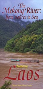
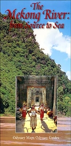
Laos & The Mekong River From Source To Sea Odyssey Map
Laos - The Mekong River from Source to Sea on a double-sided map from Odyssey Books offering an interesting combination of a road map of Laos with descriptions of main sights, plus a physical map of South-East Asia with the source of the Mekong on the Tibetan Plateau.On one side is Laos shown at 1:1, 470, 000 and accompanied by extensive notes, including descriptions of 17 most interesting locations, The map shows the network of main roads with selected local routes, indicating border crossings to the neighbouring countries. Also marked are internal airports. The map highlights places of interest grouped into cultural (UNESCO World Heritage or other historical sites, plus museums) and physical (elephant camps, protected areas, and scenic sites).The whole of the reverse side it taken
by a map of South-East Asia at 1:3, 150, 000, extending north into the Tibetan Plateau to show the location of the source of the Mekong River. Numerous other rivers are also marked, including the Irrawaddy in Burma, plus a section of the Yangzi with its source. The map is designed to present the regions geography and is based of satellite imagery with names of various mountain ranges and selected peaks. Country and within China province boundaries are marked, plus selected towns, but no road network. Latitude and longitude lines are drawn at 5° intervals.
by a map of South-East Asia at 1:3, 150, 000, extending north into the Tibetan Plateau to show the location of the source of the Mekong River. Numerous other rivers are also marked, including the Irrawaddy in Burma, plus a section of the Yangzi with its source. The map is designed to present the regions geography and is based of satellite imagery with names of various mountain ranges and selected peaks. Country and within China province boundaries are marked, plus selected towns, but no road network. Latitude and longitude lines are drawn at 5° intervals.

Product Description
Reviews/Comments
Add New
Intelligent Comparison
Archived Product
The Mekong River From Source To Sea Odyssey Map Stanfords
£8.95
Vouchers
No voucher codes found.
Do you know a voucher code for this product or supplier? Add it to Insights for others to use.
Do you know a voucher code for this product or supplier? Add it to Insights for others to use.
 Denmark