
 United Kingdom
 France
 Germany
 Netherlands
 Sweden
 USA
USA
 Italy
Italy
 Spain
Spain
More From Contributor

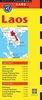

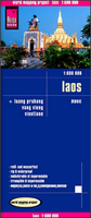
Laos Reise Know-How
Laos at 1:600, 000 on an indexed, waterproof and tear-resistant road map from Reise Know-How with topographic and tourist information, plus plans of central Vientiane, Luang Prabang and Vang Vieng. The map, part of the publishers’ highly acclaimed World Mapping Project, is double-sided to show the area at the best possible scale on a convenient size sheet and presents the country in three sections: central Laos on one side, with the far north and the southern “tail” on the reverse. Road network is easy to see on a clear base which shows the country’s topography by altitude colouring with contours, spot heights and names of mountain ranges. National parks and protected areas are highlighted and internal administrative boundaries are shown with names of the provinces. Road
network includes local tracks and indicates scenic routes. A wide range of symbols highlights various places of interest, temples and palaces, museums and archaeological remains, viewpoints, etc. The map has a latitude and longitude grid at intervals of 20’ and 30’respectively. The map is indexed and its legend includes English. Also included are street plans of central Vientiane, Luang Prabang, and Vang Vieng, highlighting various places of interest, accommodation, restaurants, banks, etc.
network includes local tracks and indicates scenic routes. A wide range of symbols highlights various places of interest, temples and palaces, museums and archaeological remains, viewpoints, etc. The map has a latitude and longitude grid at intervals of 20’ and 30’respectively. The map is indexed and its legend includes English. Also included are street plans of central Vientiane, Luang Prabang, and Vang Vieng, highlighting various places of interest, accommodation, restaurants, banks, etc.

Product Description
Reviews/Comments
Add New
Vouchers
No voucher codes found.
Do you know a voucher code for this product or supplier? Add it to Insights for others to use.
Do you know a voucher code for this product or supplier? Add it to Insights for others to use.
 Denmark