
 United Kingdom
 France
 Germany
 Netherlands
 Sweden
 USA
USA
 Italy
Italy
 Spain
Spain
More From Contributor


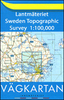


Öland
The Swedish island of Öland on a detailed road map 1:100, 000 from Norstedts, highlighting 51 places of interest, plus street plans of Borgholm and the mainland town of Kalmar, and an enlargement for road access to the island from Kalmar to Fäejestaden.On one side is a road map of Öland showing its road network and waymarked cycling and hiking trails. The landscape is presented by colouring for woodlands, marshland, limestone and open countryside. A range of symbols indicate various tourist facilities including campsites, youth hostels, cabin housing, etc. 51 locations on the map are cross referenced to lovely drawings of various places of interest, fauna and flora, etc. The map has no geographical coordinates.On the reverse are street plans of Borgholm and Kalma, plus an
enlargement showing main roads either side of the Ölandbron bridge. Extensive text provides more information about the area. Map legend and all the text include English.
enlargement showing main roads either side of the Ölandbron bridge. Extensive text provides more information about the area. Map legend and all the text include English.
Product Description
Reviews/Comments
Add New
Vouchers
No voucher codes found.
Do you know a voucher code for this product or supplier? Add it to Insights for others to use.
Do you know a voucher code for this product or supplier? Add it to Insights for others to use.
 Denmark