More From Contributor
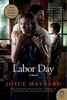
£7.99
As the end of summer approaches & a long, hot Labor Day weekend looms, the life of lonely thirteen-year-old Henry Wheeler is irrevocably changed when he & his emotionally fragile mother show kindness to a stranger with a terrible secret. Now a major motion picture starring Kate Winslet & Josh Brolin, Labor Day is a poignant story of love, sex, adolescence, & devastating treachery. ...
Archived Product
£20.00
A social history of Labradors, & how they have become the world`s most beloved dogs, by writer, presenter & long-time dog lover Ben Fogle, whose beloved black Labrador, Inca, famously accompanied him on numerous journeys & adventures. Labradors are the most popular breed of dog in the world. Not only a great family companion, they also excel at hunting, tracking, retrieving, guiding & rescuing. But where did the breed originally come from? How did it develop? When did black, yellow & chocolate Labradors first appear? Did they really all come from Labrador in Canada & are they really all related to just one dog? In this first history of the Labrador, Ben Fogle goes in search of what makes Labradors so special. Their extraordinary companionship, intelligence, work ethic & loyalty is captured by Ben as he weaves the story of the breed into his own story of his beloved Inca. Ben visits Canada, discovers hair-raising stories of early Labrador exploits & uncovers stories of RNIB Labradors & Labradors at war, Labradors as working dogs & every other manifestation of the Labrador`s character. Exploring their origin, early characteristics, their use as gun dogs, as therapy dogs, as police dogs, as search & rescue dogs & last
- & absolutely not least
- as family pets, Ben tells the story of a dog breed which has captured our imagination & love for hundreds of years.

...
Archived Product
£8.99
A social history of Labradors, & how they have become the world`s most beloved dogs, by writer, presenter & long-time dog lover Ben Fogle, whose beloved black Labrador, Inca, famously accompanied him on numerous journeys & adventures. Labradors are the most popular breed of dog in the world. Not only a great family companion, they also excel at hunting, tracking, retrieving, guiding & rescuing. But where did the breed originally come from? How did it develop? When did black, yellow & chocolate Labradors first appear? Did they really all come from Labrador in Canada & are they really all related to just one dog? In this first history of the Labrador, Ben Fogle goes in search of what makes Labradors so special. Their extraordinary companionship, intelligence, work ethic & loyalty is captured by Ben as he weaves the story of the breed into his own story of his beloved Inca. Ben visits Canada, discovers hair-raising stories of early Labrador exploits & uncovers stories of RNIB Labradors & Labradors at war, Labradors as working dogs & every other manifestation of the Labrador`s character. Exploring their origin, early characteristics, their use as gun dogs, as therapy dogs, as police dogs, as search & rescue dogs & last
- & absolutely not least
- as family pets, Ben tells the story of a dog breed which has captured our imagination & love for hundreds of years.

...
Archived Product
£12.99
Topographic survey of France at 1:25, 000 in IGN`s excellent TOP25 / Série Bleue series. All the maps are GPS compatible, with a 1km UTM grid plus latitude & longitude lines at 5’ intervals. Contours are at 5m intervals except for mountainous areas where the maps have contours at 10m intervals, vividly enhanced by hill shading & graphics for rocky terrain. Colouring with graphics indicates different types of vegetation or land use (deciduous or coniferous forests, moors, orchards, vineyards, etc). PLEASE NOTE: coverage of France at this scale is currently being revised – the format & the presentation of each title are indicated by the letters at the end of its Sheet Reference number (e.g. 0416ET, 3531ETR, 1923SB, etc.)MAPS WITH FULL TOURIST OVERPRINT & AN ENGLISH MAP LEGEND: all TOP25 maps & the SB editions of Série Bleue have an overprint highlighting waymarked walking trails including long-distance GR routes &, where appropriate, ski routes. Symbols indicate campsites, gîtes d’etape, refuges, equestrian centres & other recreational facilities or sites, tourist information centres, cultural heritage, etc. Towns & locations of particular interest are highlighted.- ET or OT = single-sided TOP25 map covering approx. 29x 21 km / 18x 13 miles.- ETR or OTR = waterproof & tear resistant TOP25 map covering the same area as the corresponding ET or OT number, but double-sided, printed on a smaller size sheet with a good overlap between the sides.- SB = Série Bleue map with full tourist overprint; these maps, first introduced in summer 2014, each cover approx. 29x 24km / 18x 15 miles.SÉRIE BLEUE maps with numbers ending in E (Est) or O (Ouest): most editions now indicate the GR routes, but do not show any other tourist information. Map legend is in French only. Each map covers approx. 14x 20km / 9x 12 miles. ...
Archived Product
£9.99
“ Labyrinth” is a superb collection of selected works by Jorge Luis Borges, bringing together many of his stories including ...
Archived Product
£12.99
Lac de Joux area at 1:33, 333 on light, waterproof & tear-resistant map No. 3316T published by Swisstopo in cooperation with the Swiss Hiking Federation. Cartography is the same as in Swisstopo’s 50K hiking maps, simply enlarged to 1:33, 333 for extra clarity but without additional information. 1:33, 333 editions of Swisstopo’s hiking maps have cartography identical to the standard version of the country’s 1:50, 000 topographic survey, highly regarded for its superb use of graphic relief & hill shading to provide an almost 3-D picture of Switzerland`s mountainous terrain. Contours are at 20m intervals. An overprint highlights routes maintained by the SHF, distinguishing between hiking routes, mountain routes requiring proper footwear, & alpine routes where equipment is needed. Paths which are part of the national or regional network of long-distance hiking routes are specially marked & in the more recent editions are annotated with their official numbers. The maps show mountain huts, refuges & in remote areas also inns, plus roads with bus service & the positions of bus stops. All the maps have a 1-km grid of the Swiss national coordinates. For a list of all the titles in this series, please click on the series link. ...
Archived Product
£12.99
Topographic survey of France at 1:25, 000 in IGN`s excellent TOP25 / Série Bleue series. All the maps are GPS compatible, with a 1km UTM grid plus latitude & longitude lines at 5’ intervals. Contours are at 5m intervals except for mountainous areas where the maps have contours at 10m intervals, vividly enhanced by hill shading & graphics for rocky terrain. Colouring with graphics indicates different types of vegetation or land use (deciduous or coniferous forests, moors, orchards, vineyards, etc). PLEASE NOTE: coverage of France at this scale is currently being revised – the format & the presentation of each title are indicated by the letters at the end of its Sheet Reference number (e.g. 0416ET, 3531ETR, 1923SB, etc.)MAPS WITH FULL TOURIST OVERPRINT & AN ENGLISH MAP LEGEND: all TOP25 maps & the SB editions of Série Bleue have an overprint highlighting waymarked walking trails including long-distance GR routes &, where appropriate, ski routes. Symbols indicate campsites, gîtes d’etape, refuges, equestrian centres & other recreational facilities or sites, tourist information centres, cultural heritage, etc. Towns & locations of particular interest are highlighted.- ET or OT = single-sided TOP25 map covering approx. 29x 21 km / 18x 13 miles.- ETR or OTR = waterproof & tear resistant TOP25 map covering the same area as the corresponding ET or OT number, but double-sided, printed on a smaller size sheet with a good overlap between the sides.- SB = Série Bleue map with full tourist overprint; these maps, first introduced in summer 2014, each cover approx. 29x 24km / 18x 15 miles.SÉRIE BLEUE maps with numbers ending in E (Est) or O (Ouest): most editions now indicate the GR routes, but do not show any other tourist information. Map legend is in French only. Each map covers approx. 14x 20km / 9x 12 miles. ...
Archived Product
£18.99
Topographic survey of France at 1:25, 000 in IGN`s excellent TOP25 / Série Bleue series. All the maps are GPS compatible, with a 1km UTM grid plus latitude & longitude lines at 5’ intervals. Contours are at 5m intervals except for mountainous areas where the maps have contours at 10m intervals, vividly enhanced by hill shading & graphics for rocky terrain. Colouring with graphics indicates different types of vegetation or land use (deciduous or coniferous forests, moors, orchards, vineyards, etc). PLEASE NOTE: coverage of France at this scale is currently being revised – the format & the presentation of each title are indicated by the letters at the end of its Sheet Reference number (e.g. 0416ET, 3531ETR, 1923SB, etc.) MAPS WITH FULL TOURIST OVERPRINT & AN ENGLISH MAP LEGEND: all TOP25 maps & the SB editions of Série Bleue have an overprint highlighting waymarked walking trails including long-distance GR routes &, where appropriate, ski routes. Symbols indicate campsites, gîtes d’etape, refuges, equestrian centres & other recreational facilities or sites, tourist information centres, cultural heritage, etc. Towns & locations of particular interest are highlighted.
- ET or OT = single-sided TOP25 map covering approx. 29x 21 km / 18x 13 miles.
- ETR or OTR = waterproof & tear resistant TOP25 map covering the same area as the corresponding ET or OT number, but double-sided, printed on a smaller size sheet with a good overlap between the sides.
- SB = Série Bleue map with full tourist overprint; these maps, first introduced in summer 2014, each cover approx. 29x 24km / 18x 15 miles. SÉRIE BLEUE maps with numbers ending in E (Est) or O (Ouest): most editions now indicate the GR routes, but do not show any other tourist information. Map legend is in French only. Each map covers approx. 14x 20km / 9x 12 miles.


...
Archived Product

Labyrinth

When Dr Alice Tanner discovers two skeletons during an archaeological dig in southern France, she unearths a link with a horrific and brutal past. But it's not just the sight of the shattered bones that makes her uneasy; there's an overwhelming sense of evil in the tomb that Alice finds hard to shake off, even in the bright French sunshine. Puzzled by the words carved inside the chamber, Alice has an uneasy feeling that she has disturbed something which was meant to remain hidden...Eight hundred years ago, on the night before a brutal civil war ripped apart Languedoc, a book was entrusted to Alais, a young herbalist and healer. Although she cannot understand the symbols and diagrams the book contains, Alais knows her destiny lies in protecting their secret, at all costs. Skilfully
blending the lives of two women divided by centuries but united by a common destiny, Labyrinth is a powerful story steeped in the atmosphere and history of southern France.
RIP - This product is no longer available on our network. It was last seen on 25.09.2019

This page now acts as a permanent archive for this product. Add more information using the comments box below to ensure it can still be found by future generations.

Use our search facility to see if it is available from an alternative contributor.
  • Availability: Out Of Stock
  • Supplier: Stanfords
  • SKU: 9780752877327
Availability: In Stock
£7.99

Product Description

When Dr Alice Tanner discovers two skeletons during an archaeological dig in southern France, she unearths a link with a horrific & brutal past. But it's not just the sight of the shattered bones that makes her uneasy; there's an overwhelming sense of evil in the tomb that Alice finds hard to shake off, even in the bright French sunshine. Puzzled by the words carved inside the chamber, Alice has an uneasy feeling that she has disturbed something which was meant to remain hidden... Eight hundred years ago, on the night before a brutal civil war ripped apart Languedoc, a book was entrusted to Alais, a young herbalist & healer. Although she cannot understand the symbols & diagrams the book contains, Alais knows her destiny lies in protecting their secret, at all costs. Skilfully blending the lives of two women divided by centuries but united by a common destiny, Labyrinth is a powerful story steeped in the atmosphere & history of southern France.

Reviews/Comments

Add New

Price History

Vouchers

No voucher codes found.
Do you know a voucher code for this product or supplier? Add it to Insights for others to use.

Facebook

Jargon Buster

France - A state situated in Western Europe with several overseas territories.
History - Anything that happens in the past. An acedemic subject.

Supplier Information

Stanfords
Stanfords was established in 1853 and opened their iconic Covent Garden flagship store in 1901. They have become the top retailer of maps, travel books and accessories in the UK and arguably offer the largest selection of maps and travel books worldwide. Famous names such as Captain Robert Falcon Scott, Ranulph Fiennes and Michael Palin have purchased from Stanfords. They now have a shop in Bristol and both stores together with other venues operate a calendar of events including talks, book signings and exhibitions. As a specialist map retailer, the map selection is comprehensive and includes road maps, street maps and walking maps from worldwide destinations, as well as a selection of world atlases and wall maps. Books include travel guides and travel literature. Stanfords also stock globes, from miniatures made of blue marble to magnificent floor-standing globes. The website features a selection of interesting articles on travel topics.
Page Updated: 2023-11-12 20:15:36

Community Generated Product Tags

Oh No! The productWIKI community hasn't generated any tags for this product yet!
Menu