More From Contributor
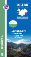
£8.50
Lérida/ Lleida on an indexed street plan at 1:8, 000 from Telstar Distrimapas, Spain’s leading publisher of city maps, with an enlargement of the city centre highlighting three sightseeing tours with English language descriptions. On one side is an indexed street plan of the city with main public buildings & places interest clearly named. Insets extend coverage to the industrial zones. On the reverse the city’s historic centre in shown in greater clarity on a large panel & accompanied by descriptions of three thematic walks: around La Seu Vella, the medieval, & the modernist parts of Lleida, as highlighted on the plan. ...
Archived Product
£11.50
Topographic survey of France at 1:25, 000 in IGN`s excellent TOP25 / Série Bleue series. All the maps are GPS compatible, with a 1km UTM grid plus latitude & longitude lines at 5’ intervals. Contours are at 5m intervals except for mountainous areas where the maps have contours at 10m intervals, vividly enhanced by hill shading & graphics for rocky terrain. Colouring with graphics indicates different types of vegetation or land use (deciduous or coniferous forests, moors, orchards, vineyards, etc). PLEASE NOTE: coverage of France at this scale is currently being revised – the format & the presentation of each title are indicated by the letters at the end of its Sheet Reference number (e.g. 0416ET, 3531ETR, 1923SB, etc.)MAPS WITH FULL TOURIST OVERPRINT & AN ENGLISH MAP LEGEND: all TOP25 maps & the SB editions of Série Bleue have an overprint highlighting waymarked walking trails including long-distance GR routes &, where appropriate, ski routes. Symbols indicate campsites, gîtes d’etape, refuges, equestrian centres & other recreational facilities or sites, tourist information centres, cultural heritage, etc. Towns & locations of particular interest are highlighted.- ET or OT = single-sided TOP25 map covering approx. 29x 21 km / 18x 13 miles.- ETR or OTR = waterproof & tear resistant TOP25 map covering the same area as the corresponding ET or OT number, but double-sided, printed on a smaller size sheet with a good overlap between the sides.- SB = Série Bleue map with full tourist overprint; these maps, first introduced in summer 2014, each cover approx. 29x 24km / 18x 15 miles.SÉRIE BLEUE maps with numbers ending in E (Est) or O (Ouest): most editions now indicate the GR routes, but do not show any other tourist information. Map legend is in French only. Each map covers approx. 14x 20km / 9x 12 miles. ...
Archived Product
£6.95
Lódz + 4 (Aleksandrów Lódzki, Konstantynów Lódzki, Pabianice & Zgierz) at 1:20, 000 from Demart, Poland’s leading publisher of high quality street plans, showing public transport routes with line numbers & stops, coach connections, petrol stations, hotels, campsites, youth hostels, places of interest, etc. Demart’s street plans are designed to cover the larger town (s) as its main map, plus include a number of nearby locations as additional panels. All are indexed separately. Where useful, the centre of the main town is also presented in greater detail on an enlargement. Selected cities are shown on their own without the additional coverage & with their indexes often providing lists of public transport routes. The plans show public transport routes: tram, bus and/or trolleybus with line numbers & stops, as well as coach terminals & stops. For motorized traffic the maps indicate main traffic arteries, paid parking zones, petrol stations, one way streets, traffic lights, restricted entry, car parks, etc. Symbols mark locations of hotels (with names), campsites, youth hostels, various services & facilities, etc. Where possible, the plans also indicate cycle trails and/or waymarked hiking trails. Map legends include English. ...
Archived Product
£6.99
Lódz & its environs at 1:50, 000 in a series of recreational maps from Poland’s Army Cartographic Service WZKart. The maps use as their base the military topographic survey, with contours at intervals varying from 5m to 20m according to the terrain & contoured depths shown on lakes. An overprint highlights waymarked hiking, cycling & canoeing routes. A wide range of symbols indicate various sport & recreational facilities, places of interest, special natural features, etc. The maps have latitude & longitude grid at 1’ intervals. Map legend

Includes::
English. On the reverse there are useful addresses & description, in Polish only.

...
Archived Product
£5.99
Lódz on an indexed street plan at 1:22, 000 from Express Map with a diagram of the night bus lines, plus a large road map covering the city’s environs at 1:85, 000 showing locations of petrol stations. Express Map street plans provide coverage of cities within their administrative boundary, spread across the two sides of the map. Bus & tram routes are shown with stops & line numbers. For drivers, main traffic arteries are highlighted, one way streets are marked & the plans also show traffic lights, petrol stations, car parks & restricted entry streets or zones. Streets are annotated with selected house numbers for easier identification of addresses. Names of suburbs & of larger housing estates are clearly marked. Symbols highlight various facilities & places of interest, including museums & other cultural institutions & historical sites, 24-hrs pharmacies, campsites & youth hostels, etc. Where more than one town is covered, each has a separate index. Map legend

Includes::
English.

...
Archived Product
£6.99
Taking you from Fishguard on the rugged West coast of Wales to just beyond the English border at Shrewsbury, the 340km Lon Camria & Lon Teifi routes cross Mid Wales & the Cambrian mountains, taking in the seaside resorts of Cardigan & Aberystwyth & the glorious Ystwyth & Elan Valleys as well as many peaceful country lanes & cyclepaths on the way. Whether tackling the route in a week of cycling or taking your time & riding it in smaller chunks, this bilingual pocket guide provides breakdowns of each section, advice on detours, where to stay & what sights not to miss. Gan fynd a chi o Abergwaun ar hyd arfordir garw Gorllewin Cymru i ychydig y tu hwnt i`r ffin a Lloegr yn yr Amwythig, mae llwybrau Lon Cambria a Lon Teifi 340km o hyd yn croesi Canolbarth Cymru a Mynyddoedd Cambria, gan fynd drwy drefi Aberteifi ac Aberystwyth a Chymoedd godidog Ystwyth ac Elan, yn ogystal a nifer o lonydd cefn gwlad tawel a llwybrau beicio ar hyd y daith. Boed eich bod yn taclo`r daith mewn wythnos o feicio neu`n treulio amser ac yn ei theithio mewn adrannau llai, mae`r canllaw poced dwyieithog hwn yn rhoi braslun i chi o bob adran, cyngor ynglyyn a dewisiadau eraill, mannau i aros a pha olygfeydd sy`n rhaid eu gweld. ...
Archived Product
£5.99
Lôn Cambria & Lôn Teifi: Mid-Wales Cycle Routes at 1:100, 000 in a series of cycling maps from Sustrans, the charity behind developing UK’s National Cycle Network. The map is printed on light waterproof paper & presents two main routes: No. 81 between Aberystwyth & Shrewsbury & its continuation southwards along the No. 82 via Lampeter to Fishguard. All the text is in English & Welsh. Each title in the Sustrans series of cycling maps covers either a single route, presented in sections on separate strip maps, or a wider area with the main cycling route (s) prominently highlighted but other recommendations for cyclists also marked. The area covered each map is shown on our website on its individual “coverage” image. The route has markers indicating steep gradients, controlled access, distances & possible danger points. Route profiles indicate riding surface & the density of traffic (main road, minor road & traffic-free) &, where appropriate, street plans show the course of the route across towns & cities. On maps covering a wider area around the main National Cycle Route suggestions of possible day ride excursions are also marked. A range of symbols highlight various facilities & places of interest, including tourist information centres, youth hostels, cafes & pubs, grocery shops, cycle shops & hire, historical & natural sites, etc. For access by rail, the rail network is shown with stations &, where appropriate, metro stations are also marked. Topography is shows by altitude colouring. Unless specifically indicated in the individual description, the maps do not show British National Grid lines for GPS. Each title also contains contact addresses for various useful organizations, etc. Many titles are printed on light, waterproof & tear-resistant synthetic paper. ...
Archived Product
£7.99
Lôn Las Cymru Cycle Route South: Llandloes
- Cardiff
- Chepstow at 1:100, 000 in a series of cycling maps from Sustrans, the

...
Archived Product
£9.99
One of the titles in a series of double-sided topographic maps with hiking routes & tourist information. Cartography is identical to the standard topographic survey of Germany, with contours at 10m intervals. Extensive overprint highlights numerous local footpaths & long-distance hiking routes, indicating waymarking. Cycling routes, mountain bike centres & trails, & cross-country ski routes are also marked. Extensive range of symbols highlight sport & leisure facilities, various types of accommodation, places of interest, tourist railways, etc. Boundaries of national parks & nature reserves are marked. The maps have a 2km UTM grid. Map legend

Includes::
English. The maps also have lists of contact details of various organizations & facilities within the region, plus brief descriptions in German only.

...
Archived Product
£12.99
Map No. 1268, Lötschental, in the topographic survey of Switzerland at 1:25, 000 from Bundesamt für Landestopographie (swisstopo), covering the whole country on 247 small format sheets, with special larger maps published for popular regions including some titles now available in hiking versions. Highly regarded for their superb use of graphic relief & hill shading, the maps give an almost 3-D picture of Switzerland`s mountainous terrain. Contours are at 10 m intervals, with 20m intervals in the mountainous areas. All the maps have a 1-km grid for Swiss national coordinates (datum CH 1903). * Small format sheets (Nos. 1011
- 1374)* Map legend in the language of the area covered by the map. Additional margin ticks show latitude & longitude in steps of 2`. The area covered by each map is 17 x 12 km (11 x 7 miles approx). * Special larger sheets (Nos. from 2501 onwards) – STANDARD editions:* No map legend is included but a separate leaflet can be provided instead. The area covered by each map is 25 x 17 km (15 x 11 miles approx).* Special larger sheets (Nos. from 2501 onwards) – HIKING editions:* An overprint highlights hiking, mountain & alpine paths, including regional & national long-distance trails. The maps also show bus routes with bus stops, plus inns in remote locations. The area covered by each map is 25 x 17 km (15 x 11 miles approx).
...
Archived Product

Lónsöræfi - Snæfell

Lónsöræfi - Snæfell area of Iceland at 1:100, 000 in a series of detailed hiking and recreational topographic maps from Mál og menning - the country`s leading cartographic publishers, with beautiful drawings of local birds and tourist information. An enlargement shows the Snæfell area in greater detail at 1:50, 000.The maps in this series present very detailed picture of country’s topography, with contours at 20m intervals supplemented by spot heights and relief shading. Colouring and/or graphics indicate different types of terrain and vegetation: lava, sand and mudflats, glaciers, etc. Road network includes gravel roads and tracks, indicating fords across rivers and streams. Footpaths and bridleways are marked and symbols indicate locations of campsites, tourist huts and
shelters, emergency shelters, golf courses and swimming pools, hydro-electric or geothermal power stations, etc. Each title carries on the reverse an enlargement of the most interesting area, descriptions of main sights, plus beautiful detailed drawings of over 35 local birds (Latin and English names are included). Map legend and the descriptions include English.To see the list of titles in this series please click on the series link.
RIP - This product is no longer available on our network. It was last seen on 25.09.2019

This page now acts as a permanent archive for this product. Add more information using the comments box below to ensure it can still be found by future generations.

Use our search facility to see if it is available from an alternative contributor.
  • Availability: Out Of Stock
  • Supplier: Stanfords
  • SKU: 9789979330370
Availability: In Stock
£15.99

Product Description

Lónsöræfi
- Snæfell area of Iceland at 1:100, 000 in a series of detailed hiking & recreational topographic maps from Mál og menning
- the country`s leading cartographic publishers, with beautiful drawings of local birds & tourist information. An enlargement shows the Snæfell area in greater detail at 1:50, 000. The maps in this series present very detailed picture of country’s topography, with contours at 20m intervals supplemented by spot heights & relief shading. Colouring and/or graphics indicate different types of terrain & vegetation: lava, sand & mudflats, glaciers, etc. Road network

Includes::
gravel roads & tracks, indicating fords across rivers & streams. Footpaths & bridleways are marked & symbols indicate locations of campsites, tourist huts & shelters, emergency shelters, golf courses & swimming pools, hydro-electric or geothermal power stations, etc. Each title carries on the reverse an enlargement of the most interesting area, descriptions of main sights, plus beautiful detailed drawings of over 35 local birds (Latin & English names are included). Map legend & the descriptions include English. To see the list of titles in this series please click on the series link.

Reviews/Comments

Add New

Intelligent Comparison

Oooops!
We couldn't find anything!
Perhaps this product's unique.... Or perhaps we are still looking for comparisons!
Click to bump this page and we'll hurry up.

Price History

Vouchers

No voucher codes found.
Do you know a voucher code for this product or supplier? Add it to Insights for others to use.

Facebook

Jargon Buster

Electric - A general term for the flow of electric charge
Hiking - An outdoor activity envolving walking in nature
Graphics - A general term for visual aspects of an item/display
Gravel - A size of rock between 2mm and 64mm
Network - A link and communication between things. Often computers or people.
Road - a manmade lane or a path that is used to speed up travel.
Golf - A sport played on a large outside grass course, the aim to hit a small ball with a club into small holes.

Supplier Information

Stanfords
Stanfords was established in 1853 and opened their iconic Covent Garden flagship store in 1901. They have become the top retailer of maps, travel books and accessories in the UK and arguably offer the largest selection of maps and travel books worldwide. Famous names such as Captain Robert Falcon Scott, Ranulph Fiennes and Michael Palin have purchased from Stanfords. They now have a shop in Bristol and both stores together with other venues operate a calendar of events including talks, book signings and exhibitions. As a specialist map retailer, the map selection is comprehensive and includes road maps, street maps and walking maps from worldwide destinations, as well as a selection of world atlases and wall maps. Books include travel guides and travel literature. Stanfords also stock globes, from miniatures made of blue marble to magnificent floor-standing globes. The website features a selection of interesting articles on travel topics.
Page Updated: 2023-11-12 20:15:36

Community Generated Product Tags

Oh No! The productWIKI community hasn't generated any tags for this product yet!
Menu