More From Contributor
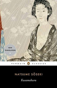
£17.99
The 1:50 000 topographic map gives a more general picture of the ground features than a basic map. It shows settlements, houses, roads, cultivated areas, waterways, cutting areas, mires, rock exposures, & relief. One map sheet covers an area of 30 x 40 km & one centimetre corresponds to 500 metres on the ground. The 1:50, 000 topographic map is also an ideal complement to nautical charts as it provides useful information about the land areas adjacent to waterways. For example, all Finnish sea areas are covered by 1:50 000 topographic map sheets. ...
Archived Product
£17.99
The 1:50, 000 topographic map gives a more general picture of the ground features than a basic map. It shows settlements, houses, roads, cultivated areas, waterways, cutting areas, mires, rock exposures, & relief. One map sheet covers an area of 30 x 40 km & one centimetre corresponds to 500 metres on the ground. The 1:50, 000 topographic map is also an ideal complement to nautical charts as it provides useful information about the land areas adjacent to waterways. For example, all Finnish sea areas are covered by 1:50, 000 topographic map sheets. ...
Archived Product
£29.99
Map No. 2722, Kuruman, in South Africa’s official topographic survey at 1:250, 000 from the country’s national survey organization, the Chief Directorate of Surveys & Mapping. The maps have altitude colouring & contours at 50m or 100m intervals, depending on the map edition, plus spot heights. Deserts, marshes, dry pans, perennial & seasonal water features, etc, as well as protected areas are shown. The maps present the country’s road & rail networks & include the usual information expected on topographic mapping at this scale, although in more rapidly developing areas road information may not necessarily be up to date. Also indicated are magisterial district & provincial boundaries. Latitude & longitude values are shown in the margins at 5` intervals together with South African grid co-ordinates. Typically, each sheet covers an area of one degree of latitude & two degrees of longitude. The projection used is Gauss Conformal. The legend is in English & Afrikaans. ...
Archived Product
£23.99
Kurzema region of Latvia in an adventure atlas at 1:100, 000 from Jana Seta in an A4 spiral-bound format with all pages printed on waterproof & tear-resistant synthetic paper. The atlas

Includes::
street plans of Aizpute, Kandava, Kuldiga, Liepaja, Saldus, Talsi, Tukums & Ventspils. Jana Seta’s adventure atlases in this series have topography shown by contour lines at 10m intervals, with colouring and/or graphics for orchards, forests, swamps, etc; boundaries of national parks & other protected area are clearly marked. The mapping provides a very detail presentation of the road network, from main roads to “difficult to travel” unsurfaced local roads. Locations of petrol stations are marked & driving distances are shown on many local routes. The atlases also show cycling routes. Railway lines are shown with stations. Interesting locations are highlighted & symbols indicate campsites & other tourist accommodation, museums, etc. In each title a selection of best sights is cross-referenced to their descriptions (in Latvian only). Latitude & longitude lines are drawn at 5’ & 10’ respectively. The atlases have no indexes. Map legend

Includes::
English. Street plans at 1:20, 000, most one or two pages in size, indicate various facilities including hotels, restaurants, petrol stations, etc. Streets are annotated with selected house numbers. To see other titles in this series please click on the series link.


...
Archived Product
£8.99
Kusadasi & Selcuk Tourist Plan from Mepmedya

Includes::
detailed street plans of these cities. Shows main streets,

...
Archived Product
£17.99
The 1:50 000 topographic map gives a more general picture of the ground features than a basic map. It shows settlements, houses, roads, cultivated areas, waterways, cutting areas, mires, rock exposures, & relief. One map sheet covers an area of 30 x 40 km & one centimetre corresponds to 500 metres on the ground. The 1:50, 000 topographic map is also an ideal complement to nautical charts as it provides useful information about the land areas adjacent to waterways. For example, all Finnish sea areas are covered by 1:50 000 topographic map sheets. ...
Archived Product
£23.99
Karttakeskus’ Water touring maps are a completely new type of map series. The pre-folded maps made from waterproof & rip-proof material can fit into a small space on the boat, but when opened, they cover a wide area. In this way, the water touring map is e.g. an excellent planning tool alongside electronic navigation solutions, offering a wide overview for e.g. route planning. On the other h&, the waterproof material makes the map easy to handle in e.g. an open boat or sailing boat. Water touring maps: In land areas, the maps have been supplemented with the National Land Survey of Finland’s Topographic Database material. New map sheet division. Size 70 × 100 cm, folded 23.3 × 11.3 cm. Additional themes incl. slipways & camp fire sites & landfalls. Scale in maritime areas 1:60 000, inland waterways 1:50 000 Base map source: Finnish Transport Agency. Not for navigation use. Does not meet the requirements of an official nautical chart. ...
Archived Product
£17.99
The 1:50 000 topographic map gives a more general picture of the ground features than a basic map. It shows settlements, houses, roads, cultivated areas, waterways, cutting areas, mires, rock exposures, & relief. One map sheet covers an area of 30 x 40 km & one centimetre corresponds to 500 metres on the ground. The 1:50, 000 topographic map is also an ideal complement to nautical charts as it provides useful information about the land areas adjacent to waterways. For example, all Finnish sea areas are covered by 1:50 000 topographic map sheets. ...
Archived Product
£17.99
The 1:50, 000 topographic map gives a more general picture of the ground features than a basic map. It shows settlements, houses, roads, cultivated areas, waterways, cutting areas, mires, rock exposures, & relief. One map sheet covers an area of 30 x 40 km & one centimetre corresponds to 500 metres on the ground. The 1:50, 000 topographic map is also an ideal complement to nautical charts as it provides useful information about the land areas adjacent to waterways. For example, all Finnish sea areas are covered by 1:50, 000 topographic map sheets. ...
Archived Product

Kusamakura

Literally meaning `Pillow of Grass`, Kusamakura is Soseki`s portrayal of an artist who opposes convention and logic, and shuns emotional involvement. Soseki`s artist attempts to live as a hermit using other people as his stimuli for his sensations and reflections. The artist fluently and prolifically composes poetry, but finds himself unable to paint - despite befriending a beautiful young divorcee. He remains emotionally distanced from her for a long time and it is only one day when he sees compassion in her eyes that he finds himself able to paint her, but also reconnected with the emotional undercurrents he had hitherto tried to avoid, thereby ending his retreat from the world. Siseko`s beautiful and haikuesque novel is infused with his own musings on art and nature, and helped to
establish the novel as a major literary form in Japan.
RIP - This product is no longer available on our network. It was last seen on 25.09.2019

This page now acts as a permanent archive for this product. Add more information using the comments box below to ensure it can still be found by future generations.

Use our search facility to see if it is available from an alternative contributor.
  • External links may include paid for promotion
  • Availability: Out Of Stock
  • Supplier: Stanfords
  • SKU: 9780143105190
Availability: In Stock
£8.99

Product Description

Literally meaning ` Pillow of Grass`, Kusamakura is Soseki`s portrayal of an artist who opposes convention & logic, & shuns emotional involvement. Soseki`s artist attempts to live as a hermit using other people as his stimuli for his sensations & reflections. The artist fluently & prolifically composes poetry, but finds himself unable to paint
- despite befriending a beautiful young divorcee. He remains emotionally distanced from her for a long time & it is only one day when he sees compassion in her eyes that he finds himself able to paint her, but also reconnected with the emotional undercurrents he had hitherto tried to avoid, thereby ending his retreat from the world. Siseko`s beautiful & haikuesque novel is infused with his own musings on art & nature, & helped to establish the novel as a major literary form in Japan.

Reviews/Comments

Add New

Intelligent Comparison

Oooops!
We couldn't find anything!
Perhaps this product's unique.... Or perhaps we are still looking for comparisons!
Click to bump this page and we'll hurry up.

Price History

Vouchers

No voucher codes found.
Do you know a voucher code for this product or supplier? Add it to Insights for others to use.

Facebook

Jargon Buster

Japan - An island in east Asia
Grass - A narrow leaved green plant
World - A physical grouping, commonly used to describe earth and everything associated with ti
Pillow - A soft cushion support for the head used while sleeping or for support.
Day - The time it takes a planet or other space objects to complete one rotation.

Supplier Information

Stanfords
Stanfords was established in 1853 and opened their iconic Covent Garden flagship store in 1901. They have become the top retailer of maps, travel books and accessories in the UK and arguably offer the largest selection of maps and travel books worldwide. Famous names such as Captain Robert Falcon Scott, Ranulph Fiennes and Michael Palin have purchased from Stanfords. They now have a shop in Bristol and both stores together with other venues operate a calendar of events including talks, book signings and exhibitions. As a specialist map retailer, the map selection is comprehensive and includes road maps, street maps and walking maps from worldwide destinations, as well as a selection of world atlases and wall maps. Books include travel guides and travel literature. Stanfords also stock globes, from miniatures made of blue marble to magnificent floor-standing globes. The website features a selection of interesting articles on travel topics.
Page Updated: 2023-11-12 20:15:36

Community Generated Product Tags

Oh No! The productWIKI community hasn't generated any tags for this product yet!
Menu